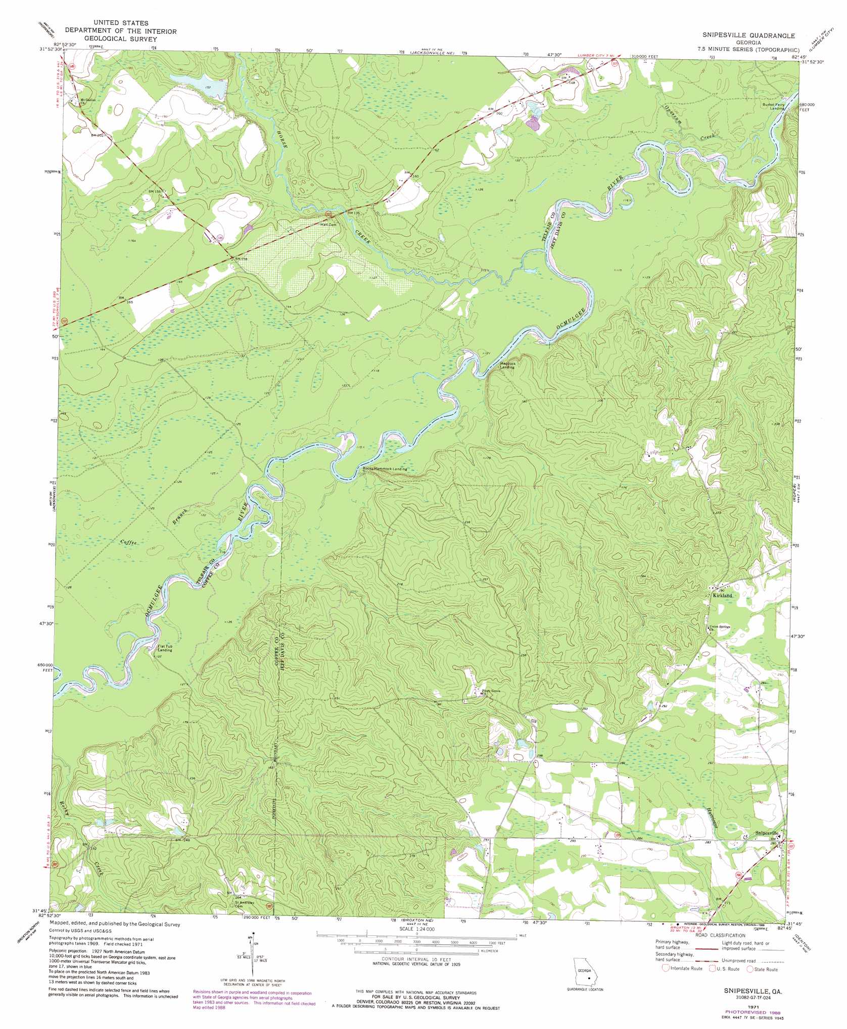
Snipesville Topo Map Georgia
To zoom in, hover over the map of Snipesville
USGS Topo Quad 31082g7 - 1:24,000 scale
| Topo Map Name: | Snipesville |
| USGS Topo Quad ID: | 31082g7 |
| Print Size: | ca. 21 1/4" wide x 27" high |
| Southeast Coordinates: | 31.75° N latitude / 82.75° W longitude |
| Map Center Coordinates: | 31.8125° N latitude / 82.8125° W longitude |
| U.S. State: | GA |
| Filename: | o31082g7.jpg |
| Download Map JPG Image: | Snipesville topo map 1:24,000 scale |
| Map Type: | Topographic |
| Topo Series: | 7.5´ |
| Map Scale: | 1:24,000 |
| Source of Map Images: | United States Geological Survey (USGS) |
| Alternate Map Versions: |
Snipesville GA 1971, updated 1974 Download PDF Buy paper map Snipesville GA 1971, updated 1988 Download PDF Buy paper map Snipesville GA 2011 Download PDF Buy paper map Snipesville GA 2014 Download PDF Buy paper map |
1:24,000 Topo Quads surrounding Snipesville
Milan |
Mcrae |
Scotland |
Jordan |
Uvalda |
Cooks Still |
Workmore |
Jacksonville Ne |
Lumber City |
Hazlehurst North |
China Hill |
Jacksonville |
Snipesville |
Roper |
Hazlehurst South |
Osierfield |
Broxton North |
Broxton Ne |
Denton |
Nicholls Ne |
Ambrose |
Broxton South |
Douglas North |
Nicholls |
Sessoms |
> Back to 31082e1 at 1:100,000 scale
> Back to 31082a1 at 1:250,000 scale
> Back to U.S. Topo Maps home
Snipesville topo map: Gazetteer
Snipesville: Crossings
Ashleys Ferry (historical) elevation 33m 108′Burketts Ferry (historical) elevation 33m 108′
Snipesville: Dams
Varnadoe Lake Dam elevation 46m 150′Snipesville: Lakes
Montgomery Lake elevation 34m 111′Snipesville: Populated Places
Bingham (historical) elevation 74m 242′Kirkland elevation 88m 288′
Paceville (historical) elevation 76m 249′
Snipesville elevation 85m 278′
Snipesville: Reservoirs
Varnadoe Lake elevation 46m 150′Snipesville: Streams
Coffee Branch elevation 35m 114′Horse Creek elevation 33m 108′
Opossum Creek elevation 33m 108′
Snipesville digital topo map on disk
Buy this Snipesville topo map showing relief, roads, GPS coordinates and other geographical features, as a high-resolution digital map file on DVD: