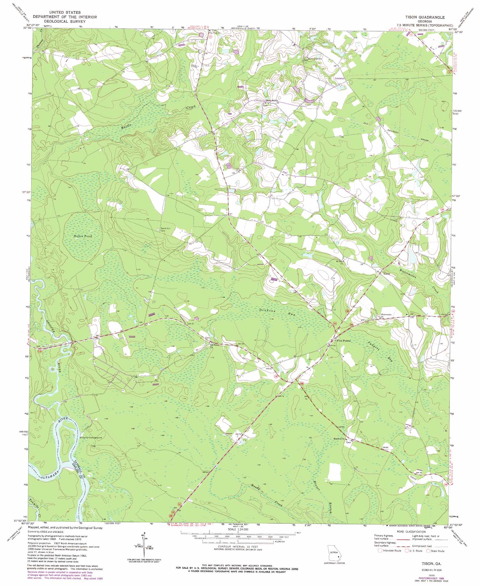
Tison Topo Map Georgia
To zoom in, hover over the map of Tison
USGS Topo Quad 31082h1 - 1:24,000 scale
| Topo Map Name: | Tison |
| USGS Topo Quad ID: | 31082h1 |
| Print Size: | ca. 21 1/4" wide x 27" high |
| Southeast Coordinates: | 31.875° N latitude / 82° W longitude |
| Map Center Coordinates: | 31.9375° N latitude / 82.0625° W longitude |
| U.S. State: | GA |
| Filename: | o31082h1.jpg |
| Download Map JPG Image: | Tison topo map 1:24,000 scale |
| Map Type: | Topographic |
| Topo Series: | 7.5´ |
| Map Scale: | 1:24,000 |
| Source of Map Images: | United States Geological Survey (USGS) |
| Alternate Map Versions: |
Tison GA 1970, updated 1974 Download PDF Buy paper map Tison GA 1970, updated 1988 Download PDF Buy paper map Tison GA 2011 Download PDF Buy paper map Tison GA 2014 Download PDF Buy paper map |
1:24,000 Topo Quads surrounding Tison
Lyons |
Ohoopee |
Collins |
Claxton |
Daisy |
Johnson Corner |
Reidsville West |
Reidsville East |
Deans Crossing |
Glissons Millpond |
Baxley Ne |
Altamaha |
Tison |
Glennville |
Glennville Ne |
Baxley |
Altamaha Sw |
Altamaha Se |
Glennville Sw |
Glennville Se |
Alma Ne |
Surrency |
Odum |
Jesup Nw |
Doctortown |
> Back to 31082e1 at 1:100,000 scale
> Back to 31082a1 at 1:250,000 scale
> Back to U.S. Topo Maps home
Tison topo map: Gazetteer
Tison: Bridges
Cow Ford Bridge elevation 17m 55′Tison: Dams
Surrencys Pond Dam elevation 44m 144′Tison: Populated Places
Five Points elevation 29m 95′Tison elevation 46m 150′
Tison: Reservoirs
Surrencys Pond elevation 44m 144′Tison: Streams
Four Acre Creek elevation 17m 55′Ohoopee River elevation 16m 52′
Tison: Swamps
Dinkins Bay elevation 29m 95′Dukes Pond elevation 29m 95′
Padgett Bay elevation 29m 95′
Sugar Bay elevation 29m 95′
Tison digital topo map on disk
Buy this Tison topo map showing relief, roads, GPS coordinates and other geographical features, as a high-resolution digital map file on DVD: