New Lois Topo Map Georgia
To zoom in, hover over the map of New Lois
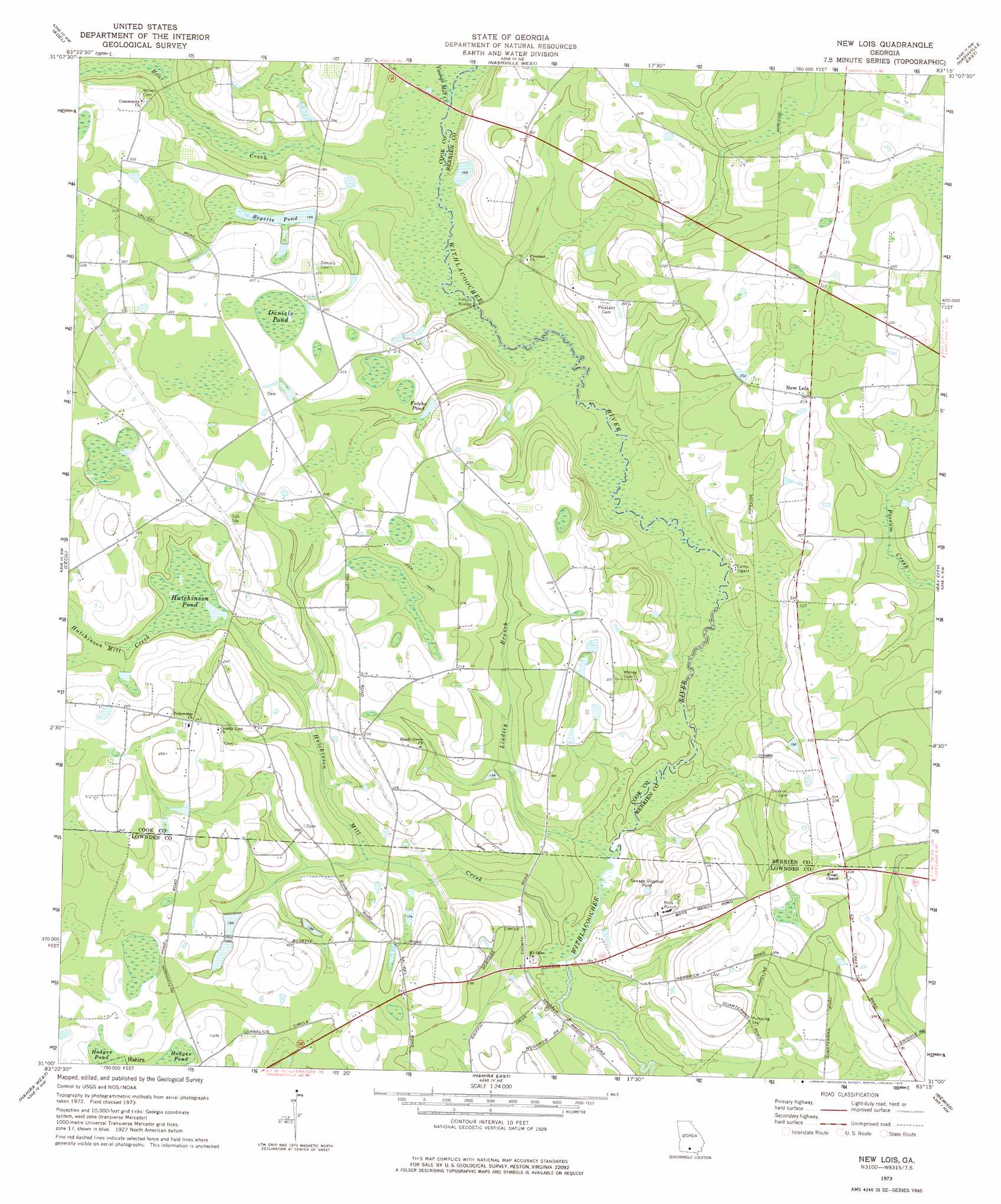
USGS Topo Quad 31083a3 - 1:24,000 scale
| Topo Map Name: | New Lois |
| USGS Topo Quad ID: | 31083a3 |
| Print Size: | ca. 21 1/4" wide x 27" high |
| Southeast Coordinates: | 31° N latitude / 83.25° W longitude |
| Map Center Coordinates: | 31.0625° N latitude / 83.3125° W longitude |
| U.S. State: | GA |
| Filename: | o31083a3.jpg |
| Download Map JPG Image: | New Lois topo map 1:24,000 scale |
| Map Type: | Topographic |
| Topo Series: | 7.5´ |
| Map Scale: | 1:24,000 |
| Source of Map Images: | United States Geological Survey (USGS) |
| Alternate Map Versions: |
New Lois GA 1973, updated 1975 Download PDF Buy paper map New Lois GA 2011 Download PDF Buy paper map New Lois GA 2014 Download PDF Buy paper map |
1:24,000 Topo Quads surrounding New Lois
Omega |
Lenox |
Sapps Lake |
Tenmile Bay |
Willacoochee |
Ellenton |
Adel |
Nashville West |
Nashville East |
Hastings Fish Pond |
Berlin East |
Cecil |
New Lois |
Ray City |
Lakeland |
Pebble Hill |
Hahira West |
Hahira East |
Bemiss |
Naylor |
Quitman |
Ousley |
Valdosta |
Indianola |
Howell |
> Back to 31083a1 at 1:100,000 scale
> Back to 31082a1 at 1:250,000 scale
> Back to U.S. Topo Maps home
New Lois topo map: Gazetteer
New Lois: Bridges
Futchs Bridge elevation 49m 160′Hagan Bridge elevation 53m 173′
Williams Bridge elevation 50m 164′
New Lois: Dams
Boyette Pond Dam elevation 58m 190′New Lois: Lakes
Daniels Pond elevation 68m 223′Hutchinson Pond elevation 59m 193′
New Lois: Populated Places
Fellowship elevation 74m 242′New Lois elevation 66m 216′
New Lois: Reservoirs
Boyette Pond elevation 61m 200′Boyette Pond elevation 58m 190′
Futchs Pond elevation 58m 190′
New Lois: Streams
Bear Creek elevation 51m 167′Hutchinson Mill Creek elevation 43m 141′
Indian Trail Branch elevation 56m 183′
Lindsey Branch elevation 45m 147′
Youngs Mill Creek elevation 50m 164′
New Lois digital topo map on disk
Buy this New Lois topo map showing relief, roads, GPS coordinates and other geographical features, as a high-resolution digital map file on DVD: