Pineboro Topo Map Georgia
To zoom in, hover over the map of Pineboro
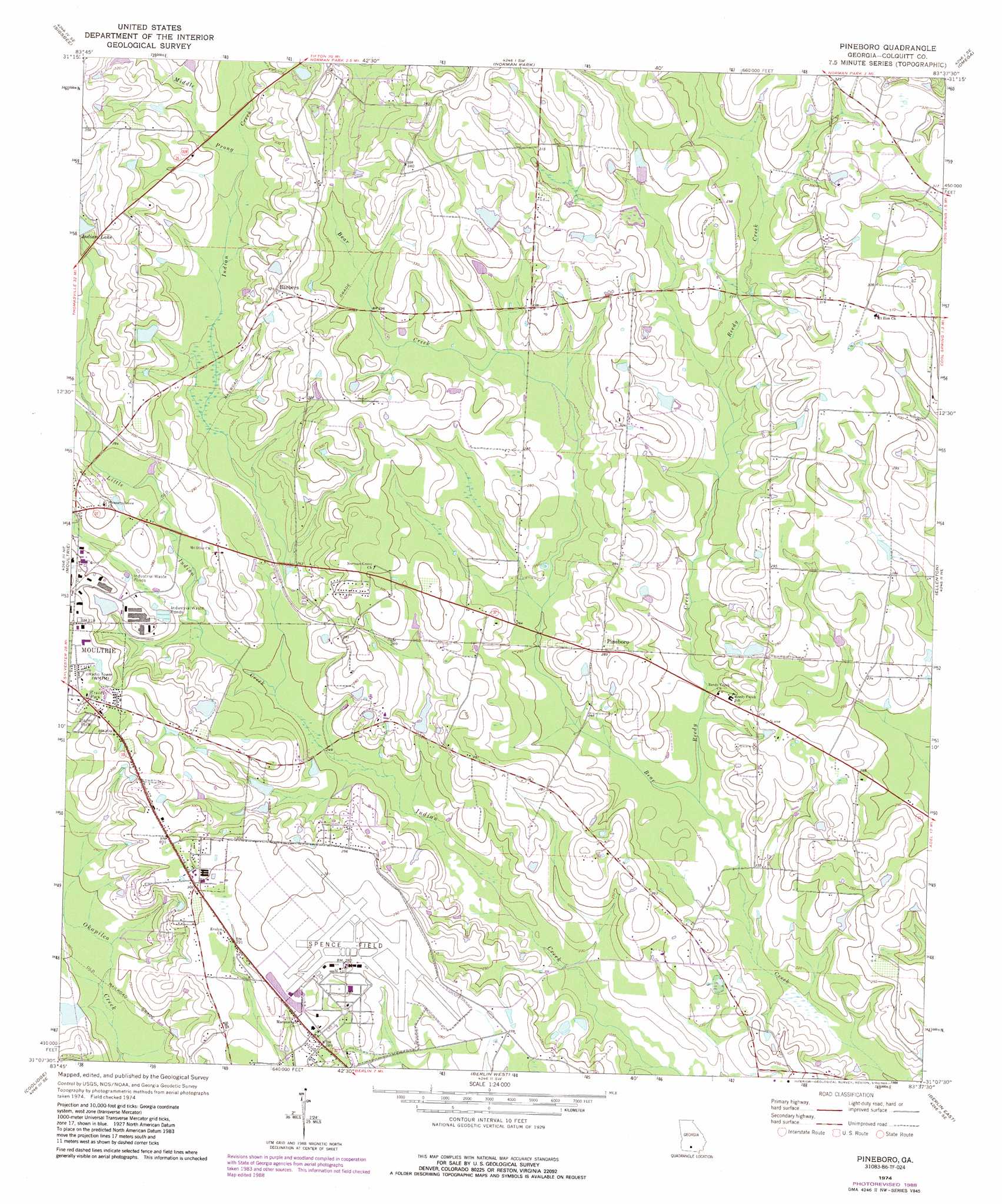
USGS Topo Quad 31083b6 - 1:24,000 scale
| Topo Map Name: | Pineboro |
| USGS Topo Quad ID: | 31083b6 |
| Print Size: | ca. 21 1/4" wide x 27" high |
| Southeast Coordinates: | 31.125° N latitude / 83.625° W longitude |
| Map Center Coordinates: | 31.1875° N latitude / 83.6875° W longitude |
| U.S. State: | GA |
| Filename: | o31083b6.jpg |
| Download Map JPG Image: | Pineboro topo map 1:24,000 scale |
| Map Type: | Topographic |
| Topo Series: | 7.5´ |
| Map Scale: | 1:24,000 |
| Source of Map Images: | United States Geological Survey (USGS) |
| Alternate Map Versions: |
Pineboro GA 1974, updated 1977 Download PDF Buy paper map Pineboro GA 1974, updated 1988 Download PDF Buy paper map Pineboro GA 2011 Download PDF Buy paper map Pineboro GA 2014 Download PDF Buy paper map |
1:24,000 Topo Quads surrounding Pineboro
Bridgeboro |
Tempy |
Ty Ty |
Tifton West |
Tifton East |
Doerun |
Sigsbee |
Norman Park |
Omega |
Lenox |
Hartsfield |
Moultrie |
Pineboro |
Ellenton |
Adel |
Chastain |
Coolidge |
Berlin West |
Berlin East |
Cecil |
Merrillville |
Patten |
Pavo |
Pebble Hill |
Hahira West |
> Back to 31083a1 at 1:100,000 scale
> Back to 31082a1 at 1:250,000 scale
> Back to U.S. Topo Maps home
Pineboro topo map: Gazetteer
Pineboro: Airports
Spence Airport elevation 83m 272′Pineboro: Dams
Adams Lake Dam elevation 91m 298′Cobb Lake Dam elevation 91m 298′
Colquitt County Lake Dam elevation 89m 291′
Indian Lake Dam elevation 94m 308′
Rowell Lake Dam elevation 75m 246′
Pineboro: Populated Places
Barbers elevation 100m 328′Pineboro elevation 86m 282′
Pineboro: Reservoirs
Adams Lake elevation 91m 298′Cobb Lake elevation 91m 298′
Colquitt County Lake elevation 89m 291′
Indian Lake elevation 94m 308′
Rowell Lake elevation 75m 246′
Pineboro: Streams
Little Indian Creek elevation 75m 246′Middle Prong Indian Creek elevation 87m 285′
Reedy Creek elevation 69m 226′
Pineboro digital topo map on disk
Buy this Pineboro topo map showing relief, roads, GPS coordinates and other geographical features, as a high-resolution digital map file on DVD: