Hartsfield Topo Map Georgia
To zoom in, hover over the map of Hartsfield
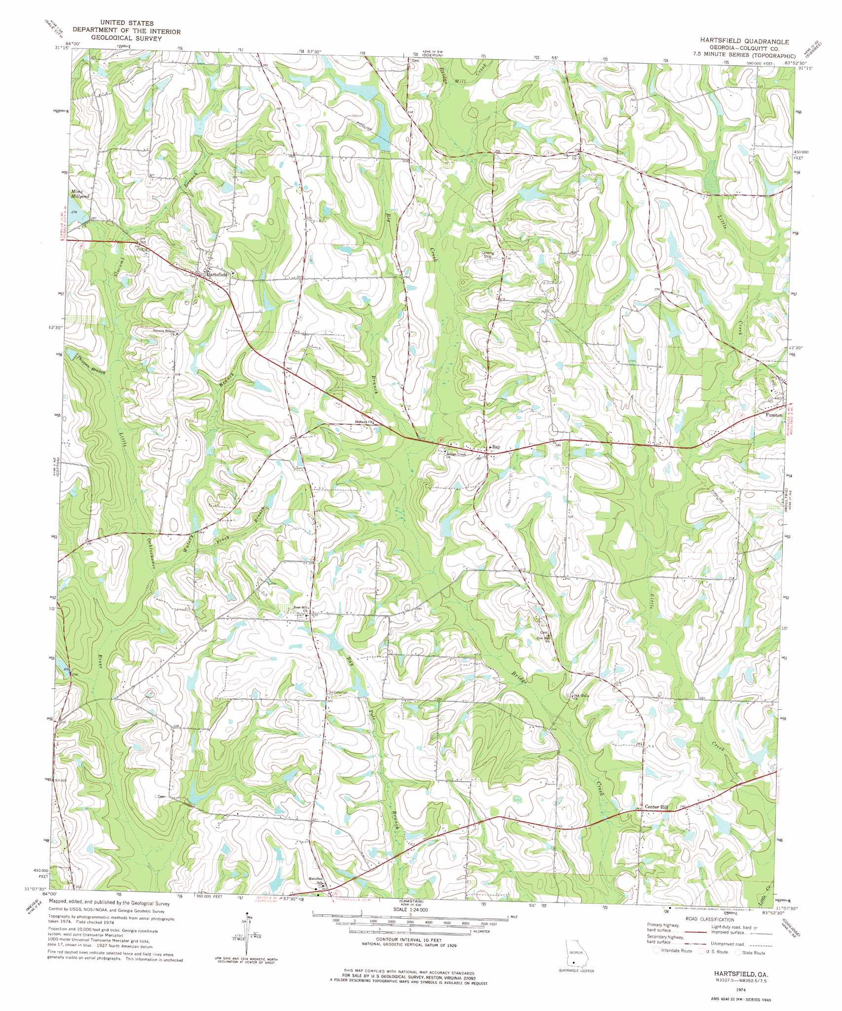
USGS Topo Quad 31083b8 - 1:24,000 scale
| Topo Map Name: | Hartsfield |
| USGS Topo Quad ID: | 31083b8 |
| Print Size: | ca. 21 1/4" wide x 27" high |
| Southeast Coordinates: | 31.125° N latitude / 83.875° W longitude |
| Map Center Coordinates: | 31.1875° N latitude / 83.9375° W longitude |
| U.S. State: | GA |
| Filename: | o31083b8.jpg |
| Download Map JPG Image: | Hartsfield topo map 1:24,000 scale |
| Map Type: | Topographic |
| Topo Series: | 7.5´ |
| Map Scale: | 1:24,000 |
| Source of Map Images: | United States Geological Survey (USGS) |
| Alternate Map Versions: |
Hartsfield GA 1974, updated 1977 Download PDF Buy paper map Hartsfield GA 2011 Download PDF Buy paper map Hartsfield GA 2014 Download PDF Buy paper map |
1:24,000 Topo Quads surrounding Hartsfield
Baconton North |
Putney |
Bridgeboro |
Tempy |
Ty Ty |
Baconton South |
Sale City |
Doerun |
Sigsbee |
Norman Park |
Camilla |
Cotton |
Hartsfield |
Moultrie |
Pineboro |
Pelham |
Meigs |
Chastain |
Coolidge |
Berlin West |
Cairo North |
Ochlocknee |
Merrillville |
Patten |
Pavo |
> Back to 31083a1 at 1:100,000 scale
> Back to 31082a1 at 1:250,000 scale
> Back to U.S. Topo Maps home
Hartsfield topo map: Gazetteer
Hartsfield: Airports
Emory Carlton Airport elevation 101m 331′Hartsfield: Dams
Bridge Creek Structure Number 83 Dam elevation 93m 305′Moss Lake Dam elevation 97m 318′
Moss Lake Dam North elevation 100m 328′
Hartsfield: Lakes
Mims Millpond elevation 85m 278′Hartsfield: Populated Places
Bay elevation 98m 321′Center Hill elevation 81m 265′
Hartsfield elevation 105m 344′
Hartsfield: Post Offices
Hartsfield Post Office elevation 104m 341′Hartsfield: Reservoirs
Bridge Creek Structure Number 83 Lake elevation 93m 305′Moss Lake elevation 97m 318′
Moss Lake North elevation 100m 328′
Hartsfield: Streams
Big Branch elevation 80m 262′Brushy Branch elevation 88m 288′
Mill Creek elevation 87m 285′
Piney Branch elevation 79m 259′
Slocumb Branch elevation 82m 269′
Thigpen Branch elevation 81m 265′
Watery Branch elevation 76m 249′
Hartsfield digital topo map on disk
Buy this Hartsfield topo map showing relief, roads, GPS coordinates and other geographical features, as a high-resolution digital map file on DVD: