Willacoochee Topo Map Georgia
To zoom in, hover over the map of Willacoochee
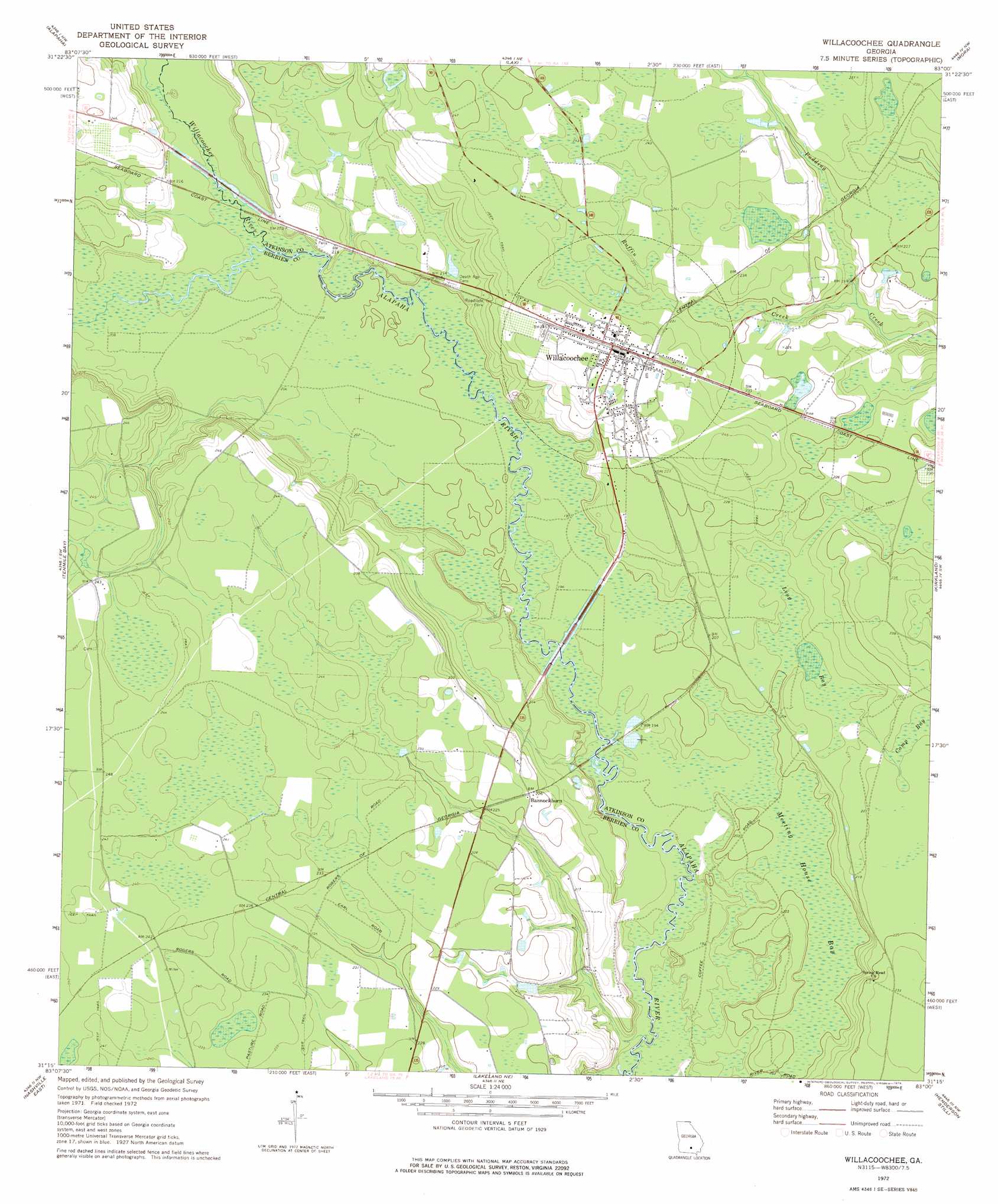
USGS Topo Quad 31083c1 - 1:24,000 scale
| Topo Map Name: | Willacoochee |
| USGS Topo Quad ID: | 31083c1 |
| Print Size: | ca. 21 1/4" wide x 27" high |
| Southeast Coordinates: | 31.25° N latitude / 83° W longitude |
| Map Center Coordinates: | 31.3125° N latitude / 83.0625° W longitude |
| U.S. State: | GA |
| Filename: | o31083c1.jpg |
| Download Map JPG Image: | Willacoochee topo map 1:24,000 scale |
| Map Type: | Topographic |
| Topo Series: | 7.5´ |
| Map Scale: | 1:24,000 |
| Source of Map Images: | United States Geological Survey (USGS) |
| Alternate Map Versions: |
Willacoochee GA 1972, updated 1976 Download PDF Buy paper map Willacoochee GA 2011 Download PDF Buy paper map Willacoochee GA 2014 Download PDF Buy paper map |
1:24,000 Topo Quads surrounding Willacoochee
Ocilla West |
Ocilla East |
Ambrose |
Broxton South |
Douglas North |
Enigma |
Alapaha |
Lax |
Mora |
Douglas South |
Sapps Lake |
Tenmile Bay |
Willacoochee |
Kirkland |
Pearson |
Nashville West |
Nashville East |
Hastings Fish Pond |
Henderson Still |
Sandy Bottom |
New Lois |
Ray City |
Lakeland |
Sirmans |
Homerville West |
> Back to 31083a1 at 1:100,000 scale
> Back to 31082a1 at 1:250,000 scale
> Back to U.S. Topo Maps home
Willacoochee topo map: Gazetteer
Willacoochee: Lakes
Long Bay elevation 61m 200′Willacoochee: Populated Places
Bannockburn elevation 69m 226′Gracys Station (historical) elevation 69m 226′
Willacoochee elevation 74m 242′
Willacoochee: Streams
Ruffin Creek elevation 63m 206′Willacoochee River elevation 61m 200′
Willacoochee: Swamps
Meeting House Bay elevation 60m 196′Willacoochee digital topo map on disk
Buy this Willacoochee topo map showing relief, roads, GPS coordinates and other geographical features, as a high-resolution digital map file on DVD: