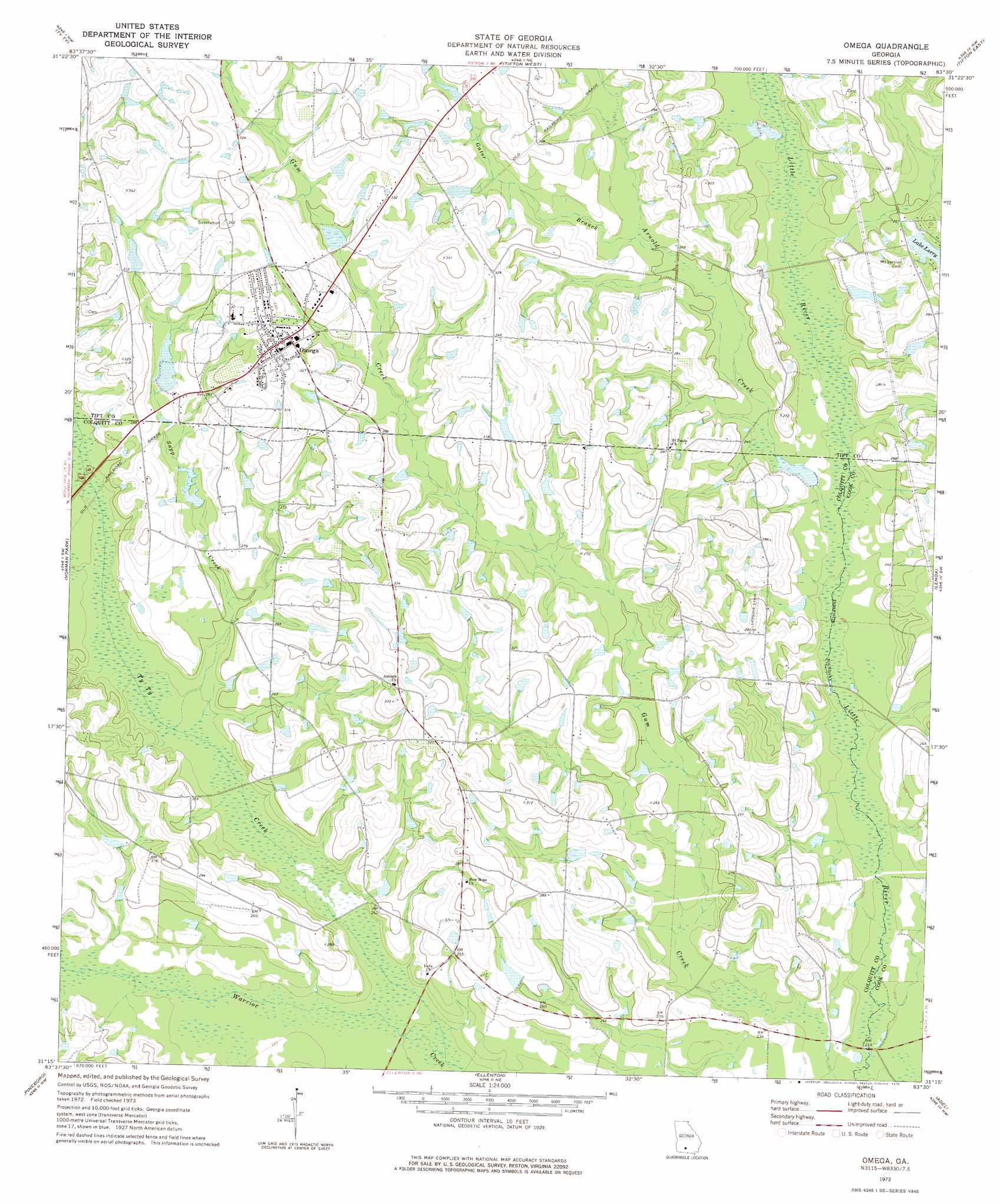
Omega Topo Map Georgia
To zoom in, hover over the map of Omega
USGS Topo Quad 31083c5 - 1:24,000 scale
| Topo Map Name: | Omega |
| USGS Topo Quad ID: | 31083c5 |
| Print Size: | ca. 21 1/4" wide x 27" high |
| Southeast Coordinates: | 31.25° N latitude / 83.5° W longitude |
| Map Center Coordinates: | 31.3125° N latitude / 83.5625° W longitude |
| U.S. State: | GA |
| Filename: | o31083c5.jpg |
| Download Map JPG Image: | Omega topo map 1:24,000 scale |
| Map Type: | Topographic |
| Topo Series: | 7.5´ |
| Map Scale: | 1:24,000 |
| Source of Map Images: | United States Geological Survey (USGS) |
| Alternate Map Versions: |
Omega GA 1973, updated 1976 Download PDF Buy paper map Omega GA 2011 Download PDF Buy paper map Omega GA 2014 Download PDF Buy paper map |
1:24,000 Topo Quads surrounding Omega
Sylvester |
Sumner |
Chula |
Waterloo |
Ocilla West |
Tempy |
Ty Ty |
Tifton West |
Tifton East |
Enigma |
Sigsbee |
Norman Park |
Omega |
Lenox |
Sapps Lake |
Moultrie |
Pineboro |
Ellenton |
Adel |
Nashville West |
Coolidge |
Berlin West |
Berlin East |
Cecil |
New Lois |
> Back to 31083a1 at 1:100,000 scale
> Back to 31082a1 at 1:250,000 scale
> Back to U.S. Topo Maps home
Omega topo map: Gazetteer
Omega: Bridges
Kinard Bridge elevation 63m 206′Lotts Bridge elevation 66m 216′
Powells Bridge elevation 70m 229′
Omega: Dams
Lake Larry Dam elevation 79m 259′Lindsey Lake Dam elevation 81m 265′
Patrick Lake Dam elevation 85m 278′
Rutland Lake Dam elevation 77m 252′
Rutland Lake South Dam elevation 73m 239′
Willington Lake Dam elevation 87m 285′
Omega: Populated Places
Omega elevation 98m 321′Omega: Reservoirs
Lake Larry elevation 79m 259′Lindsey Lake elevation 81m 265′
Patrick Lake elevation 85m 278′
Rutland Lake elevation 77m 252′
Rutland Lake South elevation 73m 239′
Willington Lake elevation 87m 285′
Omega: Streams
Arnold Creek elevation 69m 226′Gator Branch elevation 76m 249′
Sapp Creek elevation 69m 226′
Ty Ty Creek elevation 64m 209′
Omega digital topo map on disk
Buy this Omega topo map showing relief, roads, GPS coordinates and other geographical features, as a high-resolution digital map file on DVD: