Sigsbee Topo Map Georgia
To zoom in, hover over the map of Sigsbee
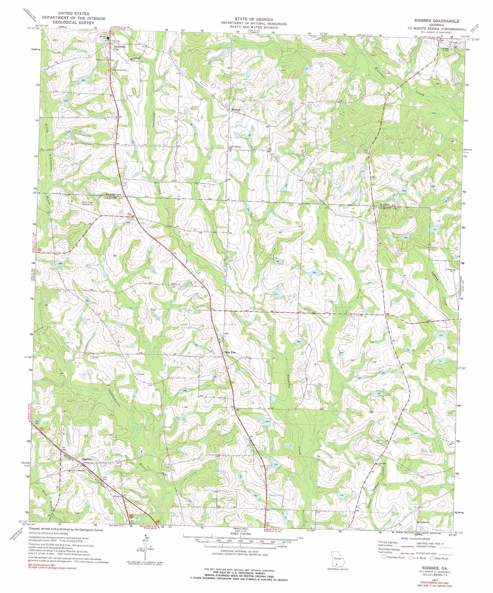
USGS Topo Quad 31083c7 - 1:24,000 scale
| Topo Map Name: | Sigsbee |
| USGS Topo Quad ID: | 31083c7 |
| Print Size: | ca. 21 1/4" wide x 27" high |
| Southeast Coordinates: | 31.25° N latitude / 83.75° W longitude |
| Map Center Coordinates: | 31.3125° N latitude / 83.8125° W longitude |
| U.S. State: | GA |
| Filename: | o31083c7.jpg |
| Download Map JPG Image: | Sigsbee topo map 1:24,000 scale |
| Map Type: | Topographic |
| Topo Series: | 7.5´ |
| Map Scale: | 1:24,000 |
| Source of Map Images: | United States Geological Survey (USGS) |
| Alternate Map Versions: |
Sigsbee GA 1974, updated 1976 Download PDF Buy paper map Sigsbee GA 1974, updated 1991 Download PDF Buy paper map Sigsbee GA 2011 Download PDF Buy paper map Sigsbee GA 2014 Download PDF Buy paper map |
1:24,000 Topo Quads surrounding Sigsbee
Albany East |
Acree |
Sylvester |
Sumner |
Chula |
Putney |
Bridgeboro |
Tempy |
Ty Ty |
Tifton West |
Sale City |
Doerun |
Sigsbee |
Norman Park |
Omega |
Cotton |
Hartsfield |
Moultrie |
Pineboro |
Ellenton |
Meigs |
Chastain |
Coolidge |
Berlin West |
Berlin East |
> Back to 31083a1 at 1:100,000 scale
> Back to 31082a1 at 1:250,000 scale
> Back to U.S. Topo Maps home
Sigsbee topo map: Gazetteer
Sigsbee: Airports
Oak Ridge Plantation Airport elevation 99m 324′Sigsbee: Dams
Beadles Lake Dam elevation 95m 311′Sigsbee: Populated Places
Anderson City elevation 125m 410′Minton elevation 120m 393′
New Elm elevation 111m 364′
Sigsbee elevation 110m 360′
Sigsbee: Reservoirs
Beadles Lake elevation 95m 311′Sigsbee digital topo map on disk
Buy this Sigsbee topo map showing relief, roads, GPS coordinates and other geographical features, as a high-resolution digital map file on DVD: