Ty Ty Topo Map Georgia
To zoom in, hover over the map of Ty Ty
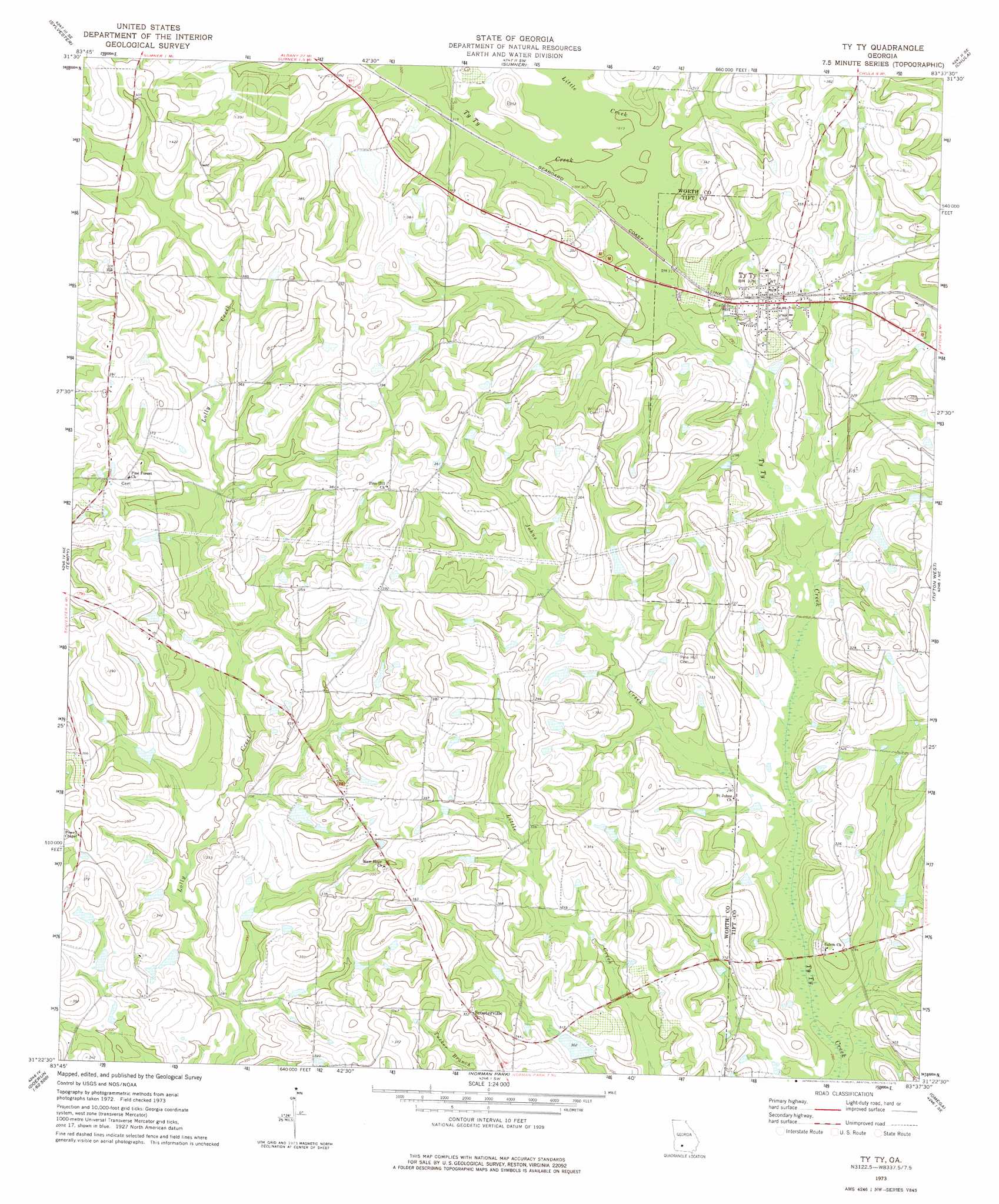
USGS Topo Quad 31083d6 - 1:24,000 scale
| Topo Map Name: | Ty Ty |
| USGS Topo Quad ID: | 31083d6 |
| Print Size: | ca. 21 1/4" wide x 27" high |
| Southeast Coordinates: | 31.375° N latitude / 83.625° W longitude |
| Map Center Coordinates: | 31.4375° N latitude / 83.6875° W longitude |
| U.S. State: | GA |
| Filename: | o31083d6.jpg |
| Download Map JPG Image: | Ty Ty topo map 1:24,000 scale |
| Map Type: | Topographic |
| Topo Series: | 7.5´ |
| Map Scale: | 1:24,000 |
| Source of Map Images: | United States Geological Survey (USGS) |
| Alternate Map Versions: |
Ty Ty GA 1973, updated 1975 Download PDF Buy paper map Ty Ty GA 2011 Download PDF Buy paper map Ty Ty GA 2014 Download PDF Buy paper map |
1:24,000 Topo Quads surrounding Ty Ty
Doles |
Cuffietown |
Ashburn |
Bethel |
Irwinville |
Acree |
Sylvester |
Sumner |
Chula |
Waterloo |
Bridgeboro |
Tempy |
Ty Ty |
Tifton West |
Tifton East |
Doerun |
Sigsbee |
Norman Park |
Omega |
Lenox |
Hartsfield |
Moultrie |
Pineboro |
Ellenton |
Adel |
> Back to 31083a1 at 1:100,000 scale
> Back to 31082a1 at 1:250,000 scale
> Back to U.S. Topo Maps home
Ty Ty topo map: Gazetteer
Ty Ty: Dams
Harold Lake Dam elevation 104m 341′Harold Lake East Dam elevation 107m 351′
Kelley Lake Dam elevation 94m 308′
Patterson Lake Dam elevation 98m 321′
Walker Lake Dam elevation 91m 298′
Ty Ty: Populated Places
Pine Hill elevation 117m 383′Scooterville elevation 107m 351′
Ty Ty elevation 96m 314′
Ty Ty: Reservoirs
Harold Lake elevation 104m 341′Harold Lake East elevation 107m 351′
Kelley Lake elevation 94m 308′
Lake Lolly elevation 102m 334′
Patterson Lake elevation 98m 321′
Walker Lake elevation 91m 298′
Ty Ty: Streams
Johns Creek elevation 81m 265′Little Creek elevation 90m 295′
Ty Ty digital topo map on disk
Buy this Ty Ty topo map showing relief, roads, GPS coordinates and other geographical features, as a high-resolution digital map file on DVD: