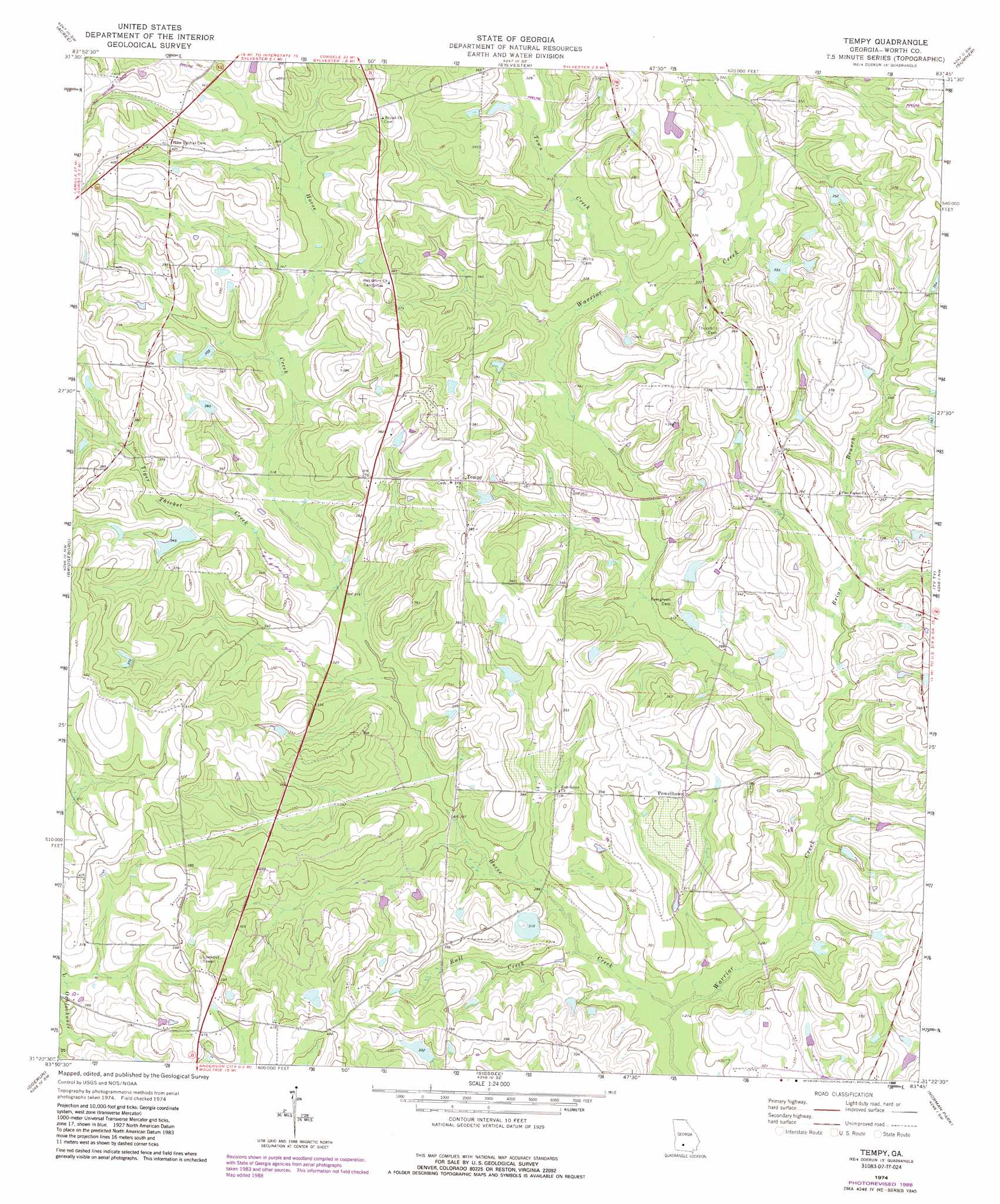
Tempy Topo Map Georgia
To zoom in, hover over the map of Tempy
USGS Topo Quad 31083d7 - 1:24,000 scale
| Topo Map Name: | Tempy |
| USGS Topo Quad ID: | 31083d7 |
| Print Size: | ca. 21 1/4" wide x 27" high |
| Southeast Coordinates: | 31.375° N latitude / 83.75° W longitude |
| Map Center Coordinates: | 31.4375° N latitude / 83.8125° W longitude |
| U.S. State: | GA |
| Filename: | o31083d7.jpg |
| Download Map JPG Image: | Tempy topo map 1:24,000 scale |
| Map Type: | Topographic |
| Topo Series: | 7.5´ |
| Map Scale: | 1:24,000 |
| Source of Map Images: | United States Geological Survey (USGS) |
| Alternate Map Versions: |
Tempy GA 1974, updated 1976 Download PDF Buy paper map Tempy GA 1974, updated 1988 Download PDF Buy paper map Tempy GA 2011 Download PDF Buy paper map Tempy GA 2014 Download PDF Buy paper map |
1:24,000 Topo Quads surrounding Tempy
Albany Ne |
Doles |
Cuffietown |
Ashburn |
Bethel |
Albany East |
Acree |
Sylvester |
Sumner |
Chula |
Putney |
Bridgeboro |
Tempy |
Ty Ty |
Tifton West |
Sale City |
Doerun |
Sigsbee |
Norman Park |
Omega |
Cotton |
Hartsfield |
Moultrie |
Pineboro |
Ellenton |
> Back to 31083a1 at 1:100,000 scale
> Back to 31082a1 at 1:250,000 scale
> Back to U.S. Topo Maps home
Tempy topo map: Gazetteer
Tempy: Dams
Brown Lake Dam elevation 105m 344′Carter Lake Dam elevation 87m 285′
Lumkins Lake Dam elevation 97m 318′
Shingle Farm Service Lake Dam elevation 88m 288′
Sizemore Lake Dam elevation 100m 328′
Strickland Dam elevation 105m 344′
Sumner Lake Dam elevation 108m 354′
Tempy: Populated Places
Powelltown elevation 105m 344′Tempy elevation 116m 380′
Tempy: Reservoirs
Brown Lake elevation 105m 344′Carter Lake elevation 87m 285′
Lumkins Lake elevation 97m 318′
Shingle Farm Service Lake elevation 88m 288′
Sizemore Lake elevation 100m 328′
Strickland Lake elevation 105m 344′
Sumner Lake elevation 108m 354′
Tempy: Streams
Briar Branch elevation 88m 288′Bull Creek elevation 85m 278′
Horse Creek elevation 82m 269′
Tiger Thicket Creek elevation 94m 308′
Town Creek elevation 94m 308′
Tempy digital topo map on disk
Buy this Tempy topo map showing relief, roads, GPS coordinates and other geographical features, as a high-resolution digital map file on DVD: