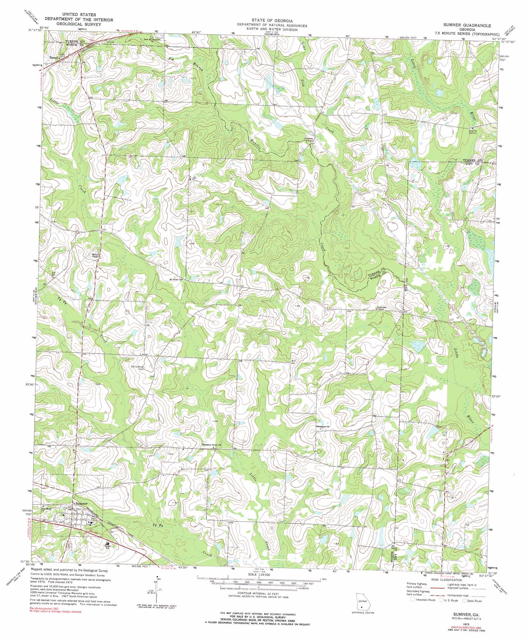
Sumner Topo Map Georgia
To zoom in, hover over the map of Sumner
USGS Topo Quad 31083e6 - 1:24,000 scale
| Topo Map Name: | Sumner |
| USGS Topo Quad ID: | 31083e6 |
| Print Size: | ca. 21 1/4" wide x 27" high |
| Southeast Coordinates: | 31.5° N latitude / 83.625° W longitude |
| Map Center Coordinates: | 31.5625° N latitude / 83.6875° W longitude |
| U.S. State: | GA |
| Filename: | o31083e6.jpg |
| Download Map JPG Image: | Sumner topo map 1:24,000 scale |
| Map Type: | Topographic |
| Topo Series: | 7.5´ |
| Map Scale: | 1:24,000 |
| Source of Map Images: | United States Geological Survey (USGS) |
| Alternate Map Versions: |
Sumner GA 1973, updated 1975 Download PDF Buy paper map Sumner GA 1973, updated 1991 Download PDF Buy paper map Sumner GA 2011 Download PDF Buy paper map Sumner GA 2014 Download PDF Buy paper map |
1:24,000 Topo Quads surrounding Sumner
Warwick |
Pateville |
Arabi |
Amboy |
Rebecca |
Doles |
Cuffietown |
Ashburn |
Bethel |
Irwinville |
Acree |
Sylvester |
Sumner |
Chula |
Waterloo |
Bridgeboro |
Tempy |
Ty Ty |
Tifton West |
Tifton East |
Doerun |
Sigsbee |
Norman Park |
Omega |
Lenox |
> Back to 31083e1 at 1:100,000 scale
> Back to 31082a1 at 1:250,000 scale
> Back to U.S. Topo Maps home
Sumner topo map: Gazetteer
Sumner: Dams
Ross Lake Dam elevation 88m 288′Wiltons Lake Dam elevation 94m 308′
Winfreds Lake Dam elevation 95m 311′
Sumner: Populated Places
Sumner elevation 115m 377′Terrell elevation 128m 419′
Sumner: Post Offices
Sumner Post Office elevation 116m 380′Sumner: Reservoirs
Cravey Pond elevation 104m 341′Ross Lake elevation 88m 288′
Wiltons Lake elevation 94m 308′
Winfreds Lake elevation 95m 311′
Sumner: Streams
Big Branch elevation 98m 321′Daniels Creek elevation 87m 285′
Lime Sink Creek elevation 94m 308′
Sumner digital topo map on disk
Buy this Sumner topo map showing relief, roads, GPS coordinates and other geographical features, as a high-resolution digital map file on DVD: