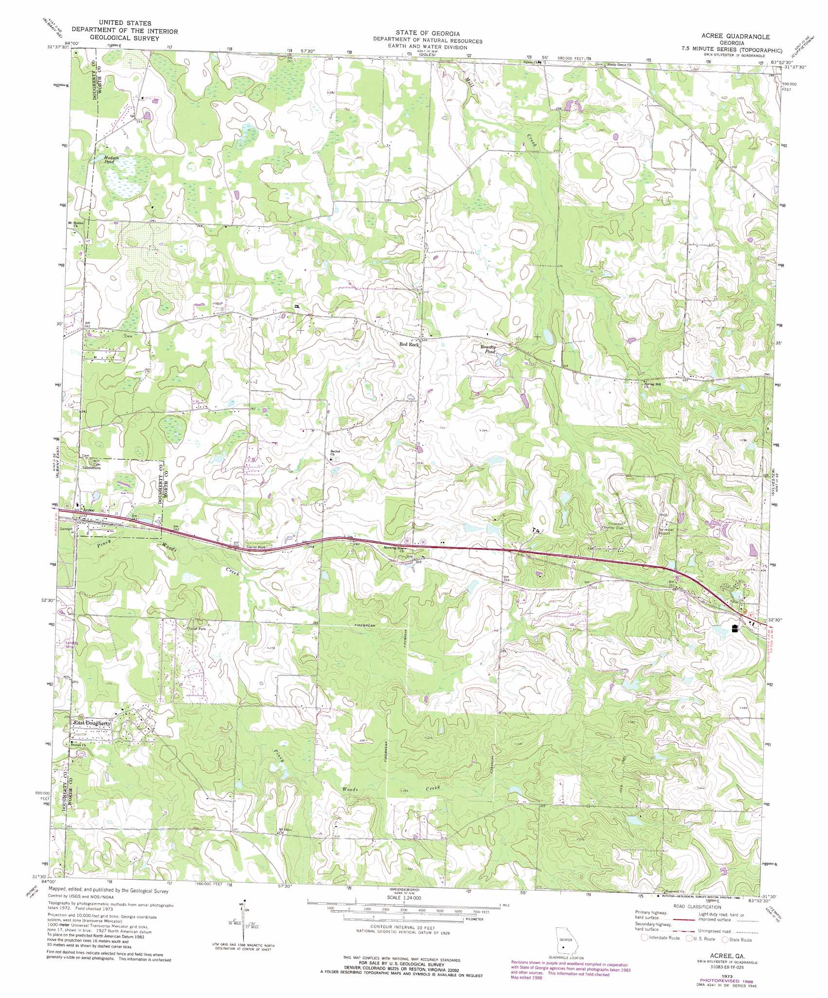
Acree Topo Map Georgia
To zoom in, hover over the map of Acree
USGS Topo Quad 31083e8 - 1:24,000 scale
| Topo Map Name: | Acree |
| USGS Topo Quad ID: | 31083e8 |
| Print Size: | ca. 21 1/4" wide x 27" high |
| Southeast Coordinates: | 31.5° N latitude / 83.875° W longitude |
| Map Center Coordinates: | 31.5625° N latitude / 83.9375° W longitude |
| U.S. State: | GA |
| Filename: | o31083e8.jpg |
| Download Map JPG Image: | Acree topo map 1:24,000 scale |
| Map Type: | Topographic |
| Topo Series: | 7.5´ |
| Map Scale: | 1:24,000 |
| Source of Map Images: | United States Geological Survey (USGS) |
| Alternate Map Versions: |
Acree GA 1973, updated 1975 Download PDF Buy paper map Acree GA 1973, updated 1988 Download PDF Buy paper map Acree GA 2011 Download PDF Buy paper map Acree GA 2014 Download PDF Buy paper map |
1:24,000 Topo Quads surrounding Acree
Neyami |
Leslie Se |
Warwick |
Pateville |
Arabi |
Leesburg |
Albany Ne |
Doles |
Cuffietown |
Ashburn |
Albany West |
Albany East |
Acree |
Sylvester |
Sumner |
Baconton North |
Putney |
Bridgeboro |
Tempy |
Ty Ty |
Baconton South |
Sale City |
Doerun |
Sigsbee |
Norman Park |
> Back to 31083e1 at 1:100,000 scale
> Back to 31082a1 at 1:250,000 scale
> Back to U.S. Topo Maps home
Acree topo map: Gazetteer
Acree: Airports
Crowe Airport elevation 90m 295′Sylvester Airport elevation 117m 383′
Acree: Dams
Thigpens Lake Dam elevation 91m 298′Acree: Lakes
Black Lake elevation 93m 305′Bonnie Pond elevation 72m 236′
Brushy Pond elevation 87m 285′
Deep Pond elevation 88m 288′
Gammage Pond elevation 74m 242′
Hudson Pond elevation 73m 239′
Rocky Branch Pond (historical) elevation 70m 229′
Waving Pond elevation 85m 278′
Yellow Pond elevation 73m 239′
Acree: Populated Places
Acree elevation 71m 232′Artesia (historical) elevation 80m 262′
Deerfield Farm Estates elevation 94m 308′
East Dougherty elevation 85m 278′
Gammage elevation 127m 416′
Mossy Oaks elevation 78m 255′
Red Rock elevation 103m 337′
Springhill elevation 89m 291′
Thomas Acres elevation 79m 259′
Willingham (historical) elevation 97m 318′
Woodcrest Subdivision elevation 85m 278′
Acree: Reservoirs
Thigpens Lake elevation 91m 298′Acree digital topo map on disk
Buy this Acree topo map showing relief, roads, GPS coordinates and other geographical features, as a high-resolution digital map file on DVD: