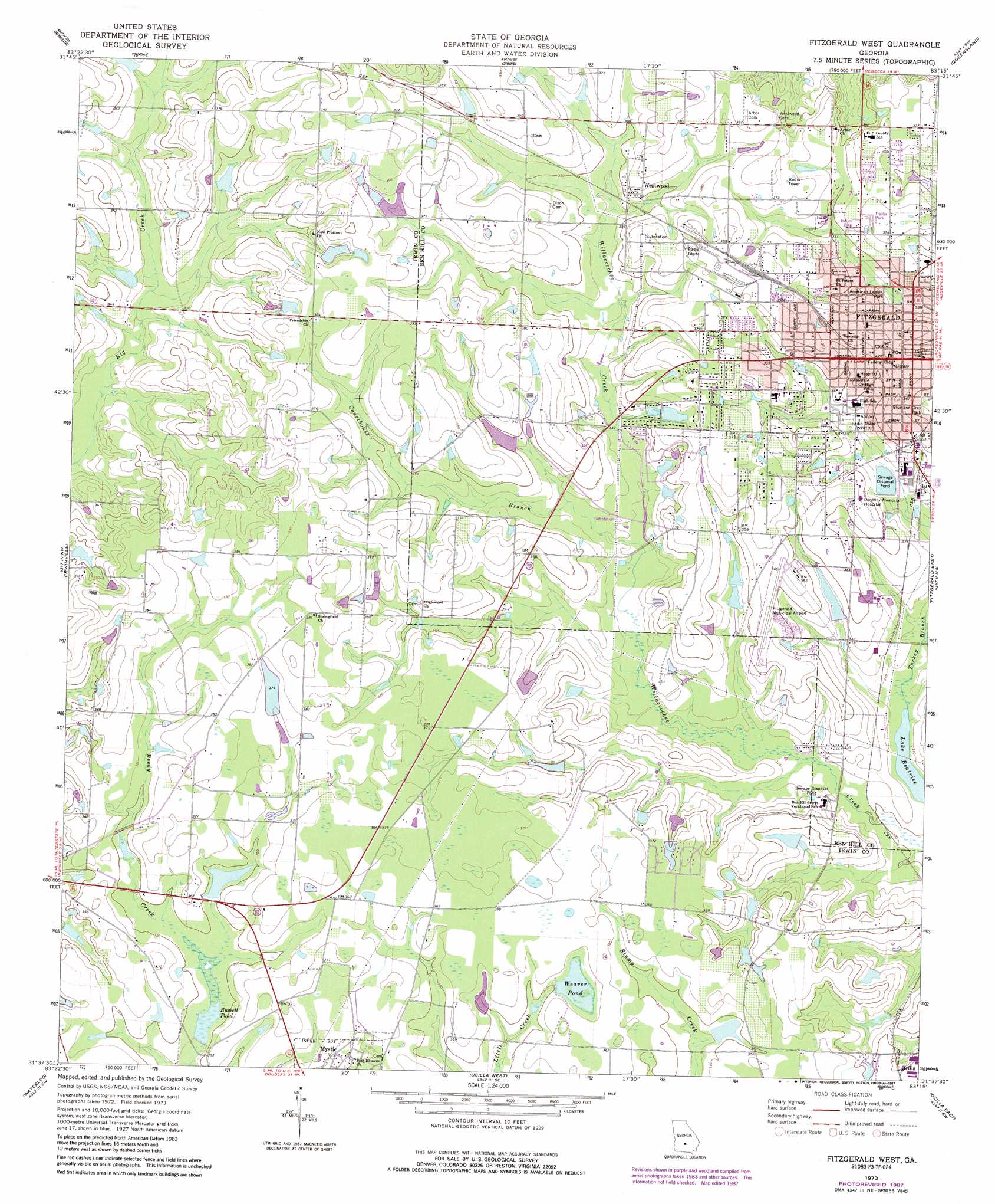
Fitzgerald West Topo Map Georgia
To zoom in, hover over the map of Fitzgerald West
USGS Topo Quad 31083f3 - 1:24,000 scale
| Topo Map Name: | Fitzgerald West |
| USGS Topo Quad ID: | 31083f3 |
| Print Size: | ca. 21 1/4" wide x 27" high |
| Southeast Coordinates: | 31.625° N latitude / 83.25° W longitude |
| Map Center Coordinates: | 31.6875° N latitude / 83.3125° W longitude |
| U.S. State: | GA |
| Filename: | o31083f3.jpg |
| Download Map JPG Image: | Fitzgerald West topo map 1:24,000 scale |
| Map Type: | Topographic |
| Topo Series: | 7.5´ |
| Map Scale: | 1:24,000 |
| Source of Map Images: | United States Geological Survey (USGS) |
| Alternate Map Versions: |
Fitzgerald West GA 1973, updated 1976 Download PDF Buy paper map Fitzgerald West GA 1973, updated 1987 Download PDF Buy paper map Fitzgerald West GA 2011 Download PDF Buy paper map Fitzgerald West GA 2014 Download PDF Buy paper map |
1:24,000 Topo Quads surrounding Fitzgerald West
Pitts |
Rochelle |
Abbeville South |
Rhine |
Cooks Still |
Amboy |
Rebecca |
Sibbie |
Queensland |
China Hill |
Bethel |
Irwinville |
Fitzgerald West |
Fitzgerald East |
Osierfield |
Chula |
Waterloo |
Ocilla West |
Ocilla East |
Ambrose |
Tifton West |
Tifton East |
Enigma |
Alapaha |
Lax |
> Back to 31083e1 at 1:100,000 scale
> Back to 31082a1 at 1:250,000 scale
> Back to U.S. Topo Maps home
Fitzgerald West topo map: Gazetteer
Fitzgerald West: Airports
Fitzgerald Municipal Airport elevation 104m 341′Fitzgerald West: Dams
Ben Hill Dam elevation 107m 351′Bussells Pond Dam elevation 104m 341′
County Lake Dam elevation 102m 334′
Fitzgerald West Lake Dam elevation 102m 334′
Hogan Lake Dam elevation 105m 344′
Old Diz Mucke Pond Dam elevation 104m 341′
Simms Lake Dam elevation 108m 354′
Stewart Lake Dam elevation 104m 341′
Taylor Lake Dam elevation 112m 367′
Walker Lake Dam elevation 104m 341′
Walters Lake Dam elevation 111m 364′
Weaver Pond Dam elevation 108m 354′
Fitzgerald West: Parks
American Legion Park elevation 102m 334′Blue and Gray Park elevation 103m 337′
Fitzgerald West: Populated Places
Fitzgerald elevation 110m 360′Westwood elevation 108m 354′
Fitzgerald West: Post Offices
Fitzgerald Post Office elevation 111m 364′Fitzgerald West: Reservoirs
Bussell Pond elevation 104m 341′County Lake elevation 102m 334′
Fitzgerald West Lake elevation 102m 334′
Hogan Lake elevation 105m 344′
Old Diz Mucke Pond elevation 104m 341′
Simms Lake elevation 108m 354′
Stewart Lake elevation 104m 341′
Taylor Lake elevation 112m 367′
Walker Lake elevation 104m 341′
Walters Lake elevation 111m 364′
Weaver Pond elevation 106m 347′
Fitzgerald West: Streams
Courthouse Branch elevation 97m 318′Turkey Creek elevation 92m 301′
Fitzgerald West digital topo map on disk
Buy this Fitzgerald West topo map showing relief, roads, GPS coordinates and other geographical features, as a high-resolution digital map file on DVD: