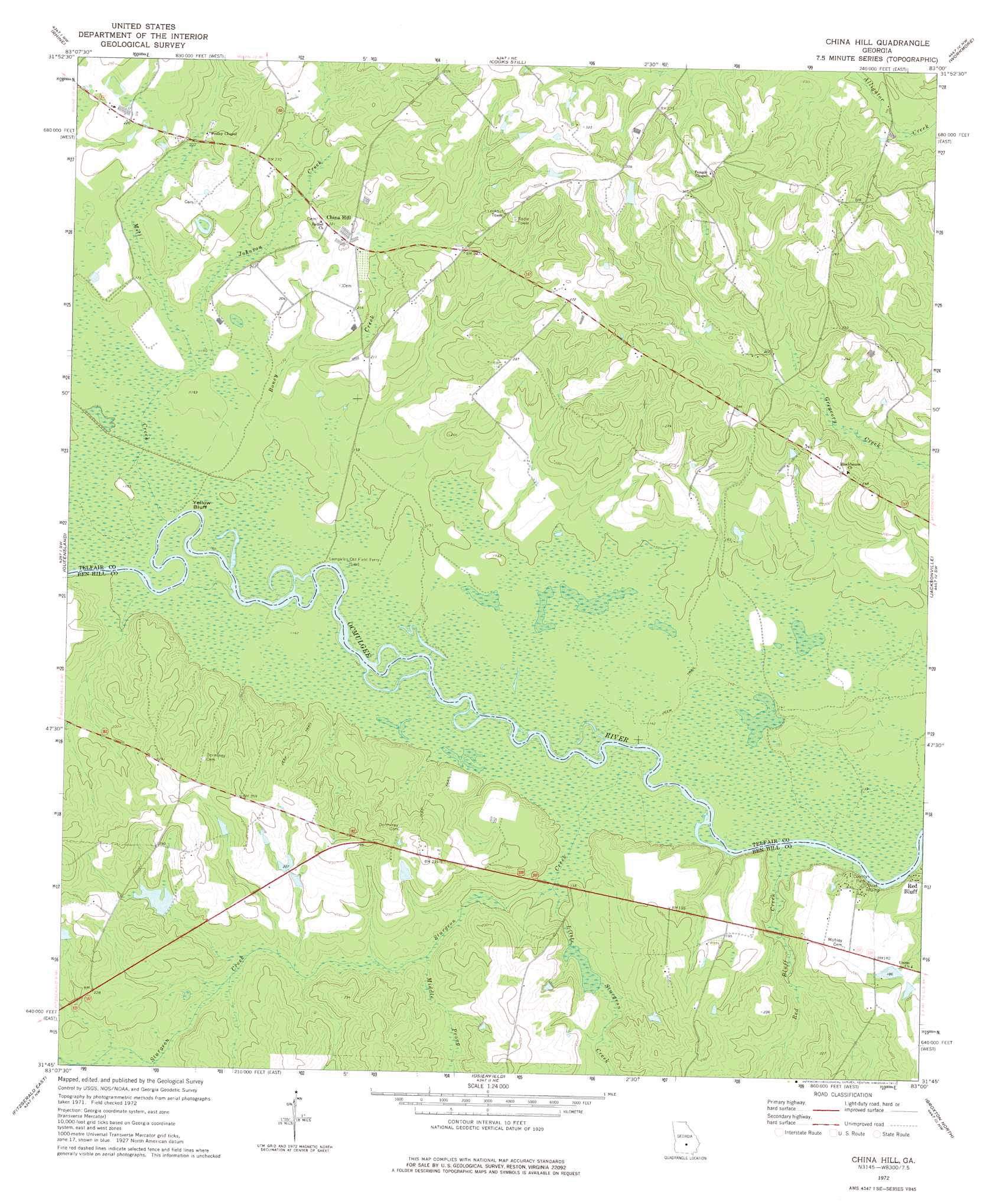
China Hill Topo Map Georgia
To zoom in, hover over the map of China Hill
USGS Topo Quad 31083g1 - 1:24,000 scale
| Topo Map Name: | China Hill |
| USGS Topo Quad ID: | 31083g1 |
| Print Size: | ca. 21 1/4" wide x 27" high |
| Southeast Coordinates: | 31.75° N latitude / 83° W longitude |
| Map Center Coordinates: | 31.8125° N latitude / 83.0625° W longitude |
| U.S. State: | GA |
| Filename: | o31083g1.jpg |
| Download Map JPG Image: | China Hill topo map 1:24,000 scale |
| Map Type: | Topographic |
| Topo Series: | 7.5´ |
| Map Scale: | 1:24,000 |
| Source of Map Images: | United States Geological Survey (USGS) |
| Alternate Map Versions: |
China Hill GA 1972, updated 1977 Download PDF Buy paper map China Hill GA 2011 Download PDF Buy paper map China Hill GA 2014 Download PDF Buy paper map |
1:24,000 Topo Quads surrounding China Hill
Abbeville North |
Lake Cypress |
Milan |
Mcrae |
Scotland |
Abbeville South |
Rhine |
Cooks Still |
Workmore |
Jacksonville Ne |
Sibbie |
Queensland |
China Hill |
Jacksonville |
Snipesville |
Fitzgerald West |
Fitzgerald East |
Osierfield |
Broxton North |
Broxton Ne |
Ocilla West |
Ocilla East |
Ambrose |
Broxton South |
Douglas North |
> Back to 31083e1 at 1:100,000 scale
> Back to 31082a1 at 1:250,000 scale
> Back to U.S. Topo Maps home
China Hill topo map: Gazetteer
China Hill: Cliffs
Gilder Bluff elevation 48m 157′Mobley Bluff elevation 41m 134′
Yellow Bluff elevation 43m 141′
China Hill: Crossings
Lampkins Old Field Ferry elevation 43m 141′China Hill: Dams
Cowan Dam elevation 56m 183′Dorminy Lake Dam elevation 59m 193′
James Dormin Dam elevation 69m 226′
China Hill: Parks
Ben Hill County Park elevation 45m 147′China Hill: Populated Places
China Hill elevation 74m 242′Red Bluff elevation 54m 177′
China Hill: Reservoirs
Dorminy Lake elevation 59m 193′China Hill: Streams
Boney Creek elevation 45m 147′Johnson Creek elevation 48m 157′
Little Sturgeon Creek elevation 45m 147′
Middle Prong Sturgeon Creek elevation 47m 154′
Mill Creek elevation 44m 144′
Red Bluff Creek elevation 41m 134′
Sturgeon Creek elevation 42m 137′
China Hill digital topo map on disk
Buy this China Hill topo map showing relief, roads, GPS coordinates and other geographical features, as a high-resolution digital map file on DVD: