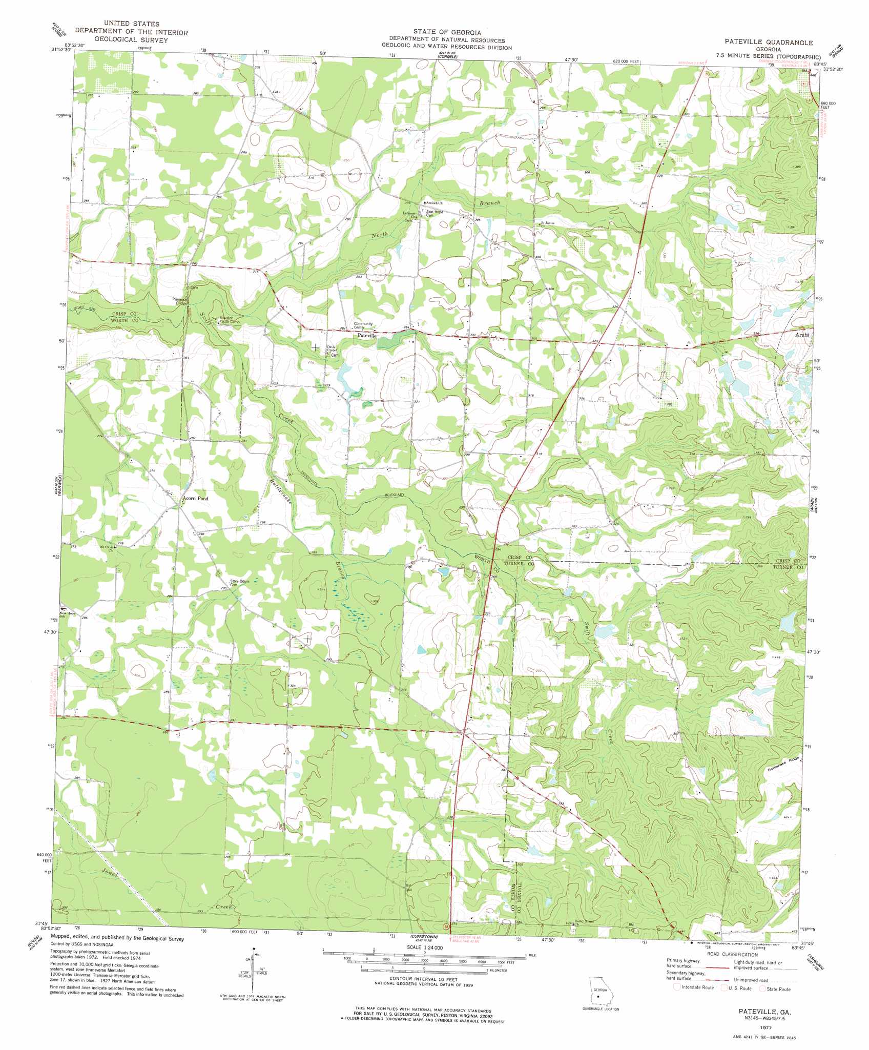
Pateville Topo Map Georgia
To zoom in, hover over the map of Pateville
USGS Topo Quad 31083g7 - 1:24,000 scale
| Topo Map Name: | Pateville |
| USGS Topo Quad ID: | 31083g7 |
| Print Size: | ca. 21 1/4" wide x 27" high |
| Southeast Coordinates: | 31.75° N latitude / 83.75° W longitude |
| Map Center Coordinates: | 31.8125° N latitude / 83.8125° W longitude |
| U.S. State: | GA |
| Filename: | o31083g7.jpg |
| Download Map JPG Image: | Pateville topo map 1:24,000 scale |
| Map Type: | Topographic |
| Topo Series: | 7.5´ |
| Map Scale: | 1:24,000 |
| Source of Map Images: | United States Geological Survey (USGS) |
| Alternate Map Versions: |
Pateville GA 1977, updated 1977 Download PDF Buy paper map Pateville GA 2011 Download PDF Buy paper map Pateville GA 2014 Download PDF Buy paper map |
1:24,000 Topo Quads surrounding Pateville
Methvins |
Drayton |
Vienna |
Pineview Sw |
Pineview West |
Leslie |
Cobb |
Cordele |
Penia |
Pitts |
Leslie Se |
Warwick |
Pateville |
Arabi |
Amboy |
Albany Ne |
Doles |
Cuffietown |
Ashburn |
Bethel |
Albany East |
Acree |
Sylvester |
Sumner |
Chula |
> Back to 31083e1 at 1:100,000 scale
> Back to 31082a1 at 1:250,000 scale
> Back to U.S. Topo Maps home
Pateville topo map: Gazetteer
Pateville: Bridges
County Line Bridge elevation 87m 285′Primrose Bridge elevation 76m 249′
Pateville: Dams
Hardin Lake Dam elevation 86m 282′Mckinney Lake Dam elevation 110m 360′
Moore Lake Dam elevation 104m 341′
Pateville: Populated Places
Acorn Pond elevation 86m 282′Bridges elevation 85m 278′
Hardin elevation 86m 282′
Pateville elevation 88m 288′
Pateville: Reservoirs
Hardin Lake elevation 86m 282′Mckinney Lake elevation 110m 360′
Moore Lake elevation 104m 341′
Pateville: Streams
North Branch Swift Creek elevation 76m 249′Rattlesnake Branch elevation 78m 255′
Pateville digital topo map on disk
Buy this Pateville topo map showing relief, roads, GPS coordinates and other geographical features, as a high-resolution digital map file on DVD: