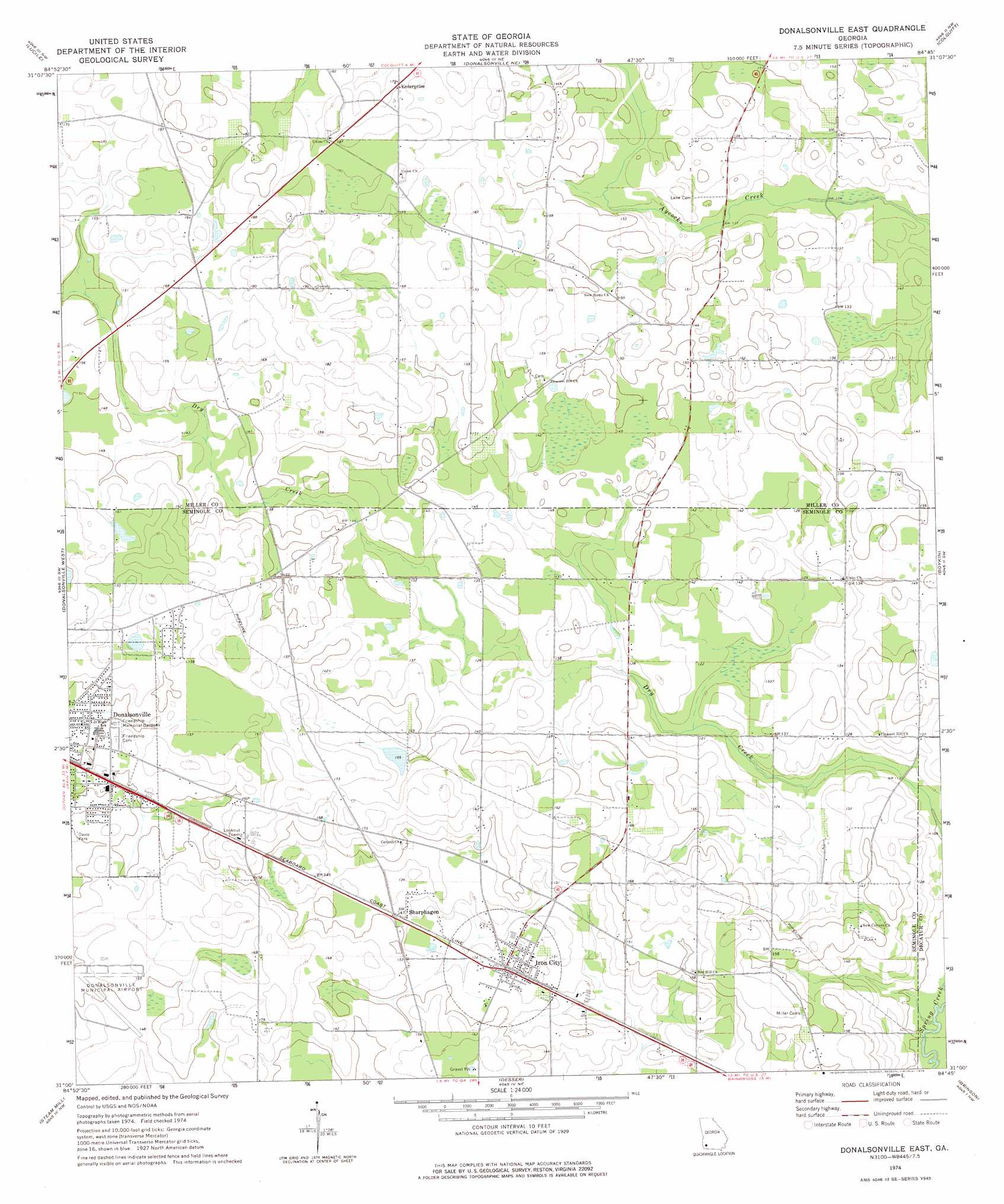
Donalsonville East Topo Map Georgia
To zoom in, hover over the map of Donalsonville East
USGS Topo Quad 31084a7 - 1:24,000 scale
| Topo Map Name: | Donalsonville East |
| USGS Topo Quad ID: | 31084a7 |
| Print Size: | ca. 21 1/4" wide x 27" high |
| Southeast Coordinates: | 31° N latitude / 84.75° W longitude |
| Map Center Coordinates: | 31.0625° N latitude / 84.8125° W longitude |
| U.S. State: | GA |
| Filename: | o31084a7.jpg |
| Download Map JPG Image: | Donalsonville East topo map 1:24,000 scale |
| Map Type: | Topographic |
| Topo Series: | 7.5´ |
| Map Scale: | 1:24,000 |
| Source of Map Images: | United States Geological Survey (USGS) |
| Alternate Map Versions: |
Donalsonville East GA 1974, updated 1976 Download PDF Buy paper map Donalsonville East GA 2011 Download PDF Buy paper map Donalsonville East GA 2014 Download PDF Buy paper map |
1:24,000 Topo Quads surrounding Donalsonville East
Columbia |
Blakely South |
Hentown |
Damascus |
Bethany |
Gordon |
Lucile |
Donalsonville Ne |
Colquitt |
Cooktown |
Saffold |
Donalsonville West |
Donalsonville East |
Boykin |
Steadhams Store |
Bascom |
Steam Mill |
Desser |
Brinson |
Bainbridge |
Dellwood |
Fairchild |
Reynoldsville |
Faceville |
Fowlstown |
> Back to 31084a1 at 1:100,000 scale
> Back to 31084a1 at 1:250,000 scale
> Back to U.S. Topo Maps home
Donalsonville East topo map: Gazetteer
Donalsonville East: Lakes
Indian Pond (historical) elevation 52m 170′Donalsonville East: Populated Places
Enterprise elevation 55m 180′Horns Cross Road (historical) elevation 58m 190′
Iron City elevation 44m 144′
Pine Lake Estates elevation 51m 167′
Sharphagen elevation 44m 144′
Spooner (historical) elevation 45m 147′
Donalsonville East digital topo map on disk
Buy this Donalsonville East topo map showing relief, roads, GPS coordinates and other geographical features, as a high-resolution digital map file on DVD:
Gulf Coast (LA, MS, AL, FL) & Southwestern Georgia
Buy digital topo maps: Gulf Coast (LA, MS, AL, FL) & Southwestern Georgia
 & Southwestern Georgia map DVD")