Cooktown Topo Map Georgia
To zoom in, hover over the map of Cooktown
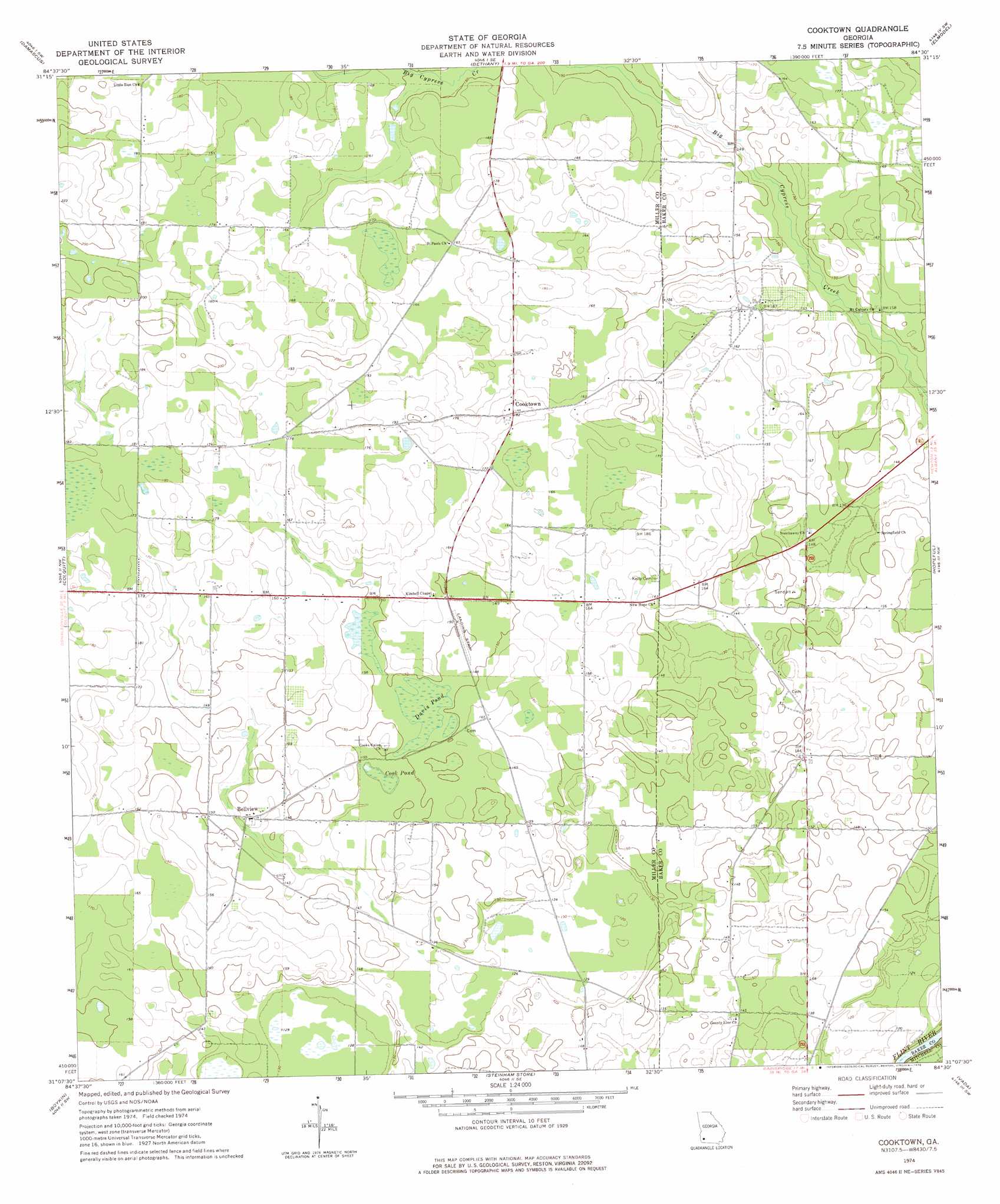
USGS Topo Quad 31084b5 - 1:24,000 scale
| Topo Map Name: | Cooktown |
| USGS Topo Quad ID: | 31084b5 |
| Print Size: | ca. 21 1/4" wide x 27" high |
| Southeast Coordinates: | 31.125° N latitude / 84.5° W longitude |
| Map Center Coordinates: | 31.1875° N latitude / 84.5625° W longitude |
| U.S. State: | GA |
| Filename: | o31084b5.jpg |
| Download Map JPG Image: | Cooktown topo map 1:24,000 scale |
| Map Type: | Topographic |
| Topo Series: | 7.5´ |
| Map Scale: | 1:24,000 |
| Source of Map Images: | United States Geological Survey (USGS) |
| Alternate Map Versions: |
Cooktown GA 1974, updated 1976 Download PDF Buy paper map Cooktown GA 2011 Download PDF Buy paper map Cooktown GA 2014 Download PDF Buy paper map |
1:24,000 Topo Quads surrounding Cooktown
Bancroft |
Arlington |
Leary |
Bermuda |
Red Store Crossroads |
Hentown |
Damascus |
Bethany |
Elmodel |
Newton |
Donalsonville Ne |
Colquitt |
Cooktown |
Hopeful |
Branchville |
Donalsonville East |
Boykin |
Steadhams Store |
Vada |
Gee Pond |
Desser |
Brinson |
Bainbridge |
Climax North |
Whigham |
> Back to 31084a1 at 1:100,000 scale
> Back to 31084a1 at 1:250,000 scale
> Back to U.S. Topo Maps home
Cooktown topo map: Gazetteer
Cooktown: Lakes
Big Pond (historical) elevation 36m 118′Cook Pond elevation 42m 137′
Davis Pond elevation 44m 144′
Cooktown: Populated Places
Bellview elevation 43m 141′Cooktown elevation 55m 180′
Cooktown digital topo map on disk
Buy this Cooktown topo map showing relief, roads, GPS coordinates and other geographical features, as a high-resolution digital map file on DVD:
Gulf Coast (LA, MS, AL, FL) & Southwestern Georgia
Buy digital topo maps: Gulf Coast (LA, MS, AL, FL) & Southwestern Georgia
 & Southwestern Georgia map DVD")