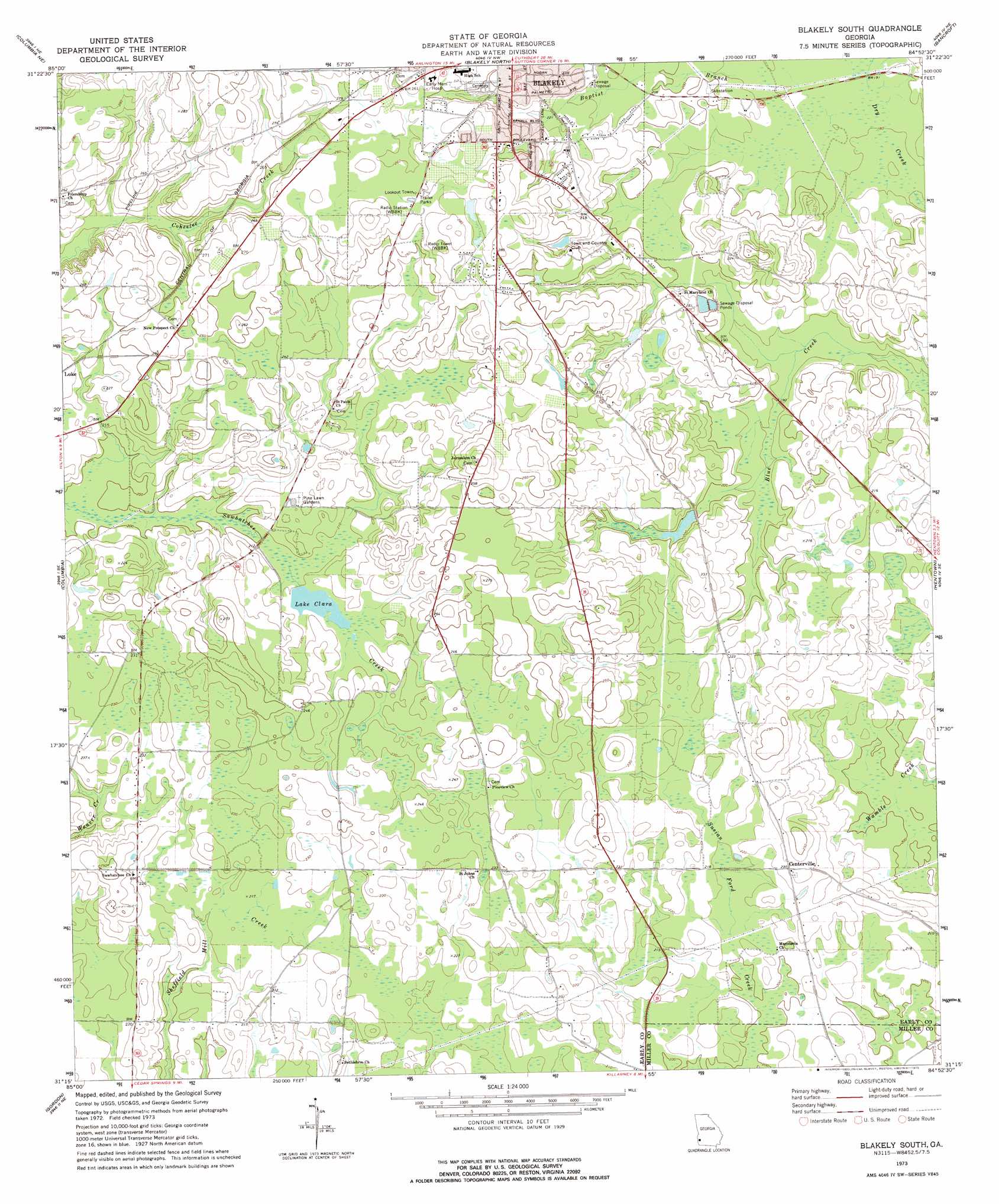
Blakely South Topo Map Georgia
To zoom in, hover over the map of Blakely South
USGS Topo Quad 31084c8 - 1:24,000 scale
| Topo Map Name: | Blakely South |
| USGS Topo Quad ID: | 31084c8 |
| Print Size: | ca. 21 1/4" wide x 27" high |
| Southeast Coordinates: | 31.25° N latitude / 84.875° W longitude |
| Map Center Coordinates: | 31.3125° N latitude / 84.9375° W longitude |
| U.S. State: | GA |
| Filename: | o31084c8.jpg |
| Download Map JPG Image: | Blakely South topo map 1:24,000 scale |
| Map Type: | Topographic |
| Topo Series: | 7.5´ |
| Map Scale: | 1:24,000 |
| Source of Map Images: | United States Geological Survey (USGS) |
| Alternate Map Versions: |
Blakely South GA 1973, updated 1975 Download PDF Buy paper map Blakely South GA 2011 Download PDF Buy paper map Blakely South GA 2014 Download PDF Buy paper map |
1:24,000 Topo Quads surrounding Blakely South
Abbeville East |
Fort Gaines |
Zetto |
Bluffton |
Edison |
Haleburg |
Columbia Ne |
Blakely North |
Bancroft |
Arlington |
Sigma |
Columbia |
Blakely South |
Hentown |
Damascus |
Ashford |
Gordon |
Lucile |
Donalsonville Ne |
Colquitt |
Grangeburg |
Saffold |
Donalsonville West |
Donalsonville East |
Boykin |
> Back to 31084a1 at 1:100,000 scale
> Back to 31084a1 at 1:250,000 scale
> Back to U.S. Topo Maps home
Blakely South topo map: Gazetteer
Blakely South: Dams
Bridges Lake Dam elevation 61m 200′Lake Clara Dam elevation 65m 213′
Blakely South: Parks
Alex Howell Baseball Park elevation 65m 213′Standifer Field elevation 78m 255′
Blakely South: Populated Places
Centerville elevation 71m 232′McLendon (historical) elevation 75m 246′
Blakely South: Reservoirs
Bridges Lake elevation 61m 200′Lake Clara elevation 65m 213′
Blakely South: Streams
Baptist Branch elevation 58m 190′Blakely South digital topo map on disk
Buy this Blakely South topo map showing relief, roads, GPS coordinates and other geographical features, as a high-resolution digital map file on DVD:
Gulf Coast (LA, MS, AL, FL) & Southwestern Georgia
Buy digital topo maps: Gulf Coast (LA, MS, AL, FL) & Southwestern Georgia
 & Southwestern Georgia map DVD")