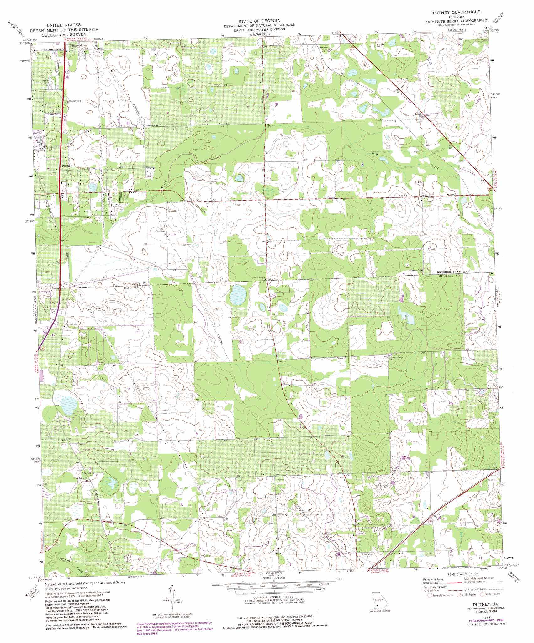
Putney Topo Map Georgia
To zoom in, hover over the map of Putney
USGS Topo Quad 31084d1 - 1:24,000 scale
| Topo Map Name: | Putney |
| USGS Topo Quad ID: | 31084d1 |
| Print Size: | ca. 21 1/4" wide x 27" high |
| Southeast Coordinates: | 31.375° N latitude / 84° W longitude |
| Map Center Coordinates: | 31.4375° N latitude / 84.0625° W longitude |
| U.S. State: | GA |
| Filename: | o31084d1.jpg |
| Download Map JPG Image: | Putney topo map 1:24,000 scale |
| Map Type: | Topographic |
| Topo Series: | 7.5´ |
| Map Scale: | 1:24,000 |
| Source of Map Images: | United States Geological Survey (USGS) |
| Alternate Map Versions: |
Putney GA 1974, updated 1976 Download PDF Buy paper map Putney GA 1974, updated 1988 Download PDF Buy paper map Putney GA 2011 Download PDF Buy paper map Putney GA 2014 Download PDF Buy paper map |
1:24,000 Topo Quads surrounding Putney
Sasser |
Leesburg |
Albany Ne |
Doles |
Cuffietown |
Pretoria |
Albany West |
Albany East |
Acree |
Sylvester |
Red Store Crossroads |
Baconton North |
Putney |
Bridgeboro |
Tempy |
Newton |
Baconton South |
Sale City |
Doerun |
Sigsbee |
Branchville |
Camilla |
Cotton |
Hartsfield |
Moultrie |
> Back to 31084a1 at 1:100,000 scale
> Back to 31084a1 at 1:250,000 scale
> Back to U.S. Topo Maps home
Putney topo map: Gazetteer
Putney: Dams
Weatherby Lake Dam elevation 82m 269′Putney: Populated Places
Hollands Folly elevation 61m 200′Loretta Heights elevation 56m 183′
Putney elevation 60m 196′
Williamsburg elevation 59m 193′
Putney: Reservoirs
Weatherby Lake elevation 82m 269′Putney digital topo map on disk
Buy this Putney topo map showing relief, roads, GPS coordinates and other geographical features, as a high-resolution digital map file on DVD:
Gulf Coast (LA, MS, AL, FL) & Southwestern Georgia
Buy digital topo maps: Gulf Coast (LA, MS, AL, FL) & Southwestern Georgia
 & Southwestern Georgia map DVD")