Pretoria Topo Map Georgia
To zoom in, hover over the map of Pretoria
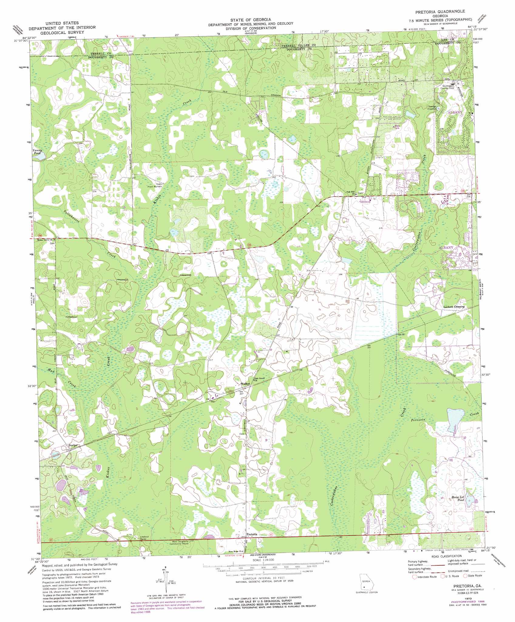
USGS Topo Quad 31084e3 - 1:24,000 scale
| Topo Map Name: | Pretoria |
| USGS Topo Quad ID: | 31084e3 |
| Print Size: | ca. 21 1/4" wide x 27" high |
| Southeast Coordinates: | 31.5° N latitude / 84.25° W longitude |
| Map Center Coordinates: | 31.5625° N latitude / 84.3125° W longitude |
| U.S. State: | GA |
| Filename: | o31084e3.jpg |
| Download Map JPG Image: | Pretoria topo map 1:24,000 scale |
| Map Type: | Topographic |
| Topo Series: | 7.5´ |
| Map Scale: | 1:24,000 |
| Source of Map Images: | United States Geological Survey (USGS) |
| Alternate Map Versions: |
Pretoria GA 1973, updated 1974 Download PDF Buy paper map Pretoria GA 1973, updated 1988 Download PDF Buy paper map Pretoria GA 2011 Download PDF Buy paper map Pretoria GA 2014 Download PDF Buy paper map |
1:24,000 Topo Quads surrounding Pretoria
Shellman |
Dawson |
Bronwood |
Neyami |
Leslie Se |
Doverel |
Chickasawhatchee |
Sasser |
Leesburg |
Albany Ne |
Morgan |
Holt |
Pretoria |
Albany West |
Albany East |
Leary |
Bermuda |
Red Store Crossroads |
Baconton North |
Putney |
Bethany |
Elmodel |
Newton |
Baconton South |
Sale City |
> Back to 31084e1 at 1:100,000 scale
> Back to 31084a1 at 1:250,000 scale
> Back to U.S. Topo Maps home
Pretoria topo map: Gazetteer
Pretoria: Airports
Pine Knoll Landing Field (historical) elevation 63m 206′Pretoria: Lakes
Horse Lot Pond elevation 56m 183′Rush Pond elevation 56m 183′
Pretoria: Parks
YMCA Sports Park elevation 64m 209′Pretoria: Populated Places
Brookhollow elevation 58m 190′Cedar Lake elevation 59m 193′
Doublegate elevation 63m 206′
Ducker elevation 61m 200′
Gillionville Forest elevation 71m 232′
Indian Creek elevation 59m 193′
Lockett Crossing elevation 58m 190′
Pretoria elevation 57m 187′
Springfield elevation 64m 209′
Vancise elevation 75m 246′
Walker elevation 59m 193′
Pretoria: Reservoirs
Yancey Pond elevation 67m 219′Pretoria: Streams
Mud Creek elevation 57m 187′Percosin Creek elevation 54m 177′
Tallahassee Creek elevation 59m 193′
Pretoria digital topo map on disk
Buy this Pretoria topo map showing relief, roads, GPS coordinates and other geographical features, as a high-resolution digital map file on DVD:
Gulf Coast (LA, MS, AL, FL) & Southwestern Georgia
Buy digital topo maps: Gulf Coast (LA, MS, AL, FL) & Southwestern Georgia
 & Southwestern Georgia map DVD")