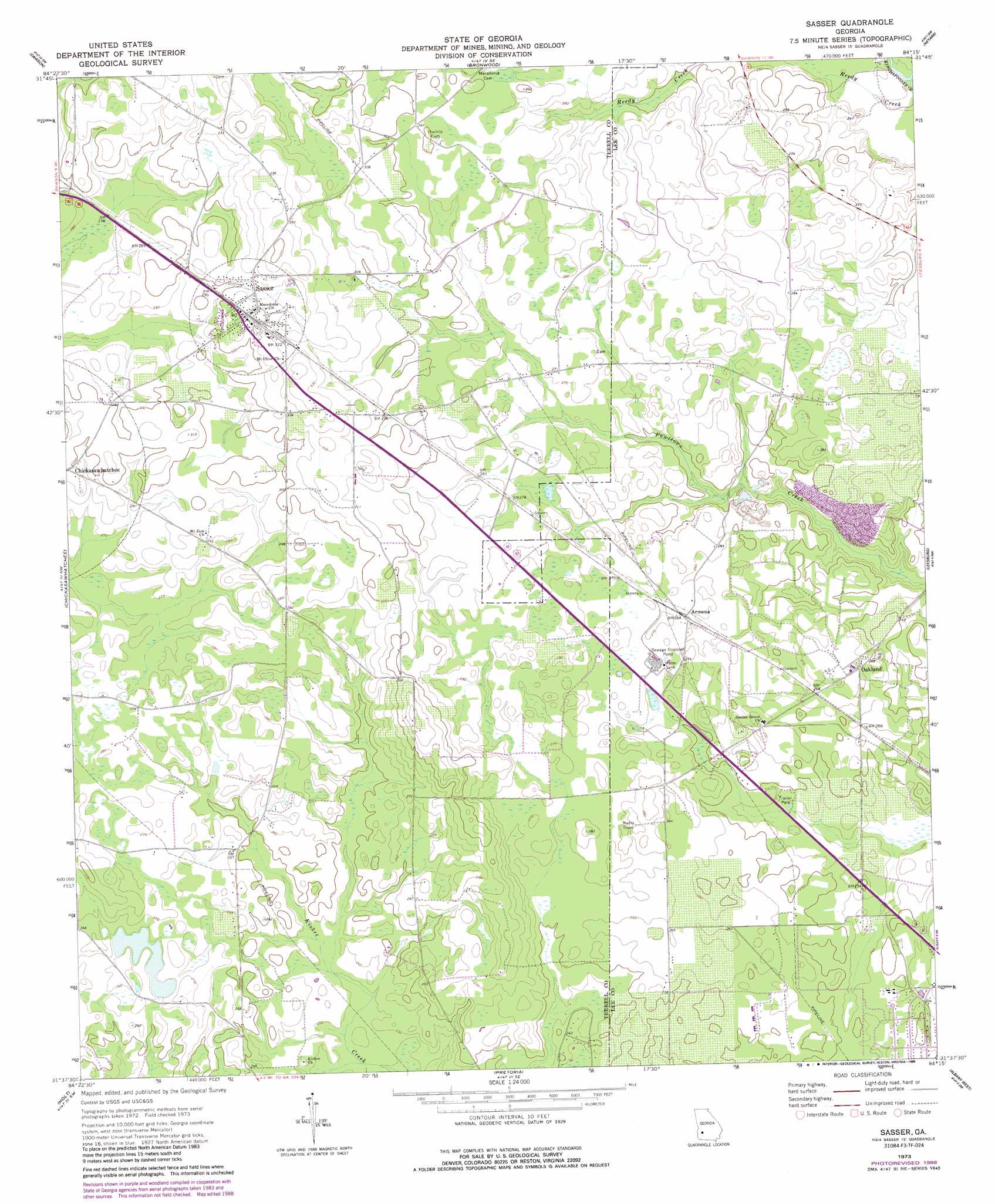
Sasser Topo Map Georgia
To zoom in, hover over the map of Sasser
USGS Topo Quad 31084f3 - 1:24,000 scale
| Topo Map Name: | Sasser |
| USGS Topo Quad ID: | 31084f3 |
| Print Size: | ca. 21 1/4" wide x 27" high |
| Southeast Coordinates: | 31.625° N latitude / 84.25° W longitude |
| Map Center Coordinates: | 31.6875° N latitude / 84.3125° W longitude |
| U.S. State: | GA |
| Filename: | o31084f3.jpg |
| Download Map JPG Image: | Sasser topo map 1:24,000 scale |
| Map Type: | Topographic |
| Topo Series: | 7.5´ |
| Map Scale: | 1:24,000 |
| Source of Map Images: | United States Geological Survey (USGS) |
| Alternate Map Versions: |
Sasser GA 1973, updated 1974 Download PDF Buy paper map Sasser GA 1973, updated 1988 Download PDF Buy paper map Sasser GA 2011 Download PDF Buy paper map Sasser GA 2014 Download PDF Buy paper map |
1:24,000 Topo Quads surrounding Sasser
Parrott |
Bottsford |
Smithville West |
Smithville East |
Leslie |
Shellman |
Dawson |
Bronwood |
Neyami |
Leslie Se |
Doverel |
Chickasawhatchee |
Sasser |
Leesburg |
Albany Ne |
Morgan |
Holt |
Pretoria |
Albany West |
Albany East |
Leary |
Bermuda |
Red Store Crossroads |
Baconton North |
Putney |
> Back to 31084e1 at 1:100,000 scale
> Back to 31084a1 at 1:250,000 scale
> Back to U.S. Topo Maps home
Sasser topo map: Gazetteer
Sasser: Airports
Ayresport Airport elevation 79m 259′Sasser: Dams
Albany Lake Dam elevation 80m 262′Sasser: Parks
Sasser Commercial Historic District elevation 96m 314′Sasser: Populated Places
Armena elevation 80m 262′Chickasawhatchee elevation 91m 298′
Oakland elevation 83m 272′
Sasser elevation 97m 318′
Sasser: Reservoirs
Albany Lake elevation 80m 262′Sasser digital topo map on disk
Buy this Sasser topo map showing relief, roads, GPS coordinates and other geographical features, as a high-resolution digital map file on DVD:
Gulf Coast (LA, MS, AL, FL) & Southwestern Georgia
Buy digital topo maps: Gulf Coast (LA, MS, AL, FL) & Southwestern Georgia
 & Southwestern Georgia map DVD")