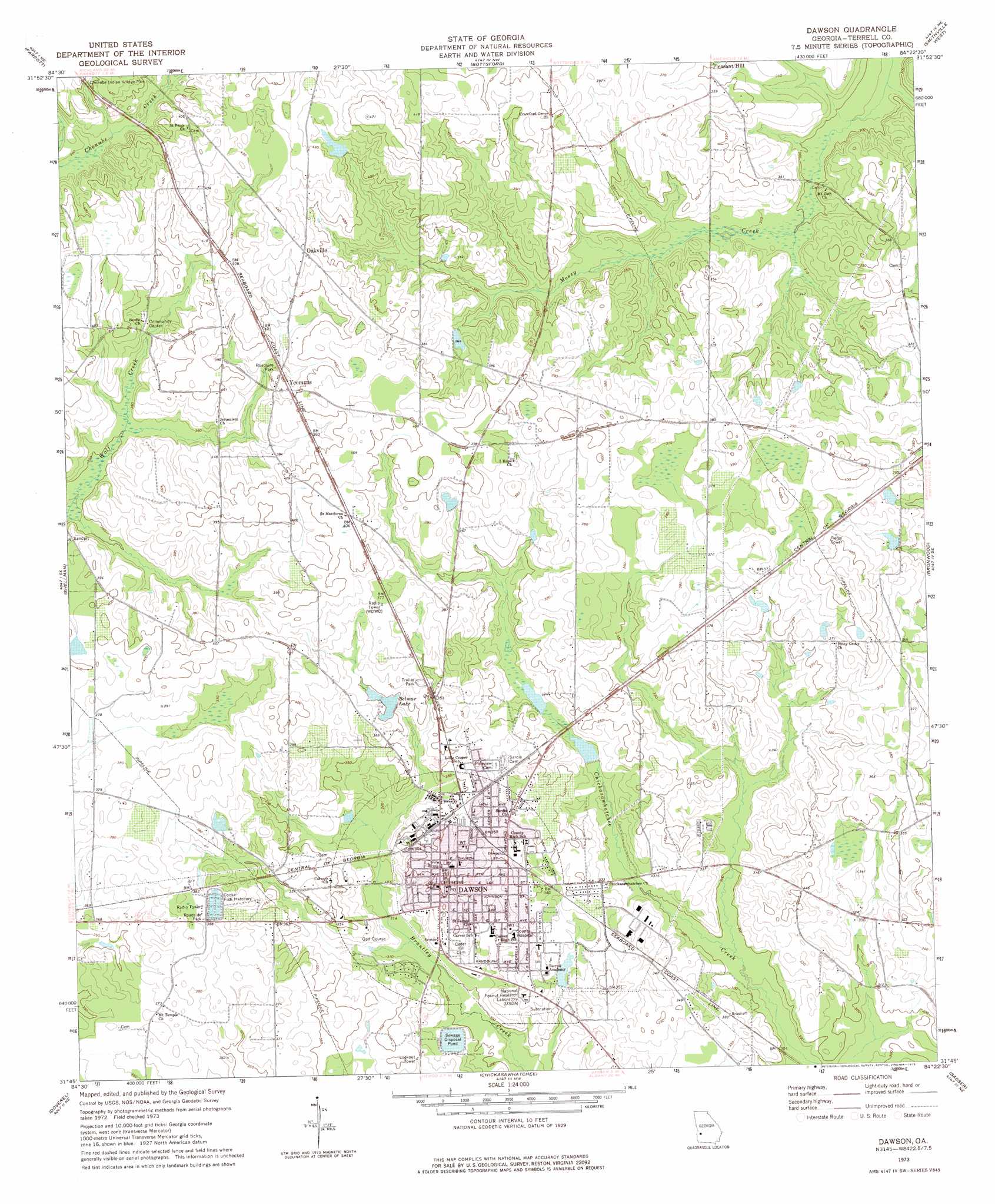
Dawson Topo Map Georgia
To zoom in, hover over the map of Dawson
USGS Topo Quad 31084g4 - 1:24,000 scale
| Topo Map Name: | Dawson |
| USGS Topo Quad ID: | 31084g4 |
| Print Size: | ca. 21 1/4" wide x 27" high |
| Southeast Coordinates: | 31.75° N latitude / 84.375° W longitude |
| Map Center Coordinates: | 31.8125° N latitude / 84.4375° W longitude |
| U.S. State: | GA |
| Filename: | o31084g4.jpg |
| Download Map JPG Image: | Dawson topo map 1:24,000 scale |
| Map Type: | Topographic |
| Topo Series: | 7.5´ |
| Map Scale: | 1:24,000 |
| Source of Map Images: | United States Geological Survey (USGS) |
| Alternate Map Versions: |
Dawson GA 1973, updated 1975 Download PDF Buy paper map Dawson GA 2011 Download PDF Buy paper map Dawson GA 2014 Download PDF Buy paper map |
1:24,000 Topo Quads surrounding Dawson
Richland |
Preston |
Plains |
Lake Collins |
Americus |
Benevolence |
Parrott |
Bottsford |
Smithville West |
Smithville East |
Brooksville |
Shellman |
Dawson |
Bronwood |
Neyami |
Martins Crossroads |
Doverel |
Chickasawhatchee |
Sasser |
Leesburg |
Edison |
Morgan |
Holt |
Pretoria |
Albany West |
> Back to 31084e1 at 1:100,000 scale
> Back to 31084a1 at 1:250,000 scale
> Back to U.S. Topo Maps home
Dawson topo map: Gazetteer
Dawson: Airports
Hayes Airport elevation 122m 400′Dawson: Dams
Belmar Lake Dam elevation 105m 344′Bolton Lake Dam elevation 116m 380′
Boyd Lake Dam elevation 98m 321′
Chamblis Lake Dam elevation 97m 318′
Dawson Sewage Pond Dam elevation 99m 324′
Kennedy Lake Dam elevation 99m 324′
McCledon Lake Dam elevation 123m 403′
Prescott Lake Dam elevation 110m 360′
Smith Lake Dam elevation 110m 360′
Dawson: Parks
Chenube Indian Village Monument elevation 119m 390′Griggs Memorial elevation 107m 351′
Dawson: Populated Places
Belmont (historical) elevation 124m 406′Chenube (historical) elevation 120m 393′
Dawson elevation 107m 351′
Oakville elevation 128m 419′
Yeomans elevation 121m 396′
Dawson: Post Offices
Dawson Post Office elevation 106m 347′Dawson: Reservoirs
Belmar Lake elevation 105m 344′Bolton Lake elevation 116m 380′
Boyd Lake elevation 98m 321′
Chamblis Lake elevation 97m 318′
Dawson Sewage Pond elevation 99m 324′
Kennedy Lake elevation 99m 324′
McCledon Lake elevation 123m 403′
Prescott Lake elevation 110m 360′
Smith Lake elevation 110m 360′
Dawson digital topo map on disk
Buy this Dawson topo map showing relief, roads, GPS coordinates and other geographical features, as a high-resolution digital map file on DVD:
Gulf Coast (LA, MS, AL, FL) & Southwestern Georgia
Buy digital topo maps: Gulf Coast (LA, MS, AL, FL) & Southwestern Georgia
 & Southwestern Georgia map DVD")