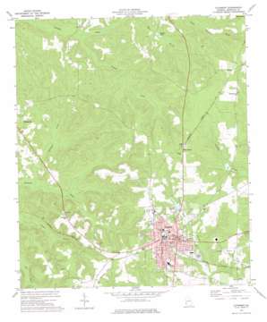
Cuthbert Topo Map Georgia
To zoom in, hover over the map of Cuthbert
USGS Topo Quad 31084g7 - 1:24,000 scale
| Topo Map Name: | Cuthbert |
| USGS Topo Quad ID: | 31084g7 |
| Print Size: | ca. 21 1/4" wide x 27" high |
| Southeast Coordinates: | 31.75° N latitude / 84.75° W longitude |
| Map Center Coordinates: | 31.8125° N latitude / 84.8125° W longitude |
| U.S. State: | GA |
| Filename: | o31084g7.jpg |
| Download Map JPG Image: | Cuthbert topo map 1:24,000 scale |
| Map Type: | Topographic |
| Topo Series: | 7.5´ |
| Map Scale: | 1:24,000 |
| Source of Map Images: | United States Geological Survey (USGS) |
| Alternate Map Versions: |
Cuthbert GA 1972, updated 1975 Download PDF Buy paper map Cuthbert GA 2011 Download PDF Buy paper map Cuthbert GA 2014 Download PDF Buy paper map |
1:24,000 Topo Quads surrounding Cuthbert
> Back to 31084e1 at 1:100,000 scale
> Back to 31084a1 at 1:250,000 scale
> Back to U.S. Topo Maps home
Cuthbert topo map: Gazetteer
Cuthbert: Dams
Bullock Lake Dam elevation 130m 426′Cloud Lake Dam elevation 119m 390′
English Lake Dam elevation 99m 324′
Faircloth Lake Dam elevation 131m 429′
Grinols Lake Dam elevation 135m 442′
Maddox Lake Dam elevation 123m 403′
Cuthbert: Parks
Cuthbert Historic District elevation 142m 465′Cuthbert: Populated Places
Coles elevation 147m 482′Cuthbert elevation 142m 465′
Peterson Hill elevation 147m 482′
Wades elevation 158m 518′
Cuthbert: Post Offices
Cuthbert Post Office elevation 143m 469′Cuthbert: Reservoirs
Bullock Lake elevation 130m 426′Butlers Pond elevation 96m 314′
Cloud Lake elevation 119m 390′
English Lake elevation 99m 324′
Faircloth Lake elevation 131m 429′
Grinols Lake elevation 135m 442′
Maddox Lake elevation 123m 403′
Cuthbert: Streams
Crooked Creek elevation 82m 269′McCallop Creek elevation 85m 278′
Pumpkin Creek elevation 77m 252′
Cuthbert digital topo map on disk
Buy this Cuthbert topo map showing relief, roads, GPS coordinates and other geographical features, as a high-resolution digital map file on DVD:
Gulf Coast (LA, MS, AL, FL) & Southwestern Georgia
Buy digital topo maps: Gulf Coast (LA, MS, AL, FL) & Southwestern Georgia


