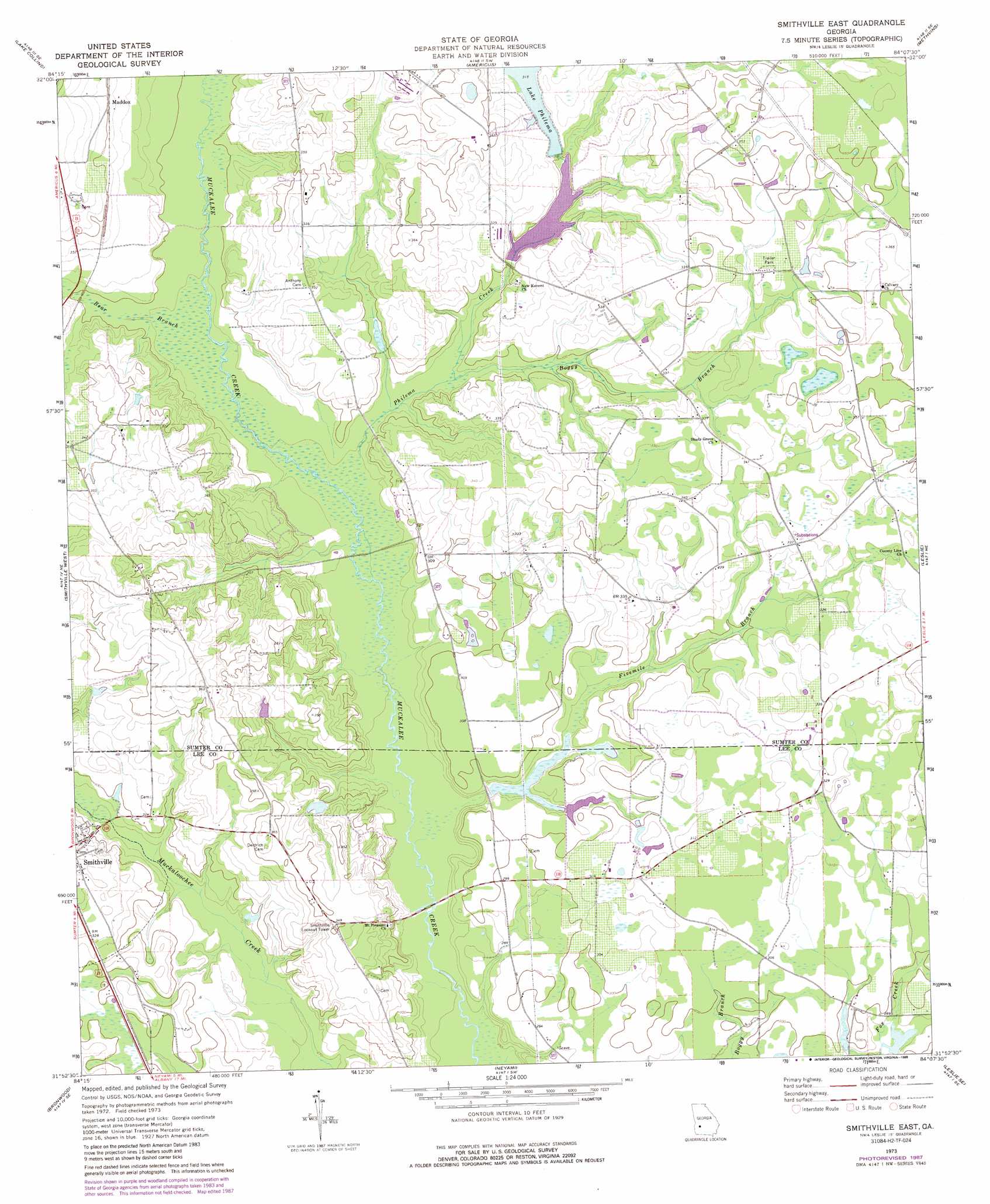
Smithville East Topo Map Georgia
To zoom in, hover over the map of Smithville East
USGS Topo Quad 31084h2 - 1:24,000 scale
| Topo Map Name: | Smithville East |
| USGS Topo Quad ID: | 31084h2 |
| Print Size: | ca. 21 1/4" wide x 27" high |
| Southeast Coordinates: | 31.875° N latitude / 84.125° W longitude |
| Map Center Coordinates: | 31.9375° N latitude / 84.1875° W longitude |
| U.S. State: | GA |
| Filename: | o31084h2.jpg |
| Download Map JPG Image: | Smithville East topo map 1:24,000 scale |
| Map Type: | Topographic |
| Topo Series: | 7.5´ |
| Map Scale: | 1:24,000 |
| Source of Map Images: | United States Geological Survey (USGS) |
| Alternate Map Versions: |
Smithville East GA 1973, updated 1976 Download PDF Buy paper map Smithville East GA 1973, updated 1988 Download PDF Buy paper map Smithville East GA 2011 Download PDF Buy paper map Smithville East GA 2014 Download PDF Buy paper map |
1:24,000 Topo Quads surrounding Smithville East
Draneville |
Ellaville South |
Andersonville |
Pennington |
Byromville |
Plains |
Lake Collins |
Americus |
Methvins |
Drayton |
Bottsford |
Smithville West |
Smithville East |
Leslie |
Cobb |
Dawson |
Bronwood |
Neyami |
Leslie Se |
Warwick |
Chickasawhatchee |
Sasser |
Leesburg |
Albany Ne |
Doles |
> Back to 31084e1 at 1:100,000 scale
> Back to 31084a1 at 1:250,000 scale
> Back to U.S. Topo Maps home
Smithville East topo map: Gazetteer
Smithville East: Bridges
Nine Bridges elevation 82m 269′Smithville East: Dams
Ballinger Lake Dam elevation 93m 305′Lake Philema Dam elevation 92m 301′
Phillips Pond Dam elevation 84m 275′
Powell Dairy Farm Dam elevation 92m 301′
Usry Lake Dam elevation 86m 282′
Virgil Holmen Lake Dam elevation 103m 337′
Wells Millpond Dam elevation 100m 328′
Smithville East: Populated Places
Maddox elevation 107m 351′Smithville East: Reservoirs
Ballinger Lake elevation 93m 305′Lake Philema elevation 92m 301′
Phillips Pond elevation 84m 275′
Powell Dairy Farm Lake elevation 92m 301′
Usry Lake elevation 86m 282′
Virgil Holmen Lake elevation 103m 337′
Well Millpond elevation 100m 328′
Smithville East: Streams
Bear Branch elevation 87m 285′Boggy Branch elevation 87m 285′
Fivemile Branch elevation 82m 269′
Philema Creek elevation 85m 278′
Smithville East digital topo map on disk
Buy this Smithville East topo map showing relief, roads, GPS coordinates and other geographical features, as a high-resolution digital map file on DVD:
Gulf Coast (LA, MS, AL, FL) & Southwestern Georgia
Buy digital topo maps: Gulf Coast (LA, MS, AL, FL) & Southwestern Georgia
 & Southwestern Georgia map DVD")