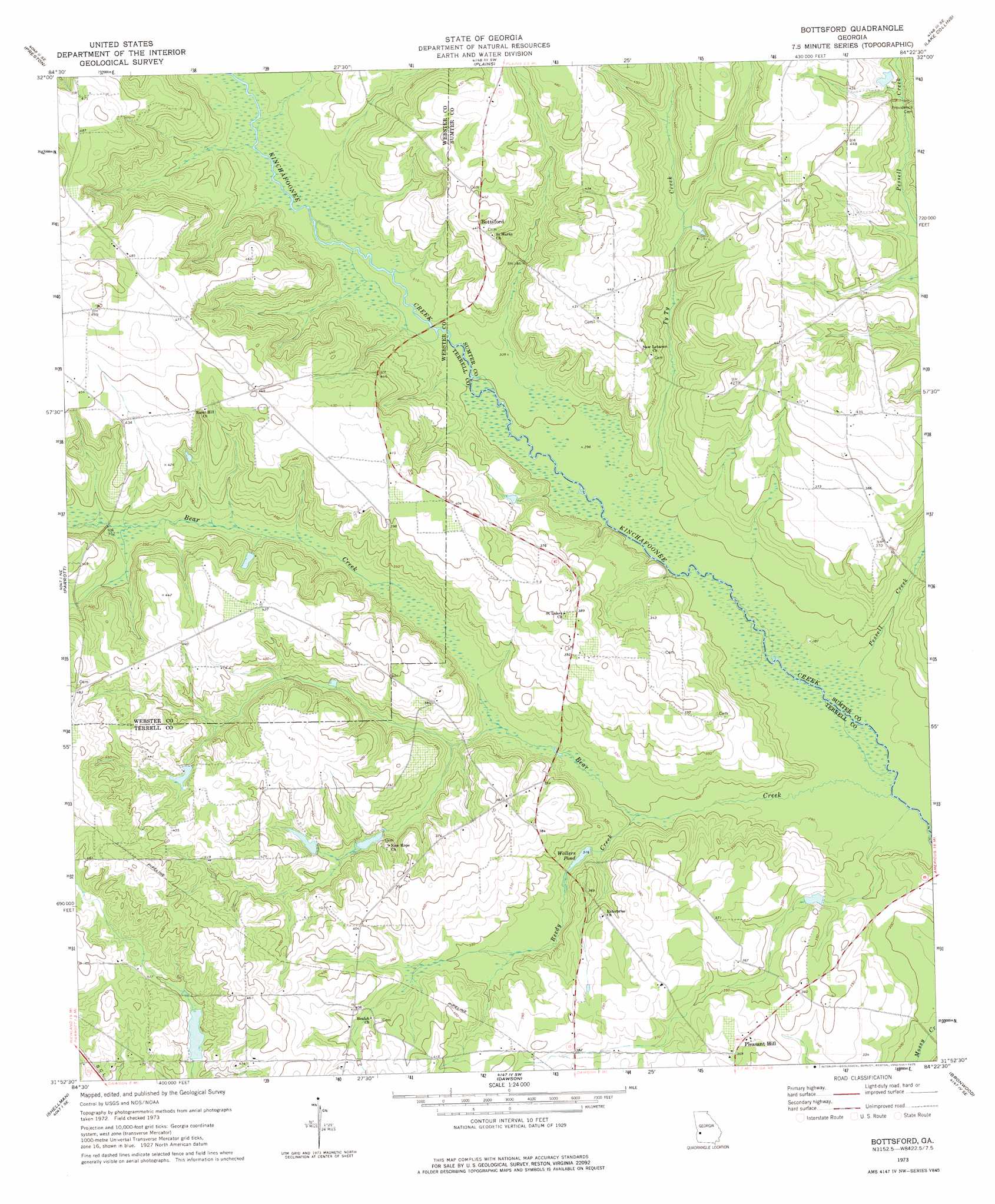
Bottsford Topo Map Georgia
To zoom in, hover over the map of Bottsford
USGS Topo Quad 31084h4 - 1:24,000 scale
| Topo Map Name: | Bottsford |
| USGS Topo Quad ID: | 31084h4 |
| Print Size: | ca. 21 1/4" wide x 27" high |
| Southeast Coordinates: | 31.875° N latitude / 84.375° W longitude |
| Map Center Coordinates: | 31.9375° N latitude / 84.4375° W longitude |
| U.S. State: | GA |
| Filename: | o31084h4.jpg |
| Download Map JPG Image: | Bottsford topo map 1:24,000 scale |
| Map Type: | Topographic |
| Topo Series: | 7.5´ |
| Map Scale: | 1:24,000 |
| Source of Map Images: | United States Geological Survey (USGS) |
| Alternate Map Versions: |
Bottsford GA 1973, updated 1975 Download PDF Buy paper map Bottsford GA 2011 Download PDF Buy paper map Bottsford GA 2014 Download PDF Buy paper map |
1:24,000 Topo Quads surrounding Bottsford
Brooklyn |
Church Hill |
Draneville |
Ellaville South |
Andersonville |
Richland |
Preston |
Plains |
Lake Collins |
Americus |
Benevolence |
Parrott |
Bottsford |
Smithville West |
Smithville East |
Brooksville |
Shellman |
Dawson |
Bronwood |
Neyami |
Martins Crossroads |
Doverel |
Chickasawhatchee |
Sasser |
Leesburg |
> Back to 31084e1 at 1:100,000 scale
> Back to 31084a1 at 1:250,000 scale
> Back to U.S. Topo Maps home
Bottsford topo map: Gazetteer
Bottsford: Bridges
Halls Bridge (historical) elevation 91m 298′Bottsford: Dams
Wallers Pond Dam elevation 96m 314′Bottsford: Populated Places
Bottsford elevation 136m 446′Cottondale elevation 116m 380′
Pleasant Hill elevation 112m 367′
Worner (historical) elevation 122m 400′
Bottsford: Reservoirs
Wallers Pond elevation 96m 314′Bottsford: Streams
Bear Creek elevation 86m 282′Pessell Creek elevation 88m 288′
Reedy Creek elevation 91m 298′
Ty Ty Creek elevation 91m 298′
Bottsford digital topo map on disk
Buy this Bottsford topo map showing relief, roads, GPS coordinates and other geographical features, as a high-resolution digital map file on DVD:
Gulf Coast (LA, MS, AL, FL) & Southwestern Georgia
Buy digital topo maps: Gulf Coast (LA, MS, AL, FL) & Southwestern Georgia
 & Southwestern Georgia map DVD")