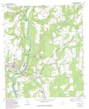
Columbia Topo Map Georgia
To zoom in, hover over the map of Columbia
USGS Topo Quad 31085c1 - 1:24,000 scale
| Topo Map Name: | Columbia |
| USGS Topo Quad ID: | 31085c1 |
| Print Size: | ca. 21 1/4" wide x 27" high |
| Southeast Coordinates: | 31.25° N latitude / 85° W longitude |
| Map Center Coordinates: | 31.3125° N latitude / 85.0625° W longitude |
| U.S. States: | GA, AL |
| Filename: | o31085c1.jpg |
| Download Map JPG Image: | Columbia topo map 1:24,000 scale |
| Map Type: | Topographic |
| Topo Series: | 7.5´ |
| Map Scale: | 1:24,000 |
| Source of Map Images: | United States Geological Survey (USGS) |
| Alternate Map Versions: |
Columbia AL 1970, updated 1972 Download PDF Buy paper map Columbia AL 1970, updated 1981 Download PDF Buy paper map Columbia AL 1980, updated 1984 Download PDF Buy paper map Columbia AL 2011 Download PDF Buy paper map Columbia AL 2011 Download PDF Buy paper map Columbia AL 2014 Download PDF Buy paper map |
1:24,000 Topo Quads surrounding Columbia
> Back to 31085a1 at 1:100,000 scale
> Back to 31084a1 at 1:250,000 scale
> Back to U.S. Topo Maps home
Columbia topo map: Gazetteer
Columbia: Bends
Freeman Bend elevation 33m 108′Columbia: Bridges
Coheelee Creek Covered Bridge elevation 37m 121′Columbia Bridge elevation 31m 101′
Columbia: Dams
George W Andrews Lock and Dam elevation 23m 75′George W Andrews Lock and Dam elevation 31m 101′
Columbia: Lakes
Jackson Pond elevation 64m 209′Spring Pond elevation 51m 167′
Columbia: Parks
Coheelee Creek Public Use Area elevation 37m 121′Fannie Askew Williams Park elevation 41m 134′
Odom Creek Public Use Area elevation 32m 104′
Omusee Creek Public Use Area elevation 34m 111′
Columbia: Populated Places
Columbia elevation 64m 209′Freeman elevation 66m 216′
Hilton elevation 66m 216′
Luke elevation 72m 236′
Rock Hill elevation 67m 219′
Sawhatchee elevation 61m 200′
Columbia: Post Offices
Columbia Post Office elevation 64m 209′Wellborn Post Office (historical) elevation 56m 183′
Columbia: Reservoirs
Good Hope Farm Pond elevation 50m 164′Lake George W. Andrews elevation 31m 101′
Martins Pond elevation 60m 196′
Columbia: Streams
Baker Creek elevation 31m 101′Chancey Mill Creek elevation 50m 164′
Coheelee Creek elevation 32m 104′
Foster Creek elevation 31m 101′
Freeman Branch elevation 32m 104′
Odom Creek elevation 32m 104′
Omusee Creek elevation 31m 101′
Weaver Creek elevation 44m 144′
Columbia digital topo map on disk
Buy this Columbia topo map showing relief, roads, GPS coordinates and other geographical features, as a high-resolution digital map file on DVD:
Gulf Coast (LA, MS, AL, FL) & Southwestern Georgia
Buy digital topo maps: Gulf Coast (LA, MS, AL, FL) & Southwestern Georgia


