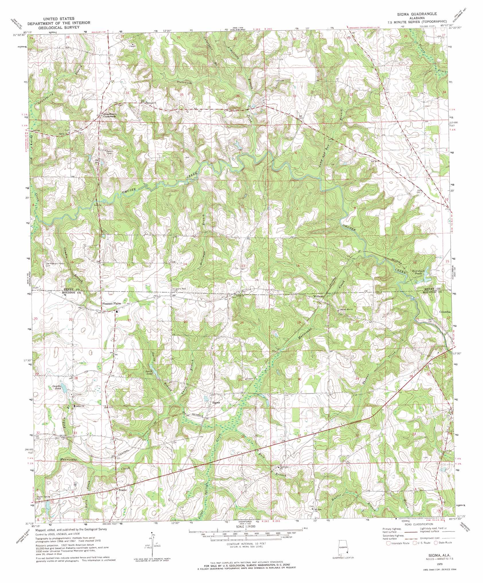
Sigma Topo Map Alabama
To zoom in, hover over the map of Sigma
USGS Topo Quad 31085c2 - 1:24,000 scale
| Topo Map Name: | Sigma |
| USGS Topo Quad ID: | 31085c2 |
| Print Size: | ca. 21 1/4" wide x 27" high |
| Southeast Coordinates: | 31.25° N latitude / 85.125° W longitude |
| Map Center Coordinates: | 31.3125° N latitude / 85.1875° W longitude |
| U.S. State: | AL |
| Filename: | o31085c2.jpg |
| Download Map JPG Image: | Sigma topo map 1:24,000 scale |
| Map Type: | Topographic |
| Topo Series: | 7.5´ |
| Map Scale: | 1:24,000 |
| Source of Map Images: | United States Geological Survey (USGS) |
| Alternate Map Versions: |
Sigma AL 1970, updated 1972 Download PDF Buy paper map Sigma AL 2011 Download PDF Buy paper map Sigma AL 2014 Download PDF Buy paper map |
1:24,000 Topo Quads surrounding Sigma
Clopton |
Abbeville West |
Abbeville East |
Fort Gaines |
Zetto |
Echo |
Newville |
Haleburg |
Columbia Ne |
Blakely North |
Midland City |
Headland |
Sigma |
Columbia |
Blakely South |
Dothan West |
Dothan East |
Ashford |
Gordon |
Lucile |
Madrid |
Cottonwood |
Grangeburg |
Saffold |
Donalsonville West |
> Back to 31085a1 at 1:100,000 scale
> Back to 31084a1 at 1:250,000 scale
> Back to U.S. Topo Maps home
Sigma topo map: Gazetteer
Sigma: Populated Places
Grandberry Crossroads elevation 95m 311′Hebron elevation 95m 311′
Pearce elevation 79m 259′
Pleasant Plains elevation 86m 282′
Sigma elevation 69m 226′
Williams elevation 47m 154′
Sigma: Reservoirs
Gamble Pond elevation 78m 255′Rivenbark Ponds elevation 50m 164′
Smith Lake elevation 60m 196′
Sigma: Streams
Armstrong Branch elevation 48m 157′Buie Branch elevation 47m 154′
Cedar Springs Creek elevation 47m 154′
Culpepper Branch elevation 53m 173′
Gamble Branch elevation 49m 160′
Grandberry Branch elevation 56m 183′
Holliman Branch elevation 45m 147′
Hunter Branch elevation 48m 157′
Hurricane Creek elevation 39m 127′
Jump and Run Branch elevation 40m 131′
Nalls Creek elevation 59m 193′
Pelham Branch elevation 61m 200′
Smith Branch elevation 51m 167′
Spivey Mill Creek elevation 49m 160′
Stevenson Creek elevation 43m 141′
Thomas Creek elevation 33m 108′
Yance Branch elevation 51m 167′
Sigma digital topo map on disk
Buy this Sigma topo map showing relief, roads, GPS coordinates and other geographical features, as a high-resolution digital map file on DVD:
Gulf Coast (LA, MS, AL, FL) & Southwestern Georgia
Buy digital topo maps: Gulf Coast (LA, MS, AL, FL) & Southwestern Georgia
 & Southwestern Georgia map DVD")