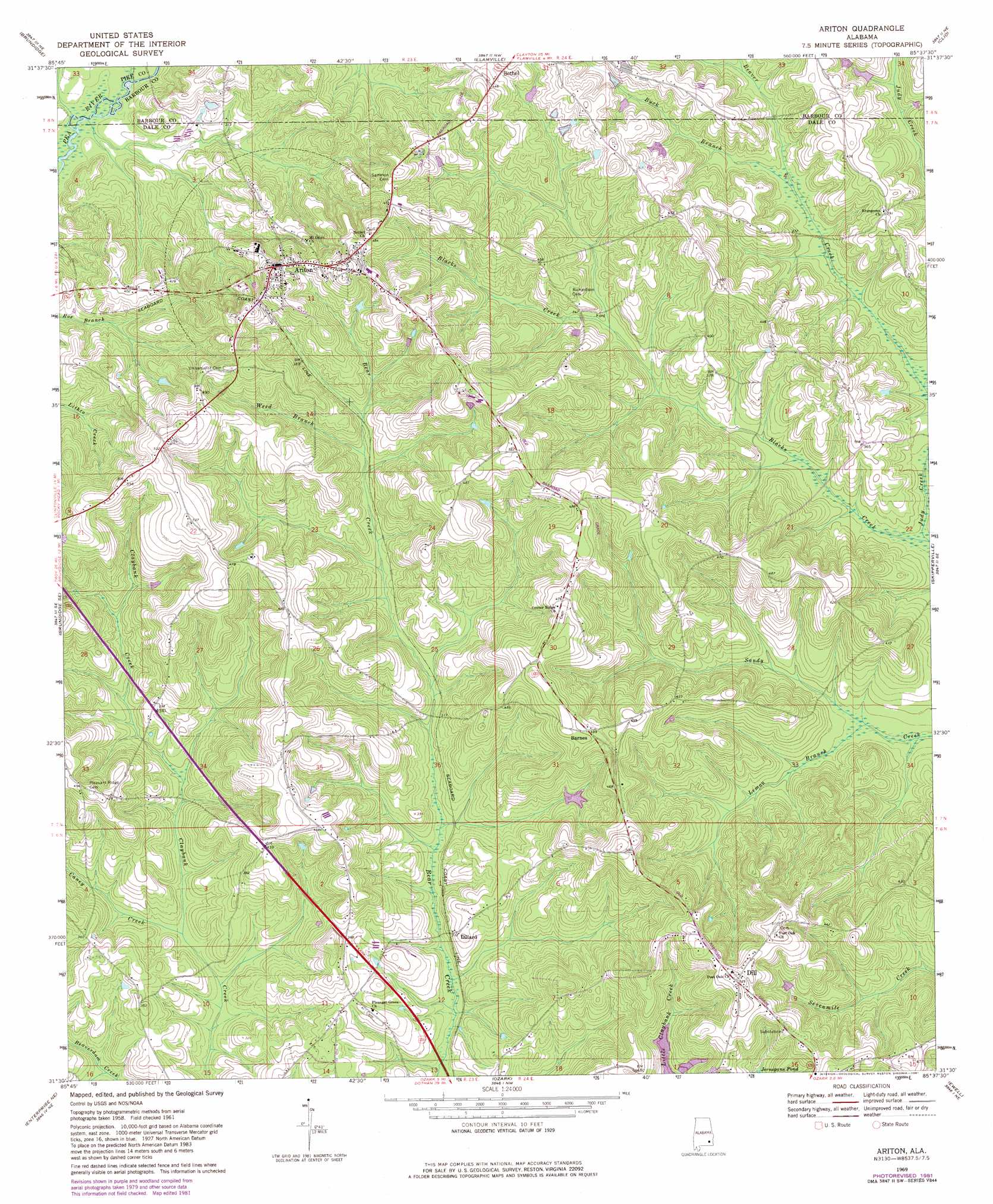
Ariton Topo Map Alabama
To zoom in, hover over the map of Ariton
USGS Topo Quad 31085e6 - 1:24,000 scale
| Topo Map Name: | Ariton |
| USGS Topo Quad ID: | 31085e6 |
| Print Size: | ca. 21 1/4" wide x 27" high |
| Southeast Coordinates: | 31.5° N latitude / 85.625° W longitude |
| Map Center Coordinates: | 31.5625° N latitude / 85.6875° W longitude |
| U.S. State: | AL |
| Filename: | o31085e6.jpg |
| Download Map JPG Image: | Ariton topo map 1:24,000 scale |
| Map Type: | Topographic |
| Topo Series: | 7.5´ |
| Map Scale: | 1:24,000 |
| Source of Map Images: | United States Geological Survey (USGS) |
| Alternate Map Versions: |
Ariton AL 1969, updated 1971 Download PDF Buy paper map Ariton AL 1969, updated 1981 Download PDF Buy paper map Ariton AL 2011 Download PDF Buy paper map Ariton AL 2014 Download PDF Buy paper map |
1:24,000 Topo Quads surrounding Ariton
Troy |
Banks |
Josie |
Louisville |
Clayton South |
Brundidge Nw |
Brundidge |
Elamville |
Clio |
Texasville |
Victoria |
Brundidge Se |
Ariton |
Skipperville |
Clopton |
New Brockton |
Enterprise Ne |
Ozark |
Ewell |
Echo |
Goodman |
Enterprise |
Daleville |
Pinckard |
Midland City |
> Back to 31085e1 at 1:100,000 scale
> Back to 31084a1 at 1:250,000 scale
> Back to U.S. Topo Maps home
Ariton topo map: Gazetteer
Ariton: Bridges
Mincheners Bridge elevation 82m 269′Ariton: Dams
Marvin Parker Lake Dam Number Two elevation 104m 341′W G Barnes Dam elevation 112m 367′
Ariton: Populated Places
Ariton elevation 140m 459′Barnes elevation 151m 495′
Dill elevation 159m 521′
Dillard elevation 93m 305′
Ariton: Post Offices
Ariton Post Office elevation 142m 465′Ariton: Reservoirs
Marvin Parker Lake Number Two elevation 104m 341′W G Barnes Lake elevation 112m 367′
Ariton: Streams
Beasley Branch elevation 81m 265′Beaver Creek elevation 88m 288′
Beaverdam Creek elevation 80m 262′
Blacks Creek elevation 84m 275′
Bruces Mill Creek elevation 79m 259′
Buck Branch elevation 94m 308′
Caney Creek elevation 83m 272′
Lemon Branch elevation 86m 282′
Weed Branch elevation 105m 344′
Ariton digital topo map on disk
Buy this Ariton topo map showing relief, roads, GPS coordinates and other geographical features, as a high-resolution digital map file on DVD:
Gulf Coast (LA, MS, AL, FL) & Southwestern Georgia
Buy digital topo maps: Gulf Coast (LA, MS, AL, FL) & Southwestern Georgia
 & Southwestern Georgia map DVD")