White Oak Topo Map Alabama
To zoom in, hover over the map of White Oak
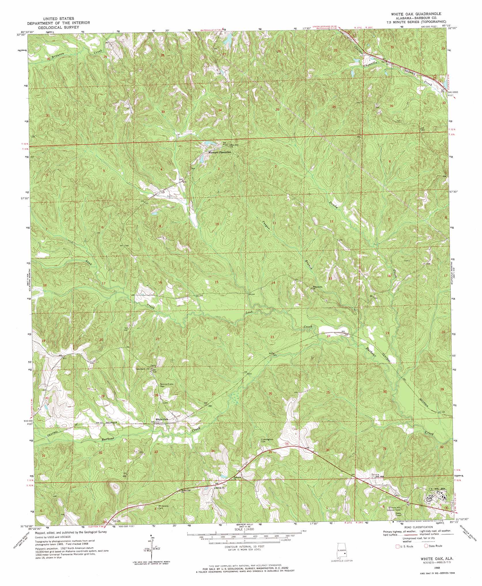
USGS Topo Quad 31085h3 - 1:24,000 scale
| Topo Map Name: | White Oak |
| USGS Topo Quad ID: | 31085h3 |
| Print Size: | ca. 21 1/4" wide x 27" high |
| Southeast Coordinates: | 31.875° N latitude / 85.25° W longitude |
| Map Center Coordinates: | 31.9375° N latitude / 85.3125° W longitude |
| U.S. State: | AL |
| Filename: | o31085h3.jpg |
| Download Map JPG Image: | White Oak topo map 1:24,000 scale |
| Map Type: | Topographic |
| Topo Series: | 7.5´ |
| Map Scale: | 1:24,000 |
| Source of Map Images: | United States Geological Survey (USGS) |
| Alternate Map Versions: |
White Oak AL 1968, updated 1970 Download PDF Buy paper map White Oak AL 2011 Download PDF Buy paper map White Oak AL 2014 Download PDF Buy paper map |
1:24,000 Topo Quads surrounding White Oak
Roba |
Hurtsboro |
Rutherford |
Pittsview |
Omaha |
Midway |
Comer |
Batesville |
Howe |
Twin Springs |
Mount Andrew |
Clayton North |
White Oak |
Eufaula North |
Georgetown |
Louisville |
Clayton South |
Baker Hill |
Eufaula South |
Hatcher |
Clio |
Texasville |
Lawrenceville |
Fort Gaines Nw |
Fort Gaines Ne |
> Back to 31085e1 at 1:100,000 scale
> Back to 31084a1 at 1:250,000 scale
> Back to U.S. Topo Maps home
White Oak topo map: Gazetteer
White Oak: Dams
Wyecott Lake Dam elevation 98m 321′White Oak: Populated Places
Knowlton (historical) elevation 73m 239′White Oak elevation 92m 301′
White Oak: Reservoirs
Claytons Pond elevation 101m 331′Wyecott Lake elevation 98m 321′
White Oak: Streams
Cooper Branch elevation 68m 223′Dowdy Creek elevation 66m 216′
Leak Creek elevation 71m 232′
White Oak digital topo map on disk
Buy this White Oak topo map showing relief, roads, GPS coordinates and other geographical features, as a high-resolution digital map file on DVD:
Gulf Coast (LA, MS, AL, FL) & Southwestern Georgia
Buy digital topo maps: Gulf Coast (LA, MS, AL, FL) & Southwestern Georgia
 & Southwestern Georgia map DVD")