Watkins Bridge Topo Map Alabama
To zoom in, hover over the map of Watkins Bridge
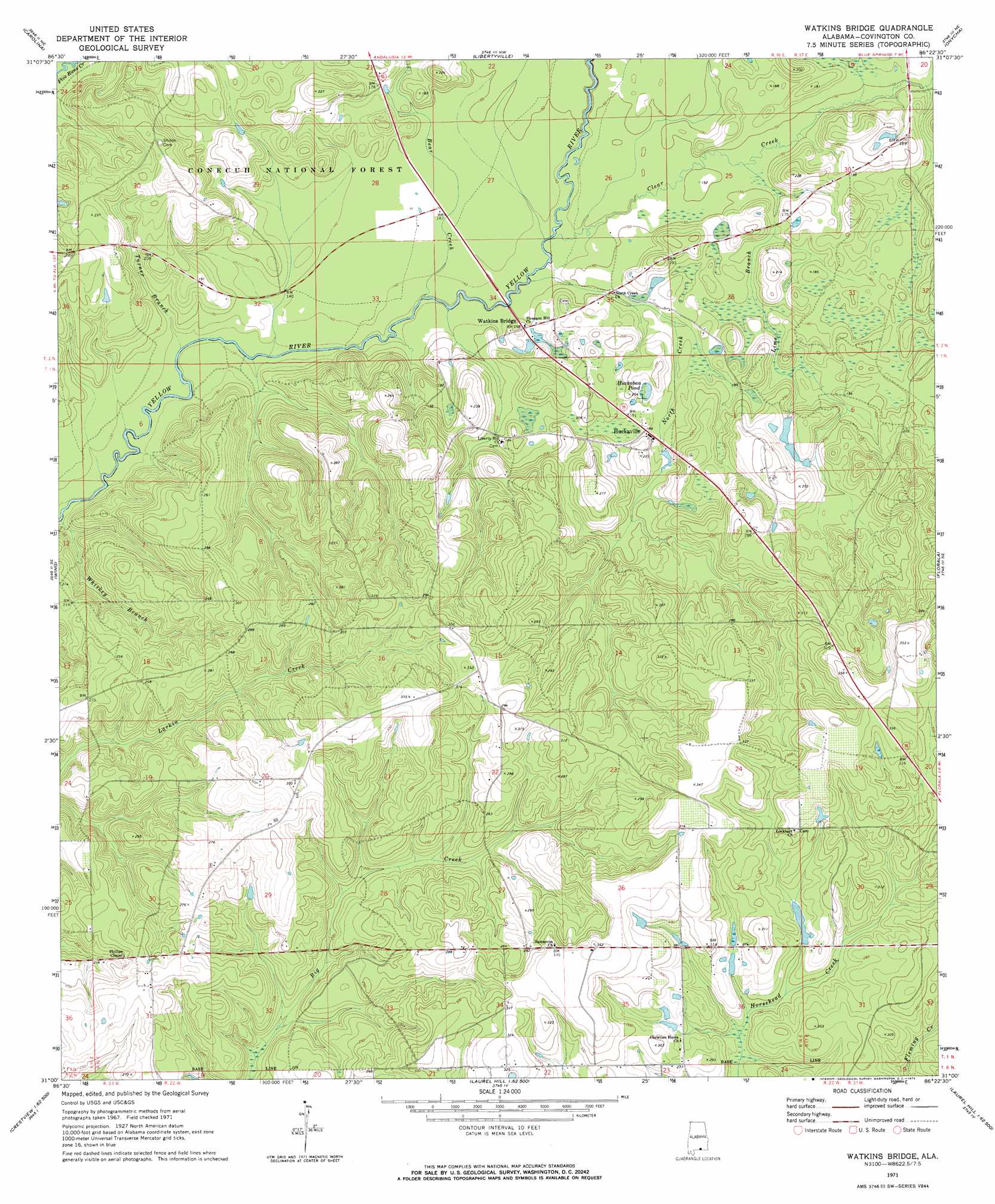
USGS Topo Quad 31086a4 - 1:24,000 scale
| Topo Map Name: | Watkins Bridge |
| USGS Topo Quad ID: | 31086a4 |
| Print Size: | ca. 21 1/4" wide x 27" high |
| Southeast Coordinates: | 31° N latitude / 86.375° W longitude |
| Map Center Coordinates: | 31.0625° N latitude / 86.4375° W longitude |
| U.S. State: | AL |
| Filename: | o31086a4.jpg |
| Download Map JPG Image: | Watkins Bridge topo map 1:24,000 scale |
| Map Type: | Topographic |
| Topo Series: | 7.5´ |
| Map Scale: | 1:24,000 |
| Source of Map Images: | United States Geological Survey (USGS) |
| Alternate Map Versions: |
Watkins Bridge AL 1971, updated 1973 Download PDF Buy paper map Watkins Bridge AL 2011 Download PDF Buy paper map Watkins Bridge AL 2014 Download PDF Buy paper map |
| FStopo: | US Forest Service topo Watkins Bridge is available: Download FStopo PDF Download FStopo TIF |
1:24,000 Topo Quads surrounding Watkins Bridge
Loango |
River Falls |
Andalusia |
Opp West |
Opp East |
Dixie |
Carolina |
Libertyville |
Onycha |
Kinston |
Bradley |
Wing |
Watkins Bridge |
Florala |
Hacoda |
Blackman |
Oak Grove |
Laurel Hill |
Paxton |
Gaskin |
Baker |
Crestview North |
Dorcas |
New Harmony |
Liberty |
> Back to 31086a1 at 1:100,000 scale
> Back to 31086a1 at 1:250,000 scale
> Back to U.S. Topo Maps home
Watkins Bridge topo map: Gazetteer
Watkins Bridge: Lakes
Huckabaa Pond elevation 54m 177′Watkins Bridge: Populated Places
Huckaville elevation 56m 183′Shiloh elevation 78m 255′
Watkins Bridge: Streams
Bear Creek elevation 39m 127′Clear Creek elevation 42m 137′
Lime Branch elevation 45m 147′
North Creek elevation 40m 131′
Turner Branch elevation 37m 121′
Whiskey Branch elevation 37m 121′
Watkins Bridge digital topo map on disk
Buy this Watkins Bridge topo map showing relief, roads, GPS coordinates and other geographical features, as a high-resolution digital map file on DVD:
Gulf Coast (LA, MS, AL, FL) & Southwestern Georgia
Buy digital topo maps: Gulf Coast (LA, MS, AL, FL) & Southwestern Georgia
 & Southwestern Georgia map DVD")