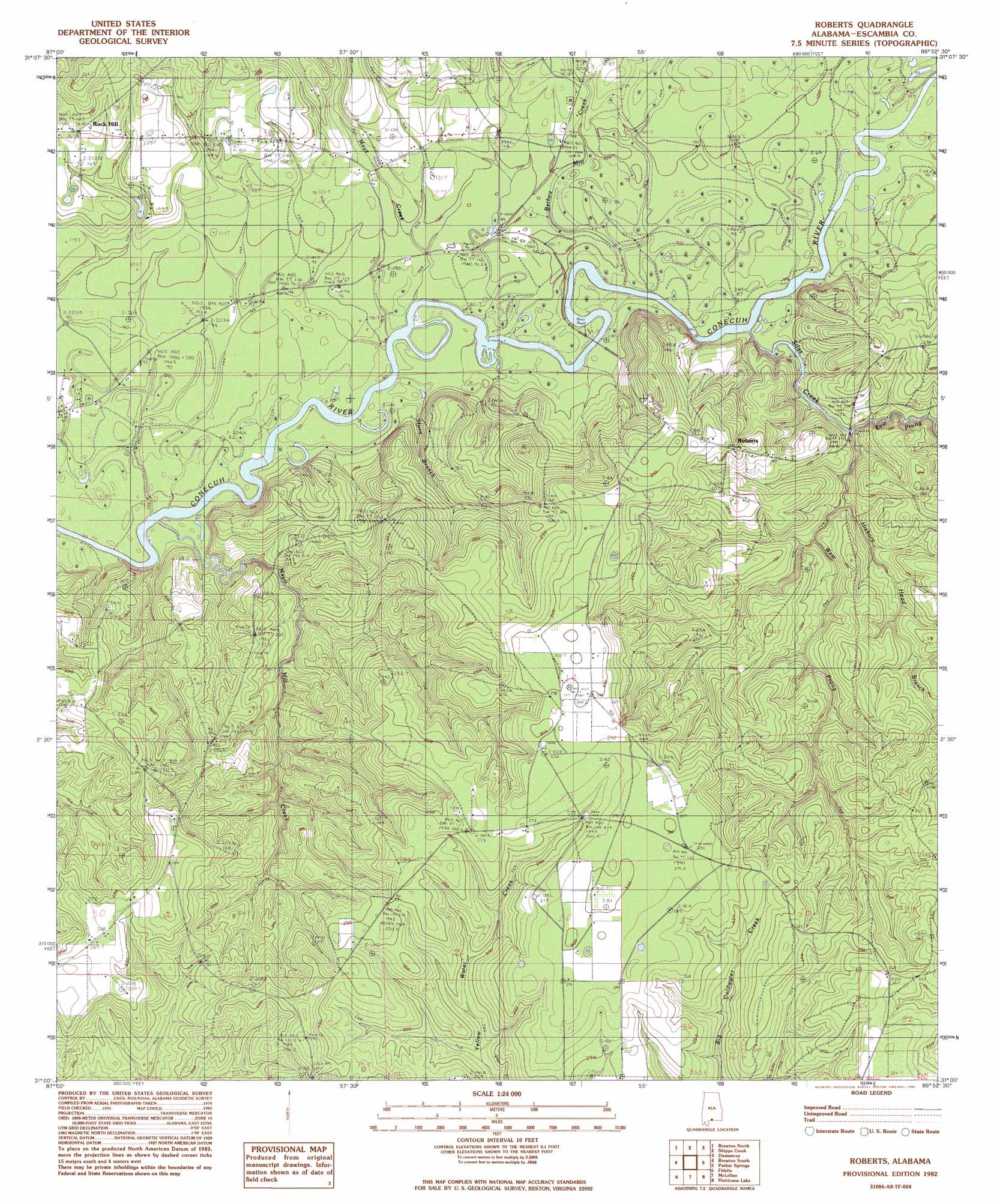
Roberts Topo Map Alabama
To zoom in, hover over the map of Roberts
USGS Topo Quad 31086a8 - 1:24,000 scale
| Topo Map Name: | Roberts |
| USGS Topo Quad ID: | 31086a8 |
| Print Size: | ca. 21 1/4" wide x 27" high |
| Southeast Coordinates: | 31° N latitude / 86.875° W longitude |
| Map Center Coordinates: | 31.0625° N latitude / 86.9375° W longitude |
| U.S. State: | AL |
| Filename: | o31086a8.jpg |
| Download Map JPG Image: | Roberts topo map 1:24,000 scale |
| Map Type: | Topographic |
| Topo Series: | 7.5´ |
| Map Scale: | 1:24,000 |
| Source of Map Images: | United States Geological Survey (USGS) |
| Alternate Map Versions: |
Roberts AL 1982, updated 1982 Download PDF Buy paper map Roberts AL 2011 Download PDF Buy paper map Roberts AL 2014 Download PDF Buy paper map |
1:24,000 Topo Quads surrounding Roberts
Range |
Castleberry |
Nymph |
Brooklyn |
Loango |
Wallace |
Brewton North |
Shipps Creek |
Damascus |
Dixie |
Pollard |
Brewton South |
Roberts |
Parker Springs |
Bradley |
Jay |
Fidelis |
Mclellan |
Hurricane Lake |
Blackman |
Chumuckla |
Allentown |
Spring Hill |
Munson |
Baker |
> Back to 31086a1 at 1:100,000 scale
> Back to 31086a1 at 1:250,000 scale
> Back to U.S. Topo Maps home
Roberts topo map: Gazetteer
Roberts: Bridges
Mayos Toll Bridge (historical) elevation 22m 72′Parker Bridge elevation 24m 78′
Roberts: Populated Places
Roberts elevation 33m 108′Rock Hill elevation 55m 180′
Roberts: Streams
Bethea Mill Creek elevation 24m 78′Crossway Creek elevation 25m 82′
East Prong Silas Creek elevation 26m 85′
Hickory Head Branch elevation 32m 104′
Maye Creek elevation 23m 75′
Mayo Mill Creek elevation 21m 68′
School House Creek elevation 30m 98′
Silas Creek elevation 24m 78′
West Prong Silas Creek elevation 26m 85′
Roberts digital topo map on disk
Buy this Roberts topo map showing relief, roads, GPS coordinates and other geographical features, as a high-resolution digital map file on DVD:
Gulf Coast (LA, MS, AL, FL) & Southwestern Georgia
Buy digital topo maps: Gulf Coast (LA, MS, AL, FL) & Southwestern Georgia
 & Southwestern Georgia map DVD")