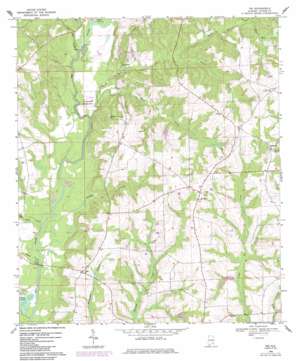
Ino Topo Map Alabama
To zoom in, hover over the map of Ino
USGS Topo Quad 31086c1 - 1:24,000 scale
| Topo Map Name: | Ino |
| USGS Topo Quad ID: | 31086c1 |
| Print Size: | ca. 21 1/4" wide x 27" high |
| Southeast Coordinates: | 31.25° N latitude / 86° W longitude |
| Map Center Coordinates: | 31.3125° N latitude / 86.0625° W longitude |
| U.S. State: | AL |
| Filename: | o31086c1.jpg |
| Download Map JPG Image: | Ino topo map 1:24,000 scale |
| Map Type: | Topographic |
| Topo Series: | 7.5´ |
| Map Scale: | 1:24,000 |
| Source of Map Images: | United States Geological Survey (USGS) |
| Alternate Map Versions: |
Ino AL 1968, updated 1970 Download PDF Buy paper map Ino AL 1968, updated 1987 Download PDF Buy paper map Ino AL 2011 Download PDF Buy paper map Ino AL 2014 Download PDF Buy paper map |
1:24,000 Topo Quads surrounding Ino
> Back to 31086a1 at 1:100,000 scale
> Back to 31086a1 at 1:250,000 scale
> Back to U.S. Topo Maps home
Ino topo map: Gazetteer
Ino: Bridges
Ballard Bridge elevation 41m 134′Ino: Dams
Elba Dam elevation 52m 170′Ellis Wise Dam elevation 72m 236′
Ino: Lakes
Beaver Pond elevation 44m 144′Shiloh Lake elevation 52m 170′
Ino: Pillars
Damascus Lookout Tower elevation 124m 406′Ino: Populated Places
Damascus elevation 109m 357′Ino elevation 95m 311′
Ino: Reservoirs
Elba Reservoir elevation 55m 180′Ellis Wise Lake elevation 72m 236′
Ino: Streams
Bills Branch elevation 93m 305′Buck Branch elevation 62m 203′
Bucks Mill Creek elevation 42m 137′
Fox Branch elevation 68m 223′
Hays Creek elevation 42m 137′
Helms Mill Creek elevation 49m 160′
Kimmy Creek elevation 43m 141′
Pages Creek elevation 42m 137′
Rattle Branch elevation 59m 193′
Wises Mill Creek elevation 55m 180′
Wooten Mill Creek elevation 70m 229′
Ino digital topo map on disk
Buy this Ino topo map showing relief, roads, GPS coordinates and other geographical features, as a high-resolution digital map file on DVD:
Gulf Coast (LA, MS, AL, FL) & Southwestern Georgia
Buy digital topo maps: Gulf Coast (LA, MS, AL, FL) & Southwestern Georgia


