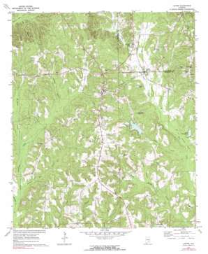
Lapine Topo Map Alabama
To zoom in, hover over the map of Lapine
USGS Topo Quad 31086h3 - 1:24,000 scale
| Topo Map Name: | Lapine |
| USGS Topo Quad ID: | 31086h3 |
| Print Size: | ca. 21 1/4" wide x 27" high |
| Southeast Coordinates: | 31.875° N latitude / 86.25° W longitude |
| Map Center Coordinates: | 31.9375° N latitude / 86.3125° W longitude |
| U.S. State: | AL |
| Filename: | o31086h3.jpg |
| Download Map JPG Image: | Lapine topo map 1:24,000 scale |
| Map Type: | Topographic |
| Topo Series: | 7.5´ |
| Map Scale: | 1:24,000 |
| Source of Map Images: | United States Geological Survey (USGS) |
| Alternate Map Versions: |
Lapine AL 1971, updated 1979 Download PDF Buy paper map Lapine AL 1971, updated 1991 Download PDF Buy paper map Lapine AL 2011 Download PDF Buy paper map Lapine AL 2014 Download PDF Buy paper map |
1:24,000 Topo Quads surrounding Lapine
> Back to 31086e1 at 1:100,000 scale
> Back to 31086a1 at 1:250,000 scale
> Back to U.S. Topo Maps home
Lapine topo map: Gazetteer
Lapine: Dams
Bradleton Lake Dam elevation 120m 393′Magnolia Shores Lake Dam elevation 128m 419′
Lapine: Parks
Clay Jordan Stadium elevation 169m 554′Lapine: Populated Places
Garnersville elevation 159m 521′Highland Home elevation 180m 590′
Lapine elevation 130m 426′
Magnolia Shores elevation 134m 439′
Sardis elevation 178m 583′
Saville elevation 148m 485′
Lapine: Post Offices
Highland Home Post Office elevation 178m 583′Lapine Post Office elevation 129m 423′
Lapine: Reservoirs
Champion Lake elevation 137m 449′Jackson Pond elevation 146m 479′
Lake Bradleyton elevation 122m 400′
Morgan Pond elevation 144m 472′
Paynes Pond elevation 128m 419′
Russells Lake elevation 125m 410′
Lapine: Streams
Berkley Mill Creek elevation 129m 423′Cat Creek elevation 120m 393′
Champion Branch elevation 123m 403′
Daniels Mill Branch elevation 111m 364′
Jordan Creek elevation 112m 367′
Long Branch elevation 122m 400′
Mac Carter Creek elevation 118m 387′
Nichols Branch elevation 125m 410′
Roberts Branch elevation 125m 410′
Rock Branch elevation 113m 370′
Ryals Mill Creek elevation 112m 367′
Tan Creek elevation 121m 396′
Lapine digital topo map on disk
Buy this Lapine topo map showing relief, roads, GPS coordinates and other geographical features, as a high-resolution digital map file on DVD:
Gulf Coast (LA, MS, AL, FL) & Southwestern Georgia
Buy digital topo maps: Gulf Coast (LA, MS, AL, FL) & Southwestern Georgia


