Atmore Topo Map Alabama
To zoom in, hover over the map of Atmore
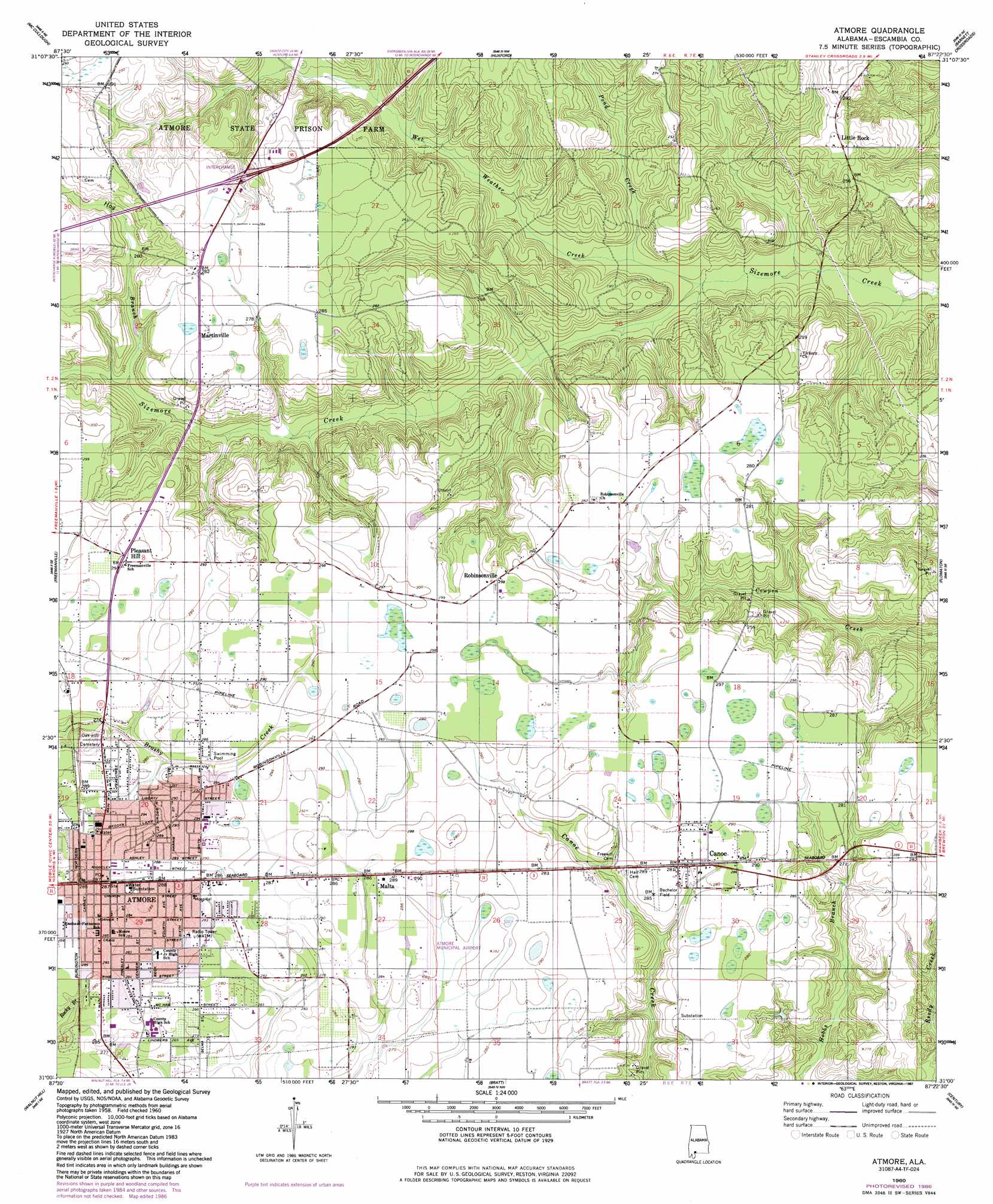
USGS Topo Quad 31087a4 - 1:24,000 scale
| Topo Map Name: | Atmore |
| USGS Topo Quad ID: | 31087a4 |
| Print Size: | ca. 21 1/4" wide x 27" high |
| Southeast Coordinates: | 31° N latitude / 87.375° W longitude |
| Map Center Coordinates: | 31.0625° N latitude / 87.4375° W longitude |
| U.S. State: | AL |
| Filename: | o31087a4.jpg |
| Download Map JPG Image: | Atmore topo map 1:24,000 scale |
| Map Type: | Topographic |
| Topo Series: | 7.5´ |
| Map Scale: | 1:24,000 |
| Source of Map Images: | United States Geological Survey (USGS) |
| Alternate Map Versions: |
Atmore AL 1960, updated 1961 Download PDF Buy paper map Atmore AL 1960, updated 1961 Download PDF Buy paper map Atmore AL 1960, updated 1987 Download PDF Buy paper map Atmore AL 2011 Download PDF Buy paper map Atmore AL 2014 Download PDF Buy paper map |
1:24,000 Topo Quads surrounding Atmore
Chrysler |
Uriah West |
Uriah East |
Frisco City Se |
Range |
Blacksher |
Mccullough |
Huxford |
Barnett Crossroads |
Wallace |
Perdido |
Freemanville |
Atmore |
Flomaton |
Pollard |
Dyas |
Walnut Hill |
Bratt |
Century |
Jay |
Dogwood Creek |
Enon |
Bay Springs |
Mcdavid |
Chumuckla |
> Back to 31087a1 at 1:100,000 scale
> Back to 31086a1 at 1:250,000 scale
> Back to U.S. Topo Maps home
Atmore topo map: Gazetteer
Atmore: Airports
Atmore Municipal Airport elevation 85m 278′Atmore: Crossings
Interchange 57 elevation 78m 255′Atmore: Oilfields
Big Escambia Creek Gas Field elevation 85m 278′Little Rock Gas Field elevation 61m 200′
Atmore: Parks
Bachelor Field elevation 86m 282′North Eighth Avenue City Park elevation 86m 282′
South Eighth Avenue City Park elevation 80m 262′
Veterans Memorial Park elevation 86m 282′
Westside Park elevation 89m 291′
Atmore: Populated Places
Atmore elevation 87m 285′Briar Lake Estates elevation 79m 259′
Canoe elevation 86m 282′
Little Rock elevation 87m 285′
Malta elevation 87m 285′
Martinville elevation 82m 269′
Pleasant Hill elevation 92m 301′
Robinsonville elevation 90m 295′
Southern Estates elevation 85m 278′
Atmore: Post Offices
Atmore Post Office elevation 87m 285′Atmore: Streams
Hog Branch elevation 63m 206′Pond Creek elevation 41m 134′
Wet Weather Creek elevation 39m 127′
Atmore digital topo map on disk
Buy this Atmore topo map showing relief, roads, GPS coordinates and other geographical features, as a high-resolution digital map file on DVD:
Gulf Coast (LA, MS, AL, FL) & Southwestern Georgia
Buy digital topo maps: Gulf Coast (LA, MS, AL, FL) & Southwestern Georgia
 & Southwestern Georgia map DVD")