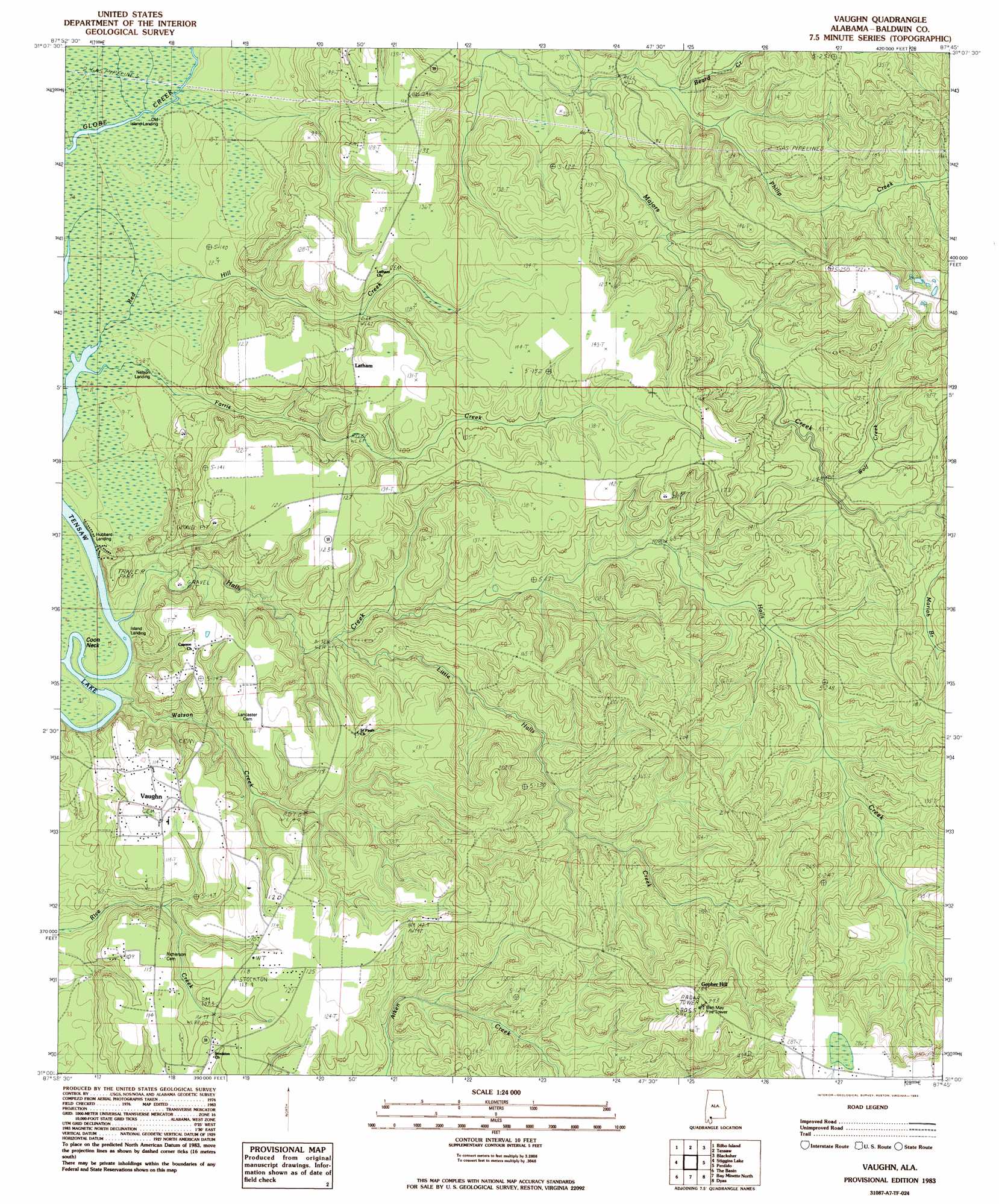
Vaughn Topo Map Alabama
To zoom in, hover over the map of Vaughn
USGS Topo Quad 31087a7 - 1:24,000 scale
| Topo Map Name: | Vaughn |
| USGS Topo Quad ID: | 31087a7 |
| Print Size: | ca. 21 1/4" wide x 27" high |
| Southeast Coordinates: | 31° N latitude / 87.75° W longitude |
| Map Center Coordinates: | 31.0625° N latitude / 87.8125° W longitude |
| U.S. State: | AL |
| Filename: | o31087a7.jpg |
| Download Map JPG Image: | Vaughn topo map 1:24,000 scale |
| Map Type: | Topographic |
| Topo Series: | 7.5´ |
| Map Scale: | 1:24,000 |
| Source of Map Images: | United States Geological Survey (USGS) |
| Alternate Map Versions: |
Vaughn AL 1983, updated 1983 Download PDF Buy paper map Vaughn AL 2011 Download PDF Buy paper map Vaughn AL 2014 Download PDF Buy paper map |
1:24,000 Topo Quads surrounding Vaughn
Mcintosh |
Gin House Island |
Carlton |
Chrysler |
Uriah West |
Calvert |
Bilbo Island |
Tensaw |
Blacksher |
Mccullough |
Mount Vernon |
Stiggins Lake |
Vaughn |
Perdido |
Freemanville |
Creola |
The Basin |
Bay Minette North |
Dyas |
Walnut Hill |
Chickasaw |
Hurricane |
Bay Minette South |
Dogwood Creek |
Enon |
> Back to 31087a1 at 1:100,000 scale
> Back to 31086a1 at 1:250,000 scale
> Back to U.S. Topo Maps home
Vaughn topo map: Gazetteer
Vaughn: Capes
Coon Neck elevation 1m 3′Vaughn: Populated Places
Latham elevation 37m 121′Vaughn elevation 34m 111′
Vaughn: Streams
Beard Creek elevation 7m 22′Farris Creek elevation 1m 3′
Halls Creek elevation 1m 3′
Little Halls Creek elevation 12m 39′
Mariah Branch elevation 18m 59′
Philip Creek elevation 11m 36′
Red Hill Creek elevation 2m 6′
Watson Creek elevation 2m 6′
Wolf Creek elevation 15m 49′
Vaughn digital topo map on disk
Buy this Vaughn topo map showing relief, roads, GPS coordinates and other geographical features, as a high-resolution digital map file on DVD:
Gulf Coast (LA, MS, AL, FL) & Southwestern Georgia
Buy digital topo maps: Gulf Coast (LA, MS, AL, FL) & Southwestern Georgia
 & Southwestern Georgia map DVD")