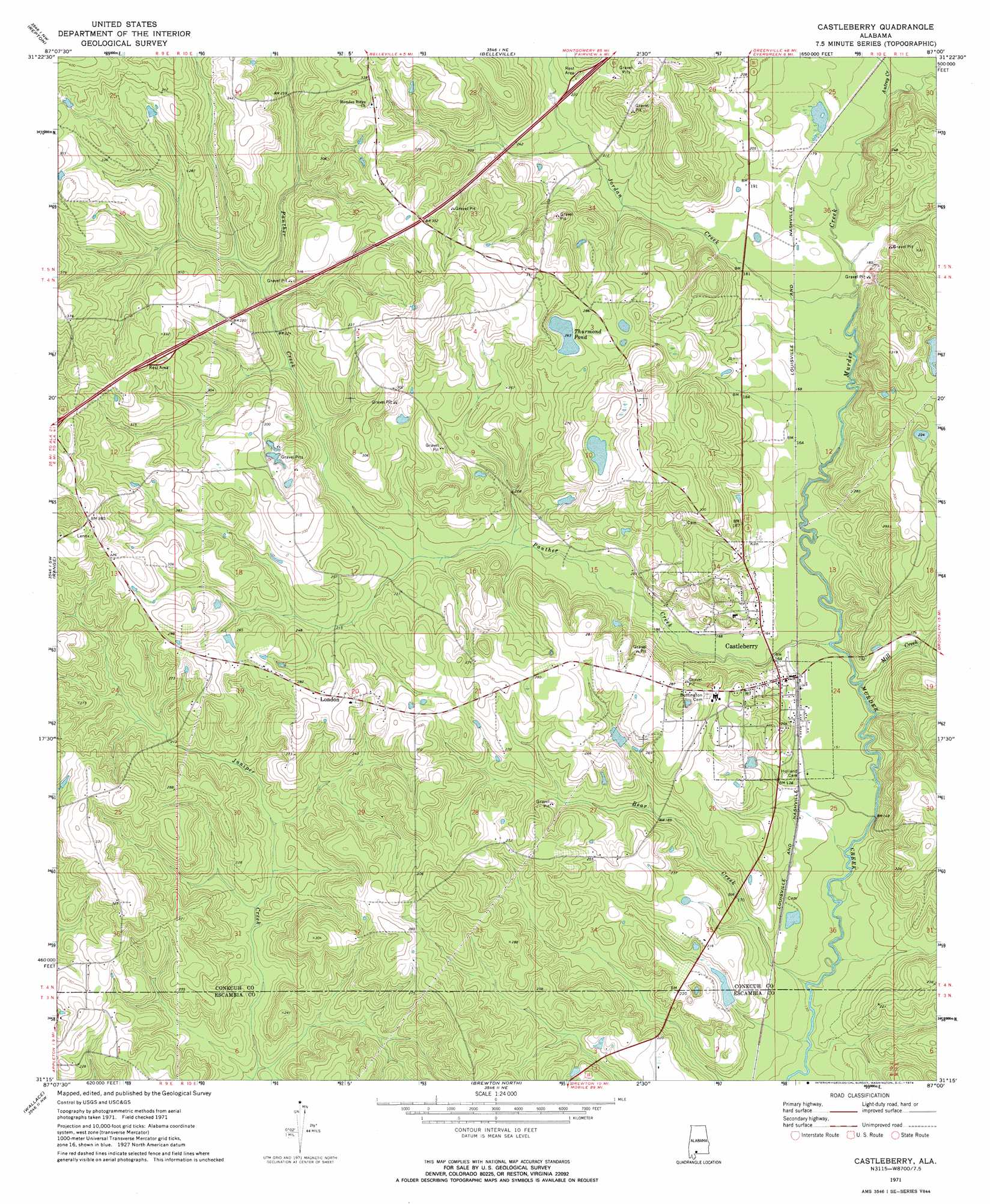
Castleberry Topo Map Alabama
To zoom in, hover over the map of Castleberry
USGS Topo Quad 31087c1 - 1:24,000 scale
| Topo Map Name: | Castleberry |
| USGS Topo Quad ID: | 31087c1 |
| Print Size: | ca. 21 1/4" wide x 27" high |
| Southeast Coordinates: | 31.25° N latitude / 87° W longitude |
| Map Center Coordinates: | 31.3125° N latitude / 87.0625° W longitude |
| U.S. State: | AL |
| Filename: | o31087c1.jpg |
| Download Map JPG Image: | Castleberry topo map 1:24,000 scale |
| Map Type: | Topographic |
| Topo Series: | 7.5´ |
| Map Scale: | 1:24,000 |
| Source of Map Images: | United States Geological Survey (USGS) |
| Alternate Map Versions: |
Castleberry AL 1971, updated 1974 Download PDF Buy paper map Castleberry AL 2011 Download PDF Buy paper map Castleberry AL 2014 Download PDF Buy paper map |
1:24,000 Topo Quads surrounding Castleberry
Monroeville |
Burnt Corn |
China |
Lyeffion |
Garland |
Excel |
Repton |
Belleville |
Evergreen |
Old Town |
Frisco City Se |
Range |
Castleberry |
Nymph |
Brooklyn |
Barnett Crossroads |
Wallace |
Brewton North |
Shipps Creek |
Damascus |
Flomaton |
Pollard |
Brewton South |
Roberts |
Parker Springs |
> Back to 31087a1 at 1:100,000 scale
> Back to 31086a1 at 1:250,000 scale
> Back to U.S. Topo Maps home
Castleberry topo map: Gazetteer
Castleberry: Dams
Carter Lake Dam elevation 68m 223′W J Ellis Dam elevation 56m 183′
Castleberry: Lakes
Thurmond Pond elevation 82m 269′Castleberry: Populated Places
Castleberry elevation 55m 180′London elevation 83m 272′
Sand Cut elevation 115m 377′
Castleberry: Post Offices
Castleberry Post Office elevation 53m 173′Castleberry: Reservoirs
Carter Lake elevation 68m 223′W J Ellis Lake elevation 56m 183′
Castleberry: Streams
Autrey Creek elevation 52m 170′Bear Creek elevation 39m 127′
Geden Branch elevation 60m 196′
Jordan Creek elevation 49m 160′
Mill Creek elevation 42m 137′
Panther Creek elevation 44m 144′
Castleberry digital topo map on disk
Buy this Castleberry topo map showing relief, roads, GPS coordinates and other geographical features, as a high-resolution digital map file on DVD:
Gulf Coast (LA, MS, AL, FL) & Southwestern Georgia
Buy digital topo maps: Gulf Coast (LA, MS, AL, FL) & Southwestern Georgia
 & Southwestern Georgia map DVD")