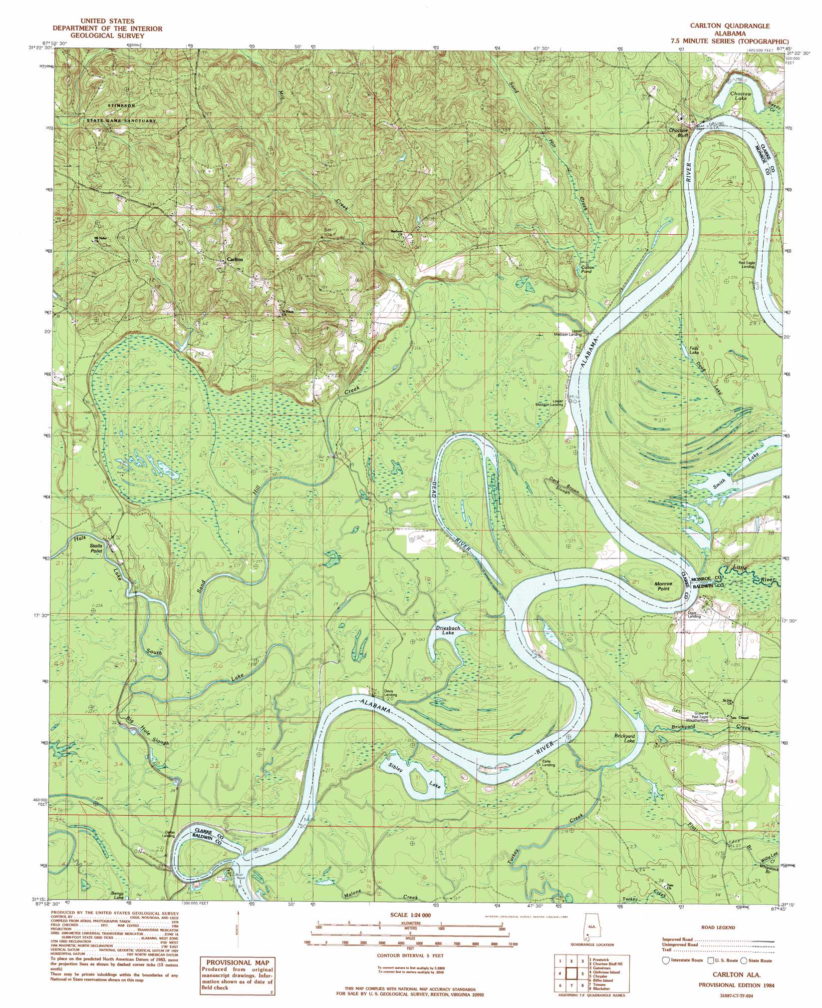
Carlton Topo Map Alabama
To zoom in, hover over the map of Carlton
USGS Topo Quad 31087c7 - 1:24,000 scale
| Topo Map Name: | Carlton |
| USGS Topo Quad ID: | 31087c7 |
| Print Size: | ca. 21 1/4" wide x 27" high |
| Southeast Coordinates: | 31.25° N latitude / 87.75° W longitude |
| Map Center Coordinates: | 31.3125° N latitude / 87.8125° W longitude |
| U.S. State: | AL |
| Filename: | o31087c7.jpg |
| Download Map JPG Image: | Carlton topo map 1:24,000 scale |
| Map Type: | Topographic |
| Topo Series: | 7.5´ |
| Map Scale: | 1:24,000 |
| Source of Map Images: | United States Geological Survey (USGS) |
| Alternate Map Versions: |
Carlton AL 1984, updated 1984 Download PDF Buy paper map Carlton AL 2011 Download PDF Buy paper map Carlton AL 2014 Download PDF Buy paper map |
1:24,000 Topo Quads surrounding Carlton
Saint Stephens |
Jackson |
Walker Springs |
Suggsville |
Claiborne |
Wagarville |
Prestwick |
Choctaw Bluff |
Gainestown |
Flynns Lake |
Mcintosh |
Gin House Island |
Carlton |
Chrysler |
Uriah West |
Calvert |
Bilbo Island |
Tensaw |
Blacksher |
Mccullough |
Mount Vernon |
Stiggins Lake |
Vaughn |
Perdido |
Freemanville |
> Back to 31087a1 at 1:100,000 scale
> Back to 31086a1 at 1:250,000 scale
> Back to U.S. Topo Maps home
Carlton topo map: Gazetteer
Carlton: Bars
Earl Bar elevation 1m 3′Matthewsons Bar elevation 1m 3′
Carlton: Bends
Choctaw Bend elevation 8m 26′Carlton: Capes
Monroe Point elevation 5m 16′Stolls Point elevation 4m 13′
Carlton: Channels
Dixie Cut-Off elevation 1m 3′Carlton: Cliffs
Choctaw Bluff elevation 1m 3′Carlton: Guts
Big Hole Slough elevation 7m 22′Dark Brown Slough elevation 6m 19′
Dead Lake elevation 3m 9′
Flat Branch elevation 5m 16′
Malone Creek elevation 3m 9′
South Lake elevation 2m 6′
Carlton: Islands
Smith Island elevation 7m 22′Carlton: Lakes
Brickyard Lake elevation 2m 6′Choctaw Lake elevation 5m 16′
Colton Pond elevation 5m 16′
Dead River elevation 1m 3′
Driesbach Lake elevation 1m 3′
Fells Lake elevation 5m 16′
Sibley Lake elevation 1m 3′
Smith Lake elevation 2m 6′
Carlton: Populated Places
Carlton elevation 52m 170′Carlton: Streams
Brickyard Creek elevation 4m 13′Little River elevation 1m 3′
Mill Creek elevation 5m 16′
Sand Hill Creek elevation 1m 3′
Sand Hill Creek elevation 5m 16′
Turkey Creek elevation 6m 19′
Whipstock Branch elevation 10m 32′
Willie Lee Creek elevation 10m 32′
Carlton digital topo map on disk
Buy this Carlton topo map showing relief, roads, GPS coordinates and other geographical features, as a high-resolution digital map file on DVD:
Gulf Coast (LA, MS, AL, FL) & Southwestern Georgia
Buy digital topo maps: Gulf Coast (LA, MS, AL, FL) & Southwestern Georgia
 & Southwestern Georgia map DVD")