China Topo Map Alabama
To zoom in, hover over the map of China
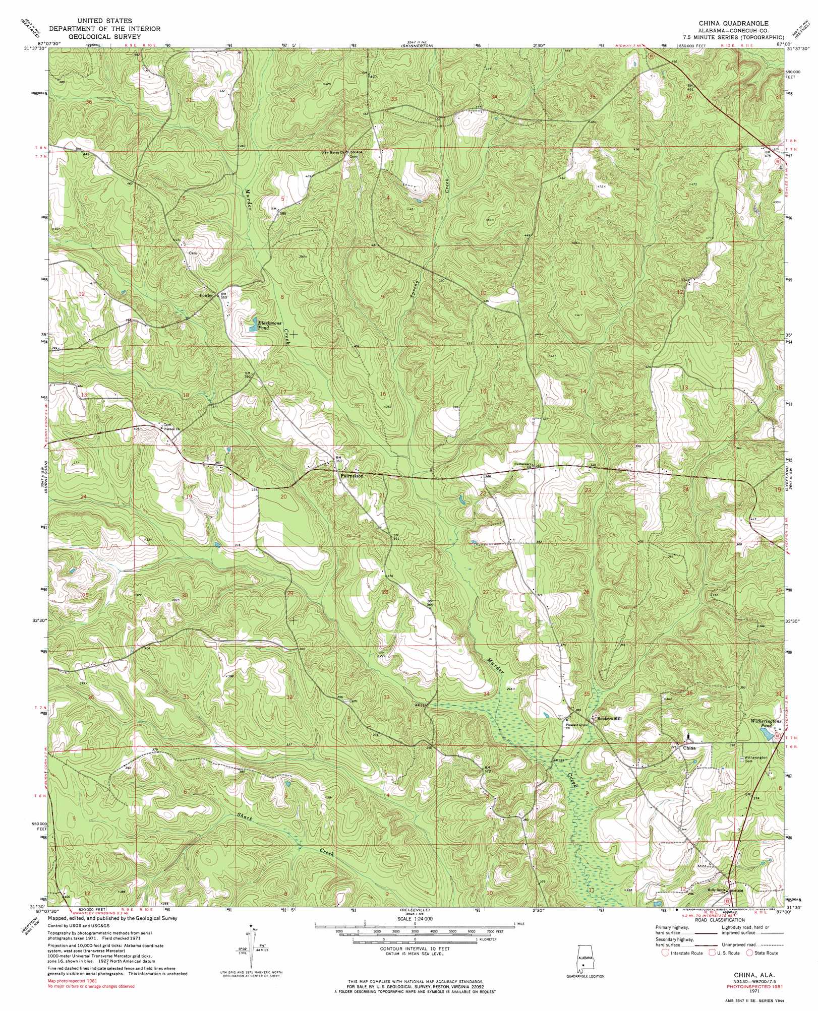
USGS Topo Quad 31087e1 - 1:24,000 scale
| Topo Map Name: | China |
| USGS Topo Quad ID: | 31087e1 |
| Print Size: | ca. 21 1/4" wide x 27" high |
| Southeast Coordinates: | 31.5° N latitude / 87° W longitude |
| Map Center Coordinates: | 31.5625° N latitude / 87.0625° W longitude |
| U.S. State: | AL |
| Filename: | o31087e1.jpg |
| Download Map JPG Image: | China topo map 1:24,000 scale |
| Map Type: | Topographic |
| Topo Series: | 7.5´ |
| Map Scale: | 1:24,000 |
| Source of Map Images: | United States Geological Survey (USGS) |
| Alternate Map Versions: |
China AL 1971, updated 1974 Download PDF Buy paper map China AL 1971, updated 1984 Download PDF Buy paper map China AL 2011 Download PDF Buy paper map China AL 2014 Download PDF Buy paper map |
1:24,000 Topo Quads surrounding China
Vredenburgh |
Nadawah |
Mcwilliams |
Pine Apple South |
Forest Home |
Natchez |
Beatrice |
Skinnerton |
Bethel |
Georgiana West |
Monroeville |
Burnt Corn |
China |
Lyeffion |
Garland |
Excel |
Repton |
Belleville |
Evergreen |
Old Town |
Frisco City Se |
Range |
Castleberry |
Nymph |
Brooklyn |
> Back to 31087e1 at 1:100,000 scale
> Back to 31086a1 at 1:250,000 scale
> Back to U.S. Topo Maps home
China topo map: Gazetteer
China: Populated Places
Bookers Mill elevation 77m 252′China elevation 115m 377′
Fairnelson elevation 110m 360′
Fowler elevation 118m 387′
China: Reservoirs
Blackmons Pond elevation 104m 341′Witheringtons Pond elevation 114m 374′
China: Streams
Little Brushy Creek elevation 72m 236′Spring Creek elevation 83m 272′
China digital topo map on disk
Buy this China topo map showing relief, roads, GPS coordinates and other geographical features, as a high-resolution digital map file on DVD:
Gulf Coast (LA, MS, AL, FL) & Southwestern Georgia
Buy digital topo maps: Gulf Coast (LA, MS, AL, FL) & Southwestern Georgia
 & Southwestern Georgia map DVD")