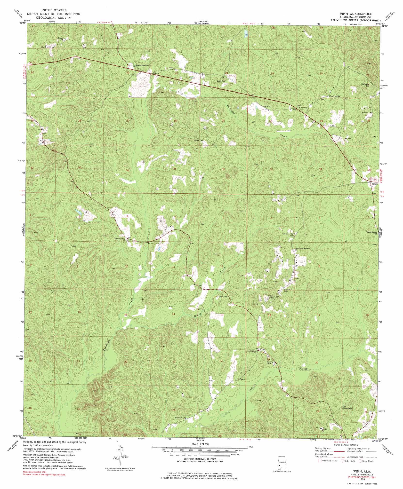
Winn Topo Map Alabama
To zoom in, hover over the map of Winn
USGS Topo Quad 31087f8 - 1:24,000 scale
| Topo Map Name: | Winn |
| USGS Topo Quad ID: | 31087f8 |
| Print Size: | ca. 21 1/4" wide x 27" high |
| Southeast Coordinates: | 31.625° N latitude / 87.875° W longitude |
| Map Center Coordinates: | 31.6875° N latitude / 87.9375° W longitude |
| U.S. State: | AL |
| Filename: | o31087f8.jpg |
| Download Map JPG Image: | Winn topo map 1:24,000 scale |
| Map Type: | Topographic |
| Topo Series: | 7.5´ |
| Map Scale: | 1:24,000 |
| Source of Map Images: | United States Geological Survey (USGS) |
| Alternate Map Versions: |
Winn AL 1978, updated 1979 Download PDF Buy paper map Winn AL 2011 Download PDF Buy paper map Winn AL 2014 Download PDF Buy paper map |
1:24,000 Topo Quads surrounding Winn
Ararat |
Woods Bluff |
Morvin |
Bashi |
Thomasville |
Coffeeville Lock And Dam |
Coffeeville |
Mcentyre |
Fulton West |
Fulton East |
Bladon Springs |
Tattlersville |
Winn |
Grove Hill |
Whatley |
Bigbee |
Saint Stephens |
Jackson |
Walker Springs |
Suggsville |
Rutan |
Wagarville |
Prestwick |
Choctaw Bluff |
Gainestown |
> Back to 31087e1 at 1:100,000 scale
> Back to 31086a1 at 1:250,000 scale
> Back to U.S. Topo Maps home
Winn topo map: Gazetteer
Winn: Populated Places
Clarksville elevation 83m 272′Winn elevation 51m 167′
Zimco elevation 84m 275′
Winn: Streams
Dodey Creek elevation 24m 78′Winn digital topo map on disk
Buy this Winn topo map showing relief, roads, GPS coordinates and other geographical features, as a high-resolution digital map file on DVD:
Gulf Coast (LA, MS, AL, FL) & Southwestern Georgia
Buy digital topo maps: Gulf Coast (LA, MS, AL, FL) & Southwestern Georgia
 & Southwestern Georgia map DVD")