Nadawah Topo Map Alabama
To zoom in, hover over the map of Nadawah
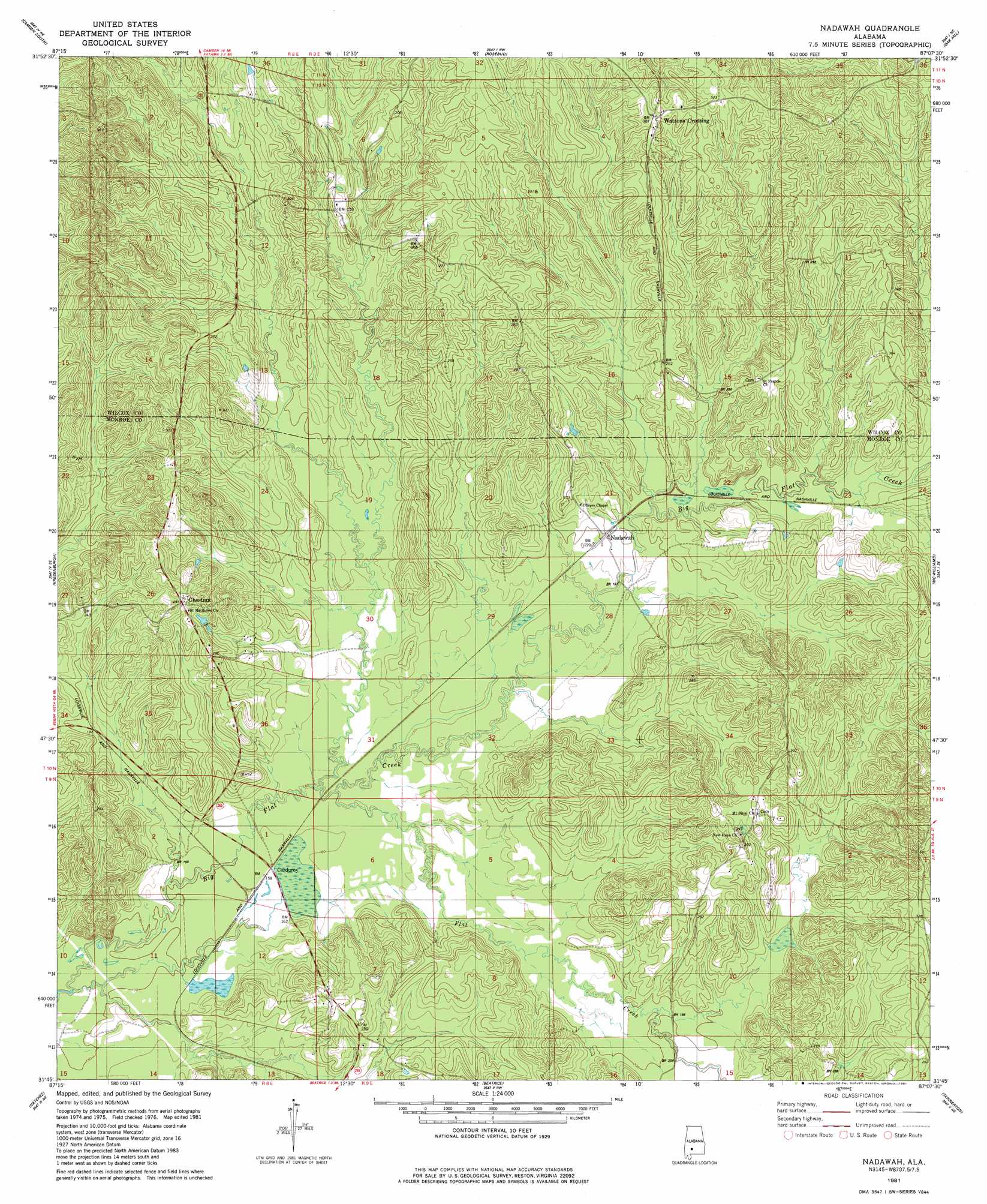
USGS Topo Quad 31087g2 - 1:24,000 scale
| Topo Map Name: | Nadawah |
| USGS Topo Quad ID: | 31087g2 |
| Print Size: | ca. 21 1/4" wide x 27" high |
| Southeast Coordinates: | 31.75° N latitude / 87.125° W longitude |
| Map Center Coordinates: | 31.8125° N latitude / 87.1875° W longitude |
| U.S. State: | AL |
| Filename: | o31087g2.jpg |
| Download Map JPG Image: | Nadawah topo map 1:24,000 scale |
| Map Type: | Topographic |
| Topo Series: | 7.5´ |
| Map Scale: | 1:24,000 |
| Source of Map Images: | United States Geological Survey (USGS) |
| Alternate Map Versions: |
Nadawah AL 1981, updated 1981 Download PDF Buy paper map Nadawah AL 2011 Download PDF Buy paper map Nadawah AL 2014 Download PDF Buy paper map |
1:24,000 Topo Quads surrounding Nadawah
Lee Long Bridge |
Camden North |
Tilden |
Carlowville |
Minter |
Coy |
Camden South |
Rosebud |
Oak Hill |
Pine Apple North |
Hybart |
Vredenburgh |
Nadawah |
Mcwilliams |
Pine Apple South |
Franklin |
Natchez |
Beatrice |
Skinnerton |
Bethel |
Mexia |
Monroeville |
Burnt Corn |
China |
Lyeffion |
> Back to 31087e1 at 1:100,000 scale
> Back to 31086a1 at 1:250,000 scale
> Back to U.S. Topo Maps home
Nadawah topo map: Gazetteer
Nadawah: Populated Places
Buena Vista elevation 62m 203′Chestnut elevation 83m 272′
Nadawah elevation 59m 193′
Turkestan (historical) elevation 83m 272′
Watsonville elevation 94m 308′
Nadawah: Streams
Dailey Creek elevation 48m 157′Flat Creek elevation 49m 160′
Galley Creek elevation 58m 190′
Roberts Creek elevation 60m 196′
Nadawah digital topo map on disk
Buy this Nadawah topo map showing relief, roads, GPS coordinates and other geographical features, as a high-resolution digital map file on DVD:
Gulf Coast (LA, MS, AL, FL) & Southwestern Georgia
Buy digital topo maps: Gulf Coast (LA, MS, AL, FL) & Southwestern Georgia
 & Southwestern Georgia map DVD")