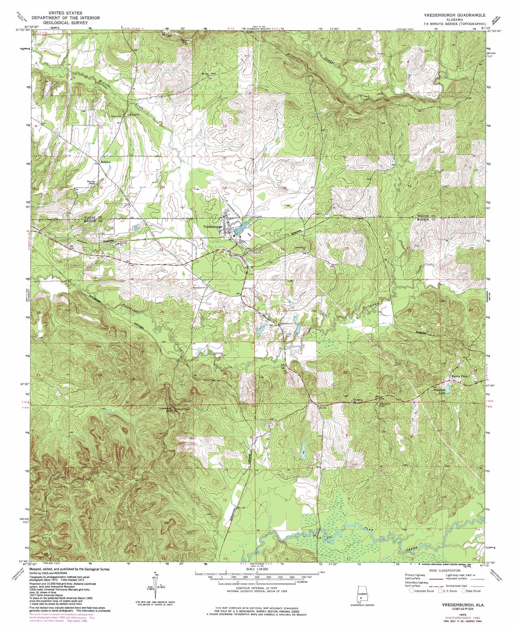
Vredenburgh Topo Map Alabama
To zoom in, hover over the map of Vredenburgh
USGS Topo Quad 31087g3 - 1:24,000 scale
| Topo Map Name: | Vredenburgh |
| USGS Topo Quad ID: | 31087g3 |
| Print Size: | ca. 21 1/4" wide x 27" high |
| Southeast Coordinates: | 31.75° N latitude / 87.25° W longitude |
| Map Center Coordinates: | 31.8125° N latitude / 87.3125° W longitude |
| U.S. State: | AL |
| Filename: | o31087g3.jpg |
| Download Map JPG Image: | Vredenburgh topo map 1:24,000 scale |
| Map Type: | Topographic |
| Topo Series: | 7.5´ |
| Map Scale: | 1:24,000 |
| Source of Map Images: | United States Geological Survey (USGS) |
| Alternate Map Versions: |
Vredenburgh AL 1973, updated 1977 Download PDF Buy paper map Vredenburgh AL 1973, updated 1987 Download PDF Buy paper map Vredenburgh AL 2011 Download PDF Buy paper map Vredenburgh AL 2014 Download PDF Buy paper map |
1:24,000 Topo Quads surrounding Vredenburgh
Kimbrough |
Lee Long Bridge |
Camden North |
Tilden |
Carlowville |
Pine Hill |
Coy |
Camden South |
Rosebud |
Oak Hill |
Lower Peach Tree |
Hybart |
Vredenburgh |
Nadawah |
Mcwilliams |
Chance |
Franklin |
Natchez |
Beatrice |
Skinnerton |
Claiborne |
Mexia |
Monroeville |
Burnt Corn |
China |
> Back to 31087e1 at 1:100,000 scale
> Back to 31086a1 at 1:250,000 scale
> Back to U.S. Topo Maps home
Vredenburgh topo map: Gazetteer
Vredenburgh: Areas
dfdfd elevation 58m 190′Vredenburgh: Dams
Pine Lake Dam elevation 67m 219′Shannon Lake Dam elevation 44m 144′
Vredenburgh: Populated Places
Bellview elevation 51m 167′Vredenburgh elevation 46m 150′
Vredenburgh: Reservoirs
Finkleas Lake elevation 67m 219′Shannon Lake elevation 44m 144′
Vredenburgh: Streams
Dry Creek elevation 29m 95′Vredenburgh: Summits
Lookout Hill elevation 132m 433′Vredenburgh digital topo map on disk
Buy this Vredenburgh topo map showing relief, roads, GPS coordinates and other geographical features, as a high-resolution digital map file on DVD:
Gulf Coast (LA, MS, AL, FL) & Southwestern Georgia
Buy digital topo maps: Gulf Coast (LA, MS, AL, FL) & Southwestern Georgia
 & Southwestern Georgia map DVD")