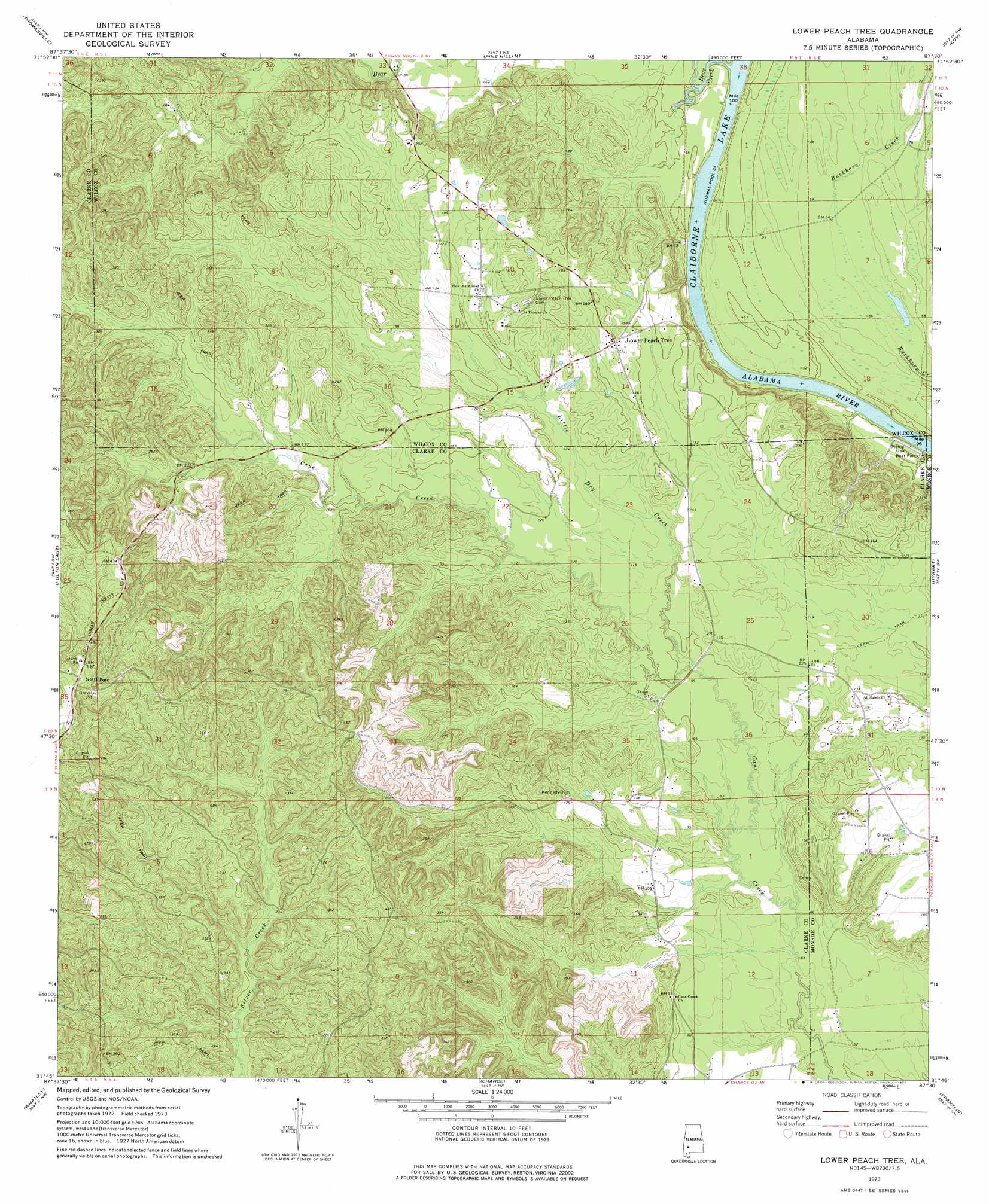
Lower Peach Tree Topo Map Alabama
To zoom in, hover over the map of Lower Peach Tree
USGS Topo Quad 31087g5 - 1:24,000 scale
| Topo Map Name: | Lower Peach Tree |
| USGS Topo Quad ID: | 31087g5 |
| Print Size: | ca. 21 1/4" wide x 27" high |
| Southeast Coordinates: | 31.75° N latitude / 87.5° W longitude |
| Map Center Coordinates: | 31.8125° N latitude / 87.5625° W longitude |
| U.S. State: | AL |
| Filename: | o31087g5.jpg |
| Download Map JPG Image: | Lower Peach Tree topo map 1:24,000 scale |
| Map Type: | Topographic |
| Topo Series: | 7.5´ |
| Map Scale: | 1:24,000 |
| Source of Map Images: | United States Geological Survey (USGS) |
| Alternate Map Versions: |
Lower Peach Tree AL 1973, updated 1977 Download PDF Buy paper map Lower Peach Tree AL 2011 Download PDF Buy paper map Lower Peach Tree AL 2014 Download PDF Buy paper map |
1:24,000 Topo Quads surrounding Lower Peach Tree
Sweet Water |
Surginer |
Kimbrough |
Lee Long Bridge |
Camden North |
Bashi |
Thomasville |
Pine Hill |
Coy |
Camden South |
Fulton West |
Fulton East |
Lower Peach Tree |
Hybart |
Vredenburgh |
Grove Hill |
Whatley |
Chance |
Franklin |
Natchez |
Walker Springs |
Suggsville |
Claiborne |
Mexia |
Monroeville |
> Back to 31087e1 at 1:100,000 scale
> Back to 31086a1 at 1:250,000 scale
> Back to U.S. Topo Maps home
Lower Peach Tree topo map: Gazetteer
Lower Peach Tree: Bars
Montgomery Bar elevation 11m 36′Ohio Bar elevation 11m 36′
Lower Peach Tree: Cliffs
Sakti Nakni Ontala elevation 32m 104′Lower Peach Tree: Crossings
Botts Ferry (historical) elevation 11m 36′Lower Peach Tree Ferry (historical) elevation 11m 36′
Lower Peach Tree: Islands
Ohio Island (historical) elevation 11m 36′Lower Peach Tree: Populated Places
Lower Peach Tree elevation 58m 190′Nettleboro elevation 164m 538′
Lower Peach Tree: Streams
Bear Creek elevation 11m 36′Jones Branch elevation 12m 39′
Little Dry Creek elevation 27m 88′
Lower Peach Tree digital topo map on disk
Buy this Lower Peach Tree topo map showing relief, roads, GPS coordinates and other geographical features, as a high-resolution digital map file on DVD:
Gulf Coast (LA, MS, AL, FL) & Southwestern Georgia
Buy digital topo maps: Gulf Coast (LA, MS, AL, FL) & Southwestern Georgia
 & Southwestern Georgia map DVD")