Morvin Topo Map Alabama
To zoom in, hover over the map of Morvin
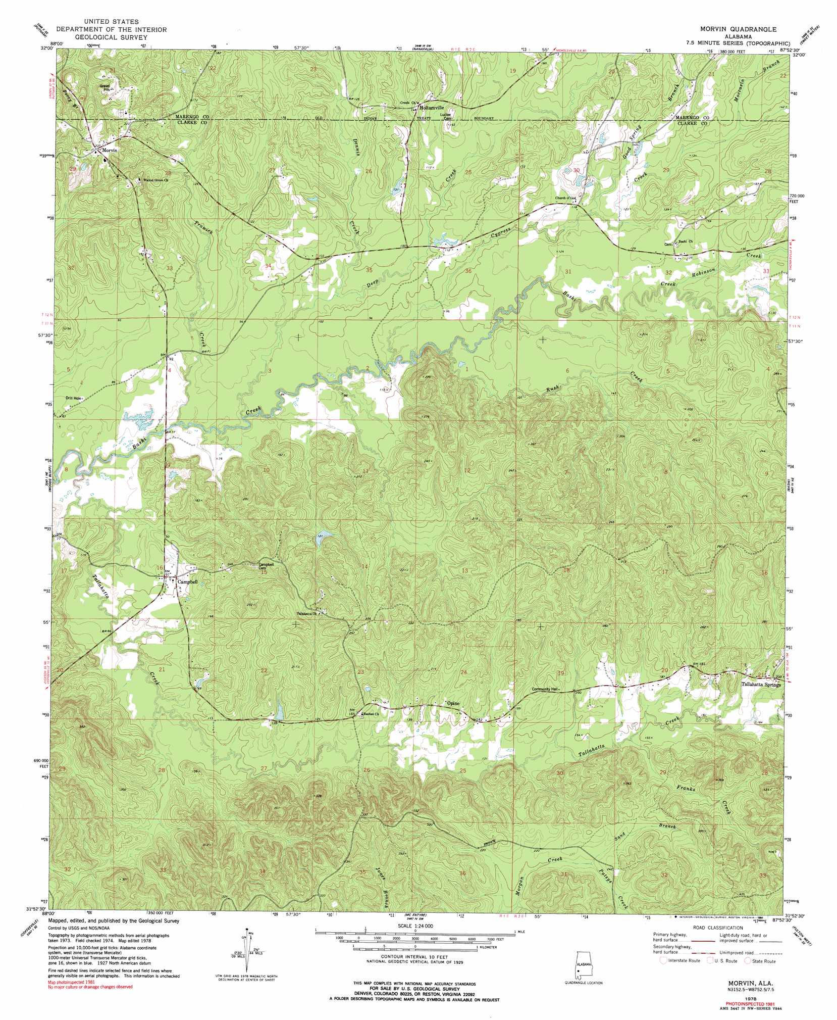
USGS Topo Quad 31087h8 - 1:24,000 scale
| Topo Map Name: | Morvin |
| USGS Topo Quad ID: | 31087h8 |
| Print Size: | ca. 21 1/4" wide x 27" high |
| Southeast Coordinates: | 31.875° N latitude / 87.875° W longitude |
| Map Center Coordinates: | 31.9375° N latitude / 87.9375° W longitude |
| U.S. State: | AL |
| Filename: | o31087h8.jpg |
| Download Map JPG Image: | Morvin topo map 1:24,000 scale |
| Map Type: | Topographic |
| Topo Series: | 7.5´ |
| Map Scale: | 1:24,000 |
| Source of Map Images: | United States Geological Survey (USGS) |
| Alternate Map Versions: |
Morvin AL 1978, updated 1991 Download PDF Buy paper map Morvin AL 2011 Download PDF Buy paper map Morvin AL 2014 Download PDF Buy paper map |
1:24,000 Topo Quads surrounding Morvin
Jachin |
Pennington |
Myrtlewood South |
Miller |
Magnolia |
Butler |
Putnam |
Nanafalia |
Sweet Water |
Surginer |
Ararat |
Woods Bluff |
Morvin |
Bashi |
Thomasville |
Coffeeville Lock And Dam |
Coffeeville |
Mcentyre |
Fulton West |
Fulton East |
Bladon Springs |
Tattlersville |
Winn |
Grove Hill |
Whatley |
> Back to 31087e1 at 1:100,000 scale
> Back to 31086a1 at 1:250,000 scale
> Back to U.S. Topo Maps home
Morvin topo map: Gazetteer
Morvin: Dams
N S Haltam Lake Dam elevation 34m 111′Opine Timber Company Dam elevation 43m 141′
Morvin: Parks
Scotch State Wildlife Management Area elevation 90m 295′Morvin: Populated Places
Campbell elevation 29m 95′Hotamville elevation 37m 121′
Morvin elevation 72m 236′
Opine elevation 48m 157′
Tallahatta Springs elevation 61m 200′
Morvin: Post Offices
Morvin Post Office elevation 71m 232′Morvin: Reservoirs
N S Haltam Lake elevation 34m 111′Opine Lake elevation 43m 141′
Morvin: Streams
Bob White Branch elevation 31m 101′Cypress Creek elevation 28m 91′
Deep Creek elevation 21m 68′
Dennis Creek elevation 25m 82′
Franks Creek elevation 43m 141′
Good Spring Branch elevation 34m 111′
Moccasin Branch elevation 41m 134′
Mud Creek elevation 32m 104′
Patsys Creek elevation 63m 206′
Robinson Creek elevation 36m 118′
Rush Creek elevation 21m 68′
Rush Creek elevation 45m 147′
Sand Branch elevation 64m 209′
Tallahatta Creek elevation 14m 45′
Trawick Creek elevation 21m 68′
Morvin digital topo map on disk
Buy this Morvin topo map showing relief, roads, GPS coordinates and other geographical features, as a high-resolution digital map file on DVD:
Gulf Coast (LA, MS, AL, FL) & Southwestern Georgia
Buy digital topo maps: Gulf Coast (LA, MS, AL, FL) & Southwestern Georgia
 & Southwestern Georgia map DVD")