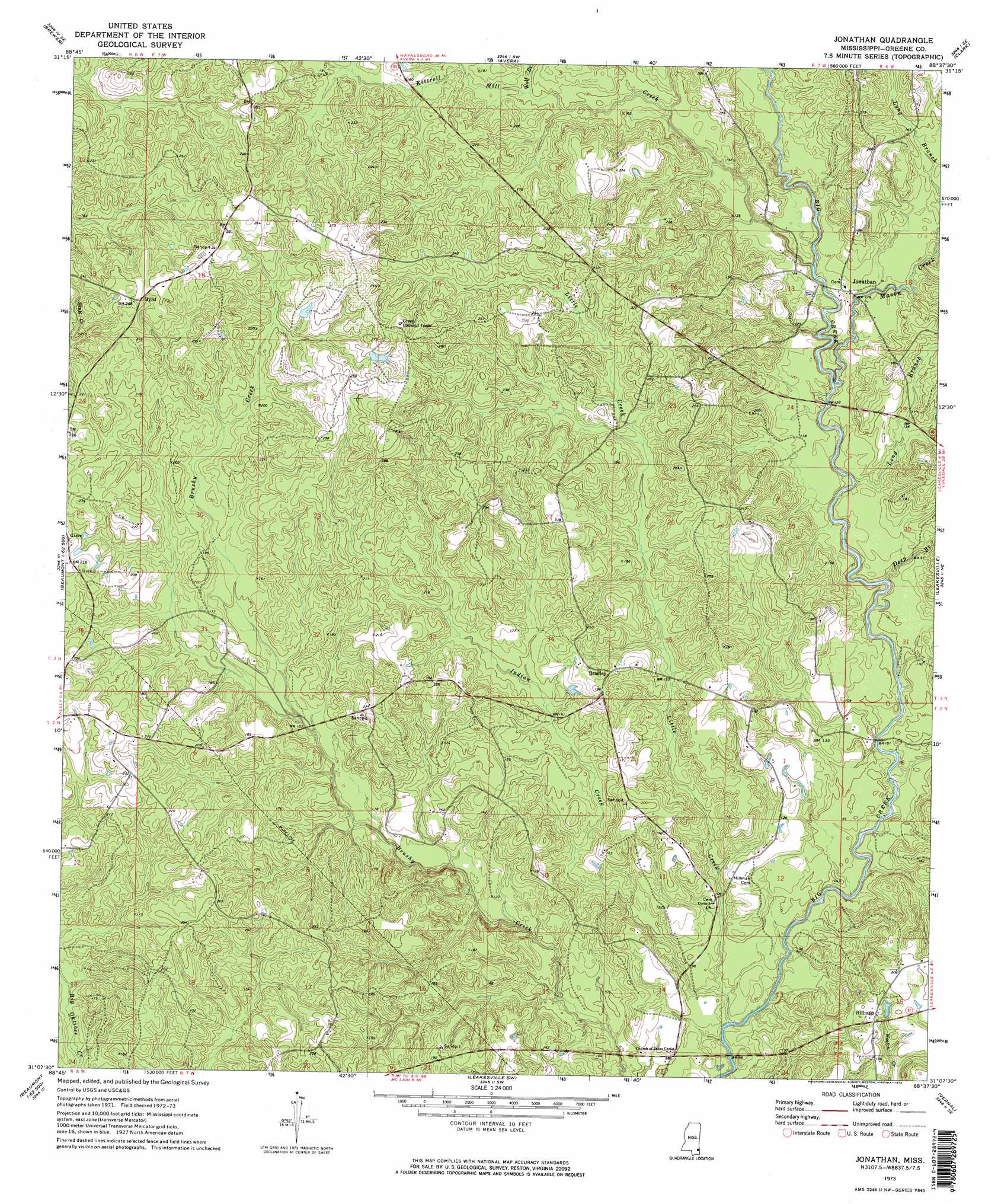
Jonathan Topo Map Mississippi
To zoom in, hover over the map of Jonathan
USGS Topo Quad 31088b6 - 1:24,000 scale
| Topo Map Name: | Jonathan |
| USGS Topo Quad ID: | 31088b6 |
| Print Size: | ca. 21 1/4" wide x 27" high |
| Southeast Coordinates: | 31.125° N latitude / 88.625° W longitude |
| Map Center Coordinates: | 31.1875° N latitude / 88.6875° W longitude |
| U.S. State: | MS |
| Filename: | o31088b6.jpg |
| Download Map JPG Image: | Jonathan topo map 1:24,000 scale |
| Map Type: | Topographic |
| Topo Series: | 7.5´ |
| Map Scale: | 1:24,000 |
| Source of Map Images: | United States Geological Survey (USGS) |
| Alternate Map Versions: |
Jonathan MS 1973, updated 1974 Download PDF Buy paper map Jonathan MS 1973, updated 1974 Download PDF Buy paper map Jonathan MS 2012 Download PDF Buy paper map Jonathan MS 2015 Download PDF Buy paper map |
1:24,000 Topo Quads surrounding Jonathan
Rhodes |
Mulberry |
Piave |
Knobtown |
State Line |
Richton |
Brewer |
Avera |
Clark |
Fruitdale |
Beaumont |
Neely |
Jonathan |
Leakesville |
Rounsaville |
Taylor Hill |
Mclain |
Leakesville Sw |
Vernal |
Brown Town |
Barbara |
Avent |
Merrill |
Lucedale |
Earlville |
> Back to 31088a1 at 1:100,000 scale
> Back to 31088a1 at 1:250,000 scale
> Back to U.S. Topo Maps home
Jonathan topo map: Gazetteer
Jonathan: Populated Places
Bradley elevation 56m 183′Byrd elevation 73m 239′
Hillman elevation 61m 200′
Jonathan elevation 34m 111′
Wilson (historical) elevation 68m 223′
Jonathan: Streams
Deep Branch elevation 24m 78′Indian Creek elevation 21m 68′
Kittrell Mill Creek elevation 31m 101′
Little Creek elevation 24m 78′
Long Branch elevation 37m 121′
Long Branch elevation 28m 91′
Mason Creek elevation 28m 91′
Wolf Branch elevation 46m 150′
Jonathan digital topo map on disk
Buy this Jonathan topo map showing relief, roads, GPS coordinates and other geographical features, as a high-resolution digital map file on DVD:
Gulf Coast (LA, MS, AL, FL) & Southwestern Georgia
Buy digital topo maps: Gulf Coast (LA, MS, AL, FL) & Southwestern Georgia
 & Southwestern Georgia map DVD")