Vinegar Bend Topo Map Alabama
To zoom in, hover over the map of Vinegar Bend
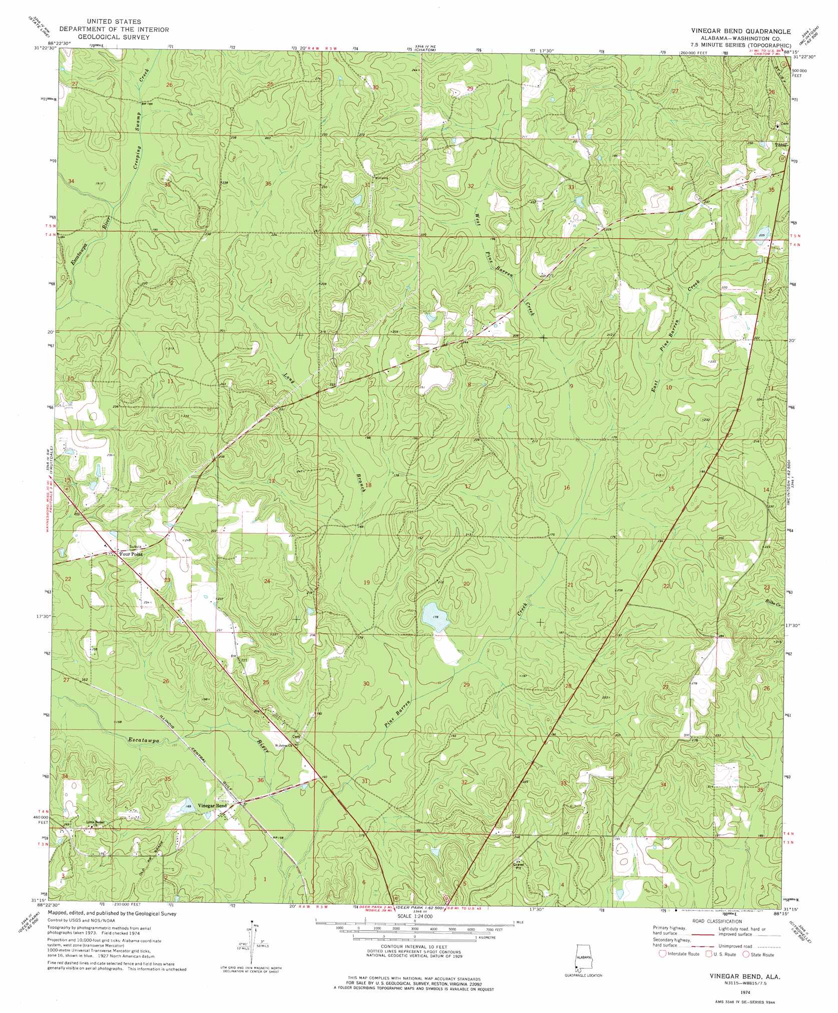
USGS Topo Quad 31088c3 - 1:24,000 scale
| Topo Map Name: | Vinegar Bend |
| USGS Topo Quad ID: | 31088c3 |
| Print Size: | ca. 21 1/4" wide x 27" high |
| Southeast Coordinates: | 31.25° N latitude / 88.25° W longitude |
| Map Center Coordinates: | 31.3125° N latitude / 88.3125° W longitude |
| U.S. State: | AL |
| Filename: | o31088c3.jpg |
| Download Map JPG Image: | Vinegar Bend topo map 1:24,000 scale |
| Map Type: | Topographic |
| Topo Series: | 7.5´ |
| Map Scale: | 1:24,000 |
| Source of Map Images: | United States Geological Survey (USGS) |
| Alternate Map Versions: |
Vinegar Bend AL 1974, updated 1977 Download PDF Buy paper map Vinegar Bend AL 2011 Download PDF Buy paper map Vinegar Bend AL 2014 Download PDF Buy paper map |
1:24,000 Topo Quads surrounding Vinegar Bend
Buckatunna |
Copeland |
Millry South |
Bigbee |
Saint Stephens |
Knobtown |
State Line |
Chatom |
Rutan |
Wagarville |
Clark |
Fruitdale |
Vinegar Bend |
Seaboard |
Mcintosh |
Leakesville |
Rounsaville |
Deer Park |
Sims Chapel |
Calvert |
Vernal |
Brown Town |
Citronelle West |
Citronelle East |
Mount Vernon |
> Back to 31088a1 at 1:100,000 scale
> Back to 31088a1 at 1:250,000 scale
> Back to U.S. Topo Maps home
Vinegar Bend topo map: Gazetteer
Vinegar Bend: Dams
D R Stallworth Dam elevation 52m 170′Parnell Dam elevation 67m 219′
Stallworth Dam elevation 54m 177′
Vinegar Bend: Populated Places
Four Point elevation 71m 232′Vinegar Bend elevation 51m 167′
Vinegar Bend: Post Offices
Tibbie Post Office elevation 74m 242′Vinegar Bend Post Office elevation 50m 164′
Vinegar Bend: Reservoirs
D R Stallworth Pond elevation 52m 170′Parnells Pond elevation 67m 219′
Stallworth Lake elevation 54m 177′
Vinegar Bend: Streams
Creeping Swamp Creek elevation 54m 177′East Pine Barren Creek elevation 52m 170′
Long Branch elevation 46m 150′
Pine Barren Creek elevation 44m 144′
Pine Branch elevation 43m 141′
West Pine Barren Creek elevation 52m 170′
Vinegar Bend digital topo map on disk
Buy this Vinegar Bend topo map showing relief, roads, GPS coordinates and other geographical features, as a high-resolution digital map file on DVD:
Gulf Coast (LA, MS, AL, FL) & Southwestern Georgia
Buy digital topo maps: Gulf Coast (LA, MS, AL, FL) & Southwestern Georgia
 & Southwestern Georgia map DVD")