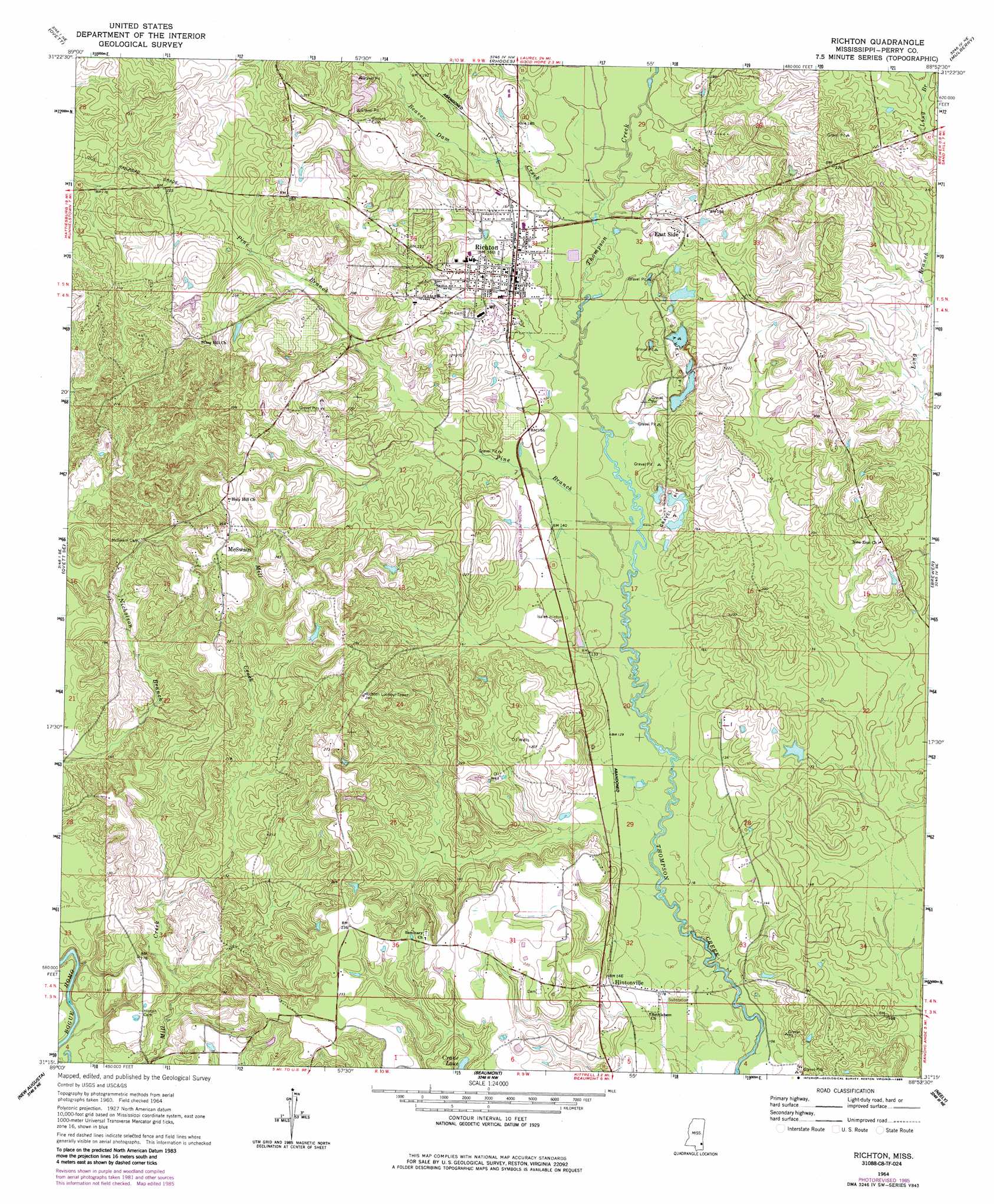
Richton Topo Map Mississippi
To zoom in, hover over the map of Richton
USGS Topo Quad 31088c8 - 1:24,000 scale
| Topo Map Name: | Richton |
| USGS Topo Quad ID: | 31088c8 |
| Print Size: | ca. 21 1/4" wide x 27" high |
| Southeast Coordinates: | 31.25° N latitude / 88.875° W longitude |
| Map Center Coordinates: | 31.3125° N latitude / 88.9375° W longitude |
| U.S. State: | MS |
| Filename: | o31088c8.jpg |
| Download Map JPG Image: | Richton topo map 1:24,000 scale |
| Map Type: | Topographic |
| Topo Series: | 7.5´ |
| Map Scale: | 1:24,000 |
| Source of Map Images: | United States Geological Survey (USGS) |
| Alternate Map Versions: |
Richton MS 1964, updated 1965 Download PDF Buy paper map Richton MS 1964, updated 1982 Download PDF Buy paper map Richton MS 1964, updated 1985 Download PDF Buy paper map Richton MS 2012 Download PDF Buy paper map Richton MS 2015 Download PDF Buy paper map |
1:24,000 Topo Quads surrounding Richton
Ellisville |
Lanham |
Strengthford |
Water Oak |
Clara |
Barrontown |
Ovett |
Rhodes |
Mulberry |
Piave |
Carterville |
Ovett Se |
Richton |
Brewer |
Avera |
Mclaurin |
New Augusta |
Beaumont |
Neely |
Jonathan |
Brooklyn |
Janice |
Taylor Hill |
Mclain |
Leakesville Sw |
> Back to 31088a1 at 1:100,000 scale
> Back to 31088a1 at 1:250,000 scale
> Back to U.S. Topo Maps home
Richton topo map: Gazetteer
Richton: Airports
Richton-Perry County Airport elevation 52m 170′Richton: Dams
George Guthrie Pond Dam elevation 46m 150′James Grantham Pond Dam elevation 64m 209′
Joe Blackmon Pond Dam elevation 82m 269′
Scott Nicholson Catfish Ponds Dam elevation 70m 229′
Richton: Lakes
Crane Lake elevation 54m 177′Richton: Populated Places
East Side elevation 52m 170′Hintonville elevation 51m 167′
McSwain elevation 85m 278′
Richton elevation 53m 173′
Richton: Streams
Beaver Dam Creek elevation 43m 141′Pine Branch elevation 37m 121′
Richton digital topo map on disk
Buy this Richton topo map showing relief, roads, GPS coordinates and other geographical features, as a high-resolution digital map file on DVD:
Gulf Coast (LA, MS, AL, FL) & Southwestern Georgia
Buy digital topo maps: Gulf Coast (LA, MS, AL, FL) & Southwestern Georgia
 & Southwestern Georgia map DVD")