Chatom Topo Map Alabama
To zoom in, hover over the map of Chatom
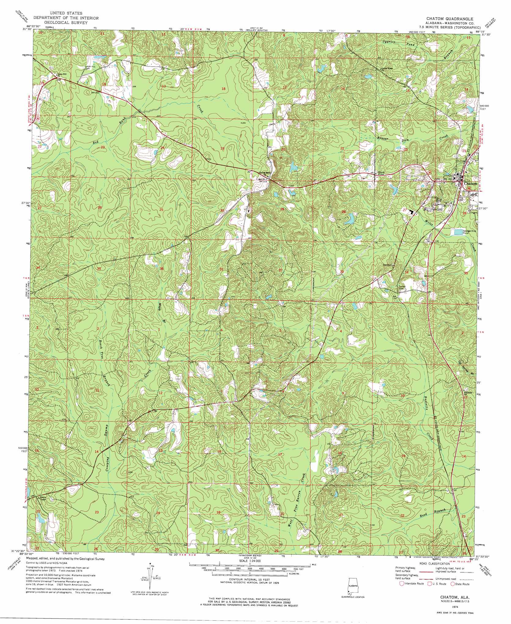
USGS Topo Quad 31088d3 - 1:24,000 scale
| Topo Map Name: | Chatom |
| USGS Topo Quad ID: | 31088d3 |
| Print Size: | ca. 21 1/4" wide x 27" high |
| Southeast Coordinates: | 31.375° N latitude / 88.25° W longitude |
| Map Center Coordinates: | 31.4375° N latitude / 88.3125° W longitude |
| U.S. State: | AL |
| Filename: | o31088d3.jpg |
| Download Map JPG Image: | Chatom topo map 1:24,000 scale |
| Map Type: | Topographic |
| Topo Series: | 7.5´ |
| Map Scale: | 1:24,000 |
| Source of Map Images: | United States Geological Survey (USGS) |
| Alternate Map Versions: |
Chatom AL 1974, updated 1977 Download PDF Buy paper map Chatom AL 2011 Download PDF Buy paper map Chatom AL 2014 Download PDF Buy paper map |
1:24,000 Topo Quads surrounding Chatom
Denham |
Aquilla |
Millry North |
Bladon Springs |
Tattlersville |
Buckatunna |
Copeland |
Millry South |
Bigbee |
Saint Stephens |
Knobtown |
State Line |
Chatom |
Rutan |
Wagarville |
Clark |
Fruitdale |
Vinegar Bend |
Seaboard |
Mcintosh |
Leakesville |
Rounsaville |
Deer Park |
Sims Chapel |
Calvert |
> Back to 31088a1 at 1:100,000 scale
> Back to 31088a1 at 1:250,000 scale
> Back to U.S. Topo Maps home
Chatom topo map: Gazetteer
Chatom: Dams
George Keen Dam elevation 73m 239′Chatom: Populated Places
Chatom elevation 64m 209′Laton Hill elevation 77m 252′
Chatom: Post Offices
Chatom Post Office elevation 66m 216′Chatom: Reservoirs
George Keen Pond elevation 73m 239′Chatom: Streams
Beech Tree Branch elevation 64m 209′Cypress Pond Branch elevation 37m 121′
Maple Branch elevation 68m 223′
Chatom digital topo map on disk
Buy this Chatom topo map showing relief, roads, GPS coordinates and other geographical features, as a high-resolution digital map file on DVD:
Gulf Coast (LA, MS, AL, FL) & Southwestern Georgia
Buy digital topo maps: Gulf Coast (LA, MS, AL, FL) & Southwestern Georgia
 & Southwestern Georgia map DVD")