Rhodes Topo Map Mississippi
To zoom in, hover over the map of Rhodes
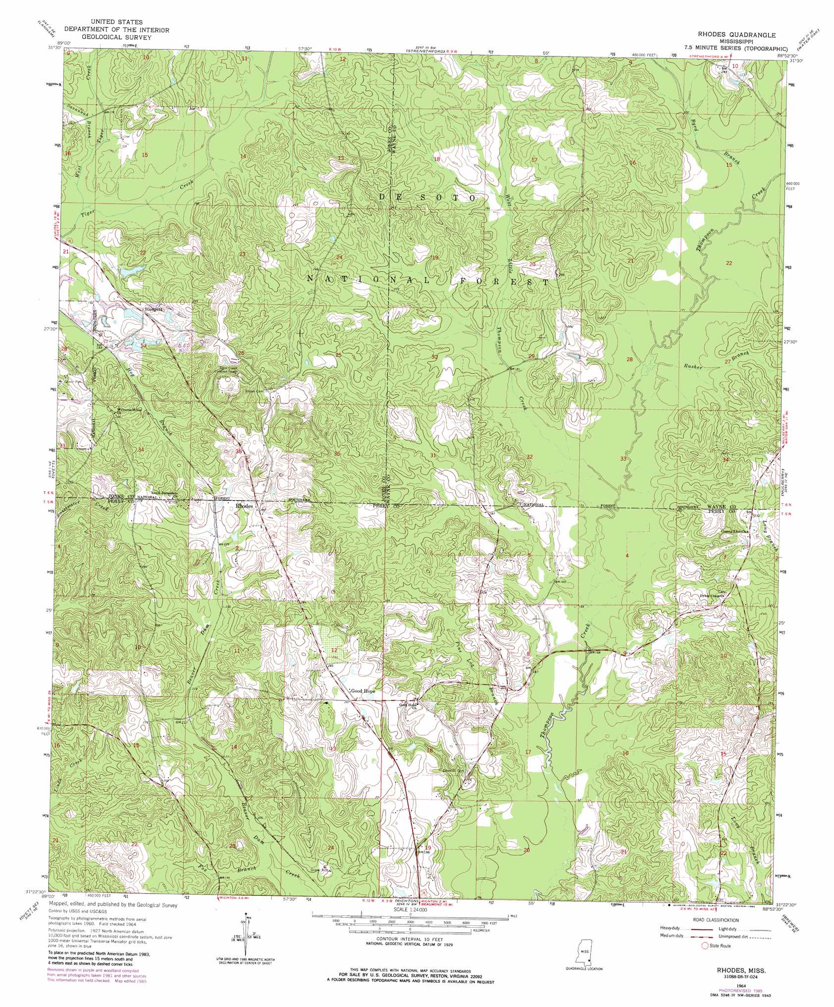
USGS Topo Quad 31088d8 - 1:24,000 scale
| Topo Map Name: | Rhodes |
| USGS Topo Quad ID: | 31088d8 |
| Print Size: | ca. 21 1/4" wide x 27" high |
| Southeast Coordinates: | 31.375° N latitude / 88.875° W longitude |
| Map Center Coordinates: | 31.4375° N latitude / 88.9375° W longitude |
| U.S. State: | MS |
| Filename: | o31088d8.jpg |
| Download Map JPG Image: | Rhodes topo map 1:24,000 scale |
| Map Type: | Topographic |
| Topo Series: | 7.5´ |
| Map Scale: | 1:24,000 |
| Source of Map Images: | United States Geological Survey (USGS) |
| Alternate Map Versions: |
Rhodes MS 1964, updated 1965 Download PDF Buy paper map Rhodes MS 1964, updated 1975 Download PDF Buy paper map Rhodes MS 1964, updated 1985 Download PDF Buy paper map Rhodes MS 2012 Download PDF Buy paper map Rhodes MS 2015 Download PDF Buy paper map |
| FStopo: | US Forest Service topo Rhodes is available: Download FStopo PDF Download FStopo TIF |
1:24,000 Topo Quads surrounding Rhodes
Laurel West |
Laurel East |
Myrick |
Whistler |
Waynesboro |
Ellisville |
Lanham |
Strengthford |
Water Oak |
Clara |
Barrontown |
Ovett |
Rhodes |
Mulberry |
Piave |
Carterville |
Ovett Se |
Richton |
Brewer |
Avera |
Mclaurin |
New Augusta |
Beaumont |
Neely |
Jonathan |
> Back to 31088a1 at 1:100,000 scale
> Back to 31088a1 at 1:250,000 scale
> Back to U.S. Topo Maps home
Rhodes topo map: Gazetteer
Rhodes: Dams
Brock Pond Dam elevation 83m 272′Rhodes: Populated Places
Blodgett elevation 64m 209′Good Hope elevation 81m 265′
Rhodes elevation 81m 265′
Rhodes: Streams
Bob Branch elevation 52m 170′Byrd Branch elevation 52m 170′
Fox Branch elevation 55m 180′
Little Thompson Branch elevation 65m 213′
Long Branch elevation 64m 209′
Noggin Head Branch elevation 50m 164′
Pine Log Branch elevation 46m 150′
Rasher Branch elevation 50m 164′
Savannah Branch elevation 51m 167′
West Little Thompson Creek elevation 49m 160′
West Tiger Creek elevation 50m 164′
Rhodes digital topo map on disk
Buy this Rhodes topo map showing relief, roads, GPS coordinates and other geographical features, as a high-resolution digital map file on DVD:
Gulf Coast (LA, MS, AL, FL) & Southwestern Georgia
Buy digital topo maps: Gulf Coast (LA, MS, AL, FL) & Southwestern Georgia
 & Southwestern Georgia map DVD")