Water Oak Topo Map Mississippi
To zoom in, hover over the map of Water Oak
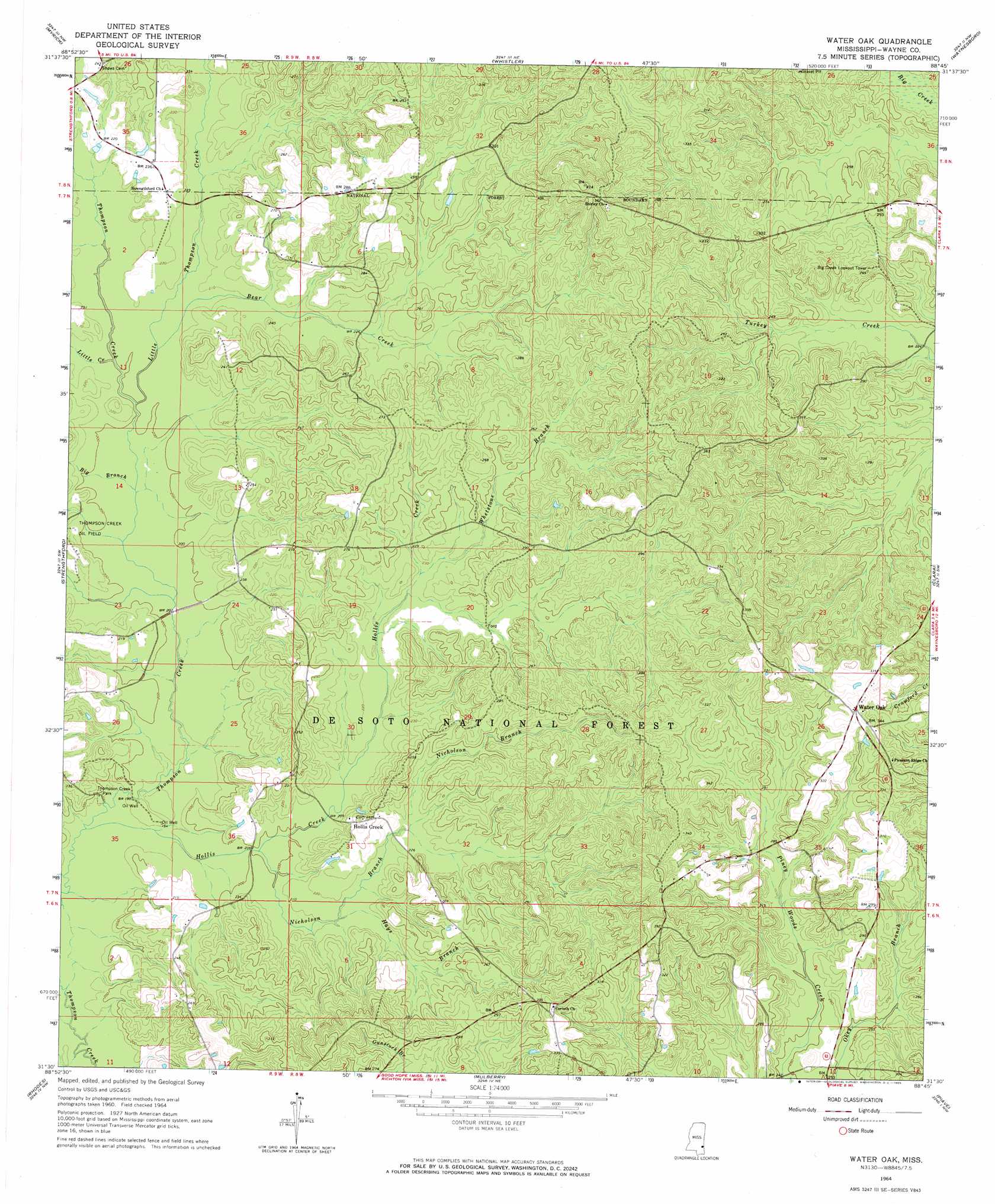
USGS Topo Quad 31088e7 - 1:24,000 scale
| Topo Map Name: | Water Oak |
| USGS Topo Quad ID: | 31088e7 |
| Print Size: | ca. 21 1/4" wide x 27" high |
| Southeast Coordinates: | 31.5° N latitude / 88.75° W longitude |
| Map Center Coordinates: | 31.5625° N latitude / 88.8125° W longitude |
| U.S. State: | MS |
| Filename: | o31088e7.jpg |
| Download Map JPG Image: | Water Oak topo map 1:24,000 scale |
| Map Type: | Topographic |
| Topo Series: | 7.5´ |
| Map Scale: | 1:24,000 |
| Source of Map Images: | United States Geological Survey (USGS) |
| Alternate Map Versions: |
Water Oak MS 2012 Download PDF Buy paper map Water Oak MS 2015 Download PDF Buy paper map |
| FStopo: | US Forest Service topo Water Oak is available: Download FStopo PDF Download FStopo TIF |
1:24,000 Topo Quads surrounding Water Oak
Sandersville |
Heidelberg Sw |
Eucutta |
Shubuta |
Matherville |
Laurel East |
Myrick |
Whistler |
Waynesboro |
Denham |
Lanham |
Strengthford |
Water Oak |
Clara |
Buckatunna |
Ovett |
Rhodes |
Mulberry |
Piave |
Knobtown |
Ovett Se |
Richton |
Brewer |
Avera |
Clark |
> Back to 31088e1 at 1:100,000 scale
> Back to 31088a1 at 1:250,000 scale
> Back to U.S. Topo Maps home
Water Oak topo map: Gazetteer
Water Oak: Dams
Sanderson Lake Dam elevation 71m 232′Water Oak: Oilfields
South Thompson Creek Oil Field elevation 58m 190′West Clara Oil Field elevation 82m 269′
Water Oak: Parks
Chickasawhay State Wildlife Management Area elevation 93m 305′Thompson Creek Park elevation 59m 193′
Water Oak: Populated Places
Hollis Creek elevation 70m 229′Water Oak: Streams
Bear Creek elevation 61m 200′Big Branch elevation 59m 193′
Hays Branch elevation 64m 209′
Hollis Creek elevation 56m 183′
Little Creek elevation 61m 200′
Little Thompson Creek elevation 60m 196′
Nicholson Branch elevation 60m 196′
Whetstone Branch elevation 68m 223′
Water Oak digital topo map on disk
Buy this Water Oak topo map showing relief, roads, GPS coordinates and other geographical features, as a high-resolution digital map file on DVD:
Gulf Coast (LA, MS, AL, FL) & Southwestern Georgia
Buy digital topo maps: Gulf Coast (LA, MS, AL, FL) & Southwestern Georgia
 & Southwestern Georgia map DVD")