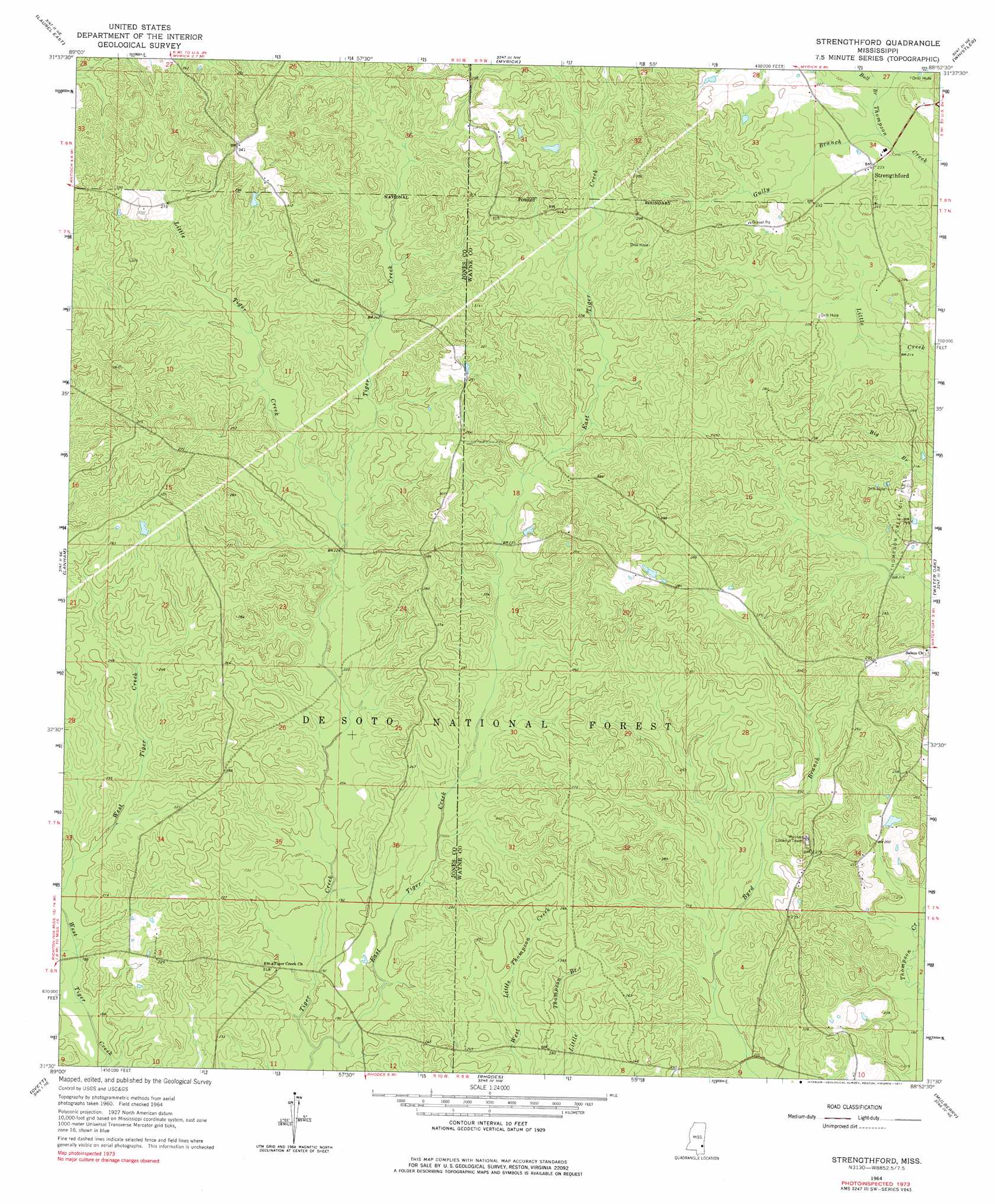
Strengthford Topo Map Mississippi
To zoom in, hover over the map of Strengthford
USGS Topo Quad 31088e8 - 1:24,000 scale
| Topo Map Name: | Strengthford |
| USGS Topo Quad ID: | 31088e8 |
| Print Size: | ca. 21 1/4" wide x 27" high |
| Southeast Coordinates: | 31.5° N latitude / 88.875° W longitude |
| Map Center Coordinates: | 31.5625° N latitude / 88.9375° W longitude |
| U.S. State: | MS |
| Filename: | o31088e8.jpg |
| Download Map JPG Image: | Strengthford topo map 1:24,000 scale |
| Map Type: | Topographic |
| Topo Series: | 7.5´ |
| Map Scale: | 1:24,000 |
| Source of Map Images: | United States Geological Survey (USGS) |
| Alternate Map Versions: |
Strengthford MS 1964, updated 1965 Download PDF Buy paper map Strengthford MS 1964, updated 1977 Download PDF Buy paper map Strengthford MS 2012 Download PDF Buy paper map Strengthford MS 2015 Download PDF Buy paper map |
| FStopo: | US Forest Service topo Strengthford is available: Download FStopo PDF Download FStopo TIF |
1:24,000 Topo Quads surrounding Strengthford
Moss |
Sandersville |
Heidelberg Sw |
Eucutta |
Shubuta |
Laurel West |
Laurel East |
Myrick |
Whistler |
Waynesboro |
Ellisville |
Lanham |
Strengthford |
Water Oak |
Clara |
Barrontown |
Ovett |
Rhodes |
Mulberry |
Piave |
Carterville |
Ovett Se |
Richton |
Brewer |
Avera |
> Back to 31088e1 at 1:100,000 scale
> Back to 31088a1 at 1:250,000 scale
> Back to U.S. Topo Maps home
Strengthford topo map: Gazetteer
Strengthford: Crossings
Strength Ford elevation 64m 209′Strengthford: Oilfields
Thompson Creek Oil Field elevation 74m 242′Strengthford: Populated Places
Strengthford elevation 68m 223′Strengthford: Streams
Bull Branch elevation 64m 209′East Tiger Creek elevation 55m 180′
Gully Branch elevation 63m 206′
Little Tiger Creek elevation 68m 223′
Strengthford digital topo map on disk
Buy this Strengthford topo map showing relief, roads, GPS coordinates and other geographical features, as a high-resolution digital map file on DVD:
Gulf Coast (LA, MS, AL, FL) & Southwestern Georgia
Buy digital topo maps: Gulf Coast (LA, MS, AL, FL) & Southwestern Georgia
 & Southwestern Georgia map DVD")